Choosing the right chart for your chartplotter
comes down to three factors: device compatibility, area of use, and the
features you need. In Finland, the most popular chart options are Navionics+,
C-MAP, Garmin Navionics+, and Raymarine LightHouse. Each chart brand is
designed to work with specific devices, so checking compatibility before buying
is essential for safe navigation.
Electronic charts have advanced significantly
in recent years. Modern chart cards offer detailed depth data, real-time
updates, and smart route-planning features. This guide walks through how to
choose the right chart for your chartplotter.
Which chart card suits which chartplotter?
Chart card
compatibility is determined by the chartplotter's manufacturer. This is the
single most important factor in choosing a chart, since the wrong type of chart
either won't work at all in a device or will only work with limited
functionality. Below is a summary of compatibility by manufacturer:
Garmin
chartplotters: Garmin devices only use Garmin Navionics+ and Garmin Navionics
Vision+ charts. A regular Navionics+ card won't work in a Garmin device. This
is because of Garmin's own chart format, which differs from the standards used
by other manufacturers.
Raymarine
chartplotters: Raymarine's Axiom and Element series support three chart
options: Raymarine LightHouse, Navionics+, and C-MAP. LightHouse charts are
Raymarine's own chart series and come pre-installed on most Raymarine
chartplotters.
Lowrance, Simrad,
and B&G: These three brands belong to the same corporate group and use
compatible charts. Both Navionics+ and C-MAP work in these devices. Lowrance
chartplotters are especially popular among anglers thanks to the C-MAP Genesis
feature.
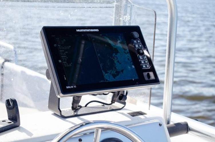
Humminbird:
Humminbird devices support Navionics+ charts, making them compatible with a
wide chart selection.
Navionics+ vs. C-MAP vs. Garmin
Navionics+ – what are the differences?
There are
significant differences between chart brands in features, update practices, and
price level. Making the right choice requires understanding these differences
in relation to your own needs.
Navionics+ – the most popular
choice in Finland
Navionics charts
are by far the most popular in Finland, and EU644L is one of the most popular
chart cards for chartplotters. Navionics is especially known for its SonarChart
depth maps and the ActiveCaptain community, which enables real-time information
sharing among boaters.
Navionics+
includes 12 months of free updates, which require registering the chart card
within two months of purchase. Updates can be downloaded via the Chart
Installer software or through the mobile app. The
Navionics WebApp lets you explore chart data for free before making a purchase
decision.
SonarChart Live's beauty is that any boater
can create and use better charts with very little effort or cost.
C-MAP – the angler's choice
C-MAP charts offer an especially detailed
High-Res Bathymetry base map, which includes depth data collected by the
Genesis community. This makes C-MAP an excellent choice for anglers who need
detailed information about bottom contours.
The C-MAP product family is divided into
tiers: Discover (basic chart), Reveal (adds a 3D bottom view), and the newest
Discover X and Reveal X for next-generation devices. It's important to note
that Discover X and Reveal X charts only work with the B&G Zeus S and
Simrad NSX series.
The C-MAP Genesis Live feature lets you record
your own depth maps directly on the device, which is especially useful in
uncharted waters or private lakes.
Garmin Navionics+ – an integrated solution
Garmin Navionics+ combines the best of Garmin
and Navionics in a single chart. In 2017, Garmin acquired Navionics, which led
to the creation of the Garmin Navionics+ chart series, offering an integrated
solution for Garmin users.
Garmin Navionics+ includes Auto Guidance+
technology, which automatically calculates a safe route between two points,
taking into account the boat's draft and overhead clearances. Daily chart
updates are available through the ActiveCaptain app.
Garmin Navionics Vision+ is the premium
version, adding extra features such as Relief Shading depth shading, satellite
imagery, aerial harbor photos, and 3D views (FishEye and MarineEye).
Raymarine LightHouse – the
built-in option
Raymarine
LightHouse is Raymarine's own chart series, which comes pre-installed on most
Axiom and Element series devices. LightHouse charts cover Northern Europe, including the Finnish coast and
inland waters.
The advantage of
LightHouse charts is seamless integration with Raymarine's devices and
operating system. The charts support the RealBathy feature, which lets you
create your own depth maps for uncharted areas.
Chart card comparison table
The table below
summarizes the key features and compatibility:
How do chart card updates work?
Update practices
vary by manufacturer, but most offer 12 months of free updates. Updates give
you access to the latest depth data, channel changes, and harbor information.
Navionics
updates: Register your chart card on Navionics' web service within two months
of purchase to get 12 months of updates. Updates are downloaded via the Chart
Installer software on a computer or the ActiveCaptain app. After the first year, you can continue updates by purchasing the
Navionics Updates service.
C-MAP updates: Purchase includes 12 months of
online updates. The Genesis Live feature also lets you record and share your
own depth data with the community.
Garmin Navionics+ updates: Daily chart updates
are available through the ActiveCaptain app. Charts are continually updated
with the latest data. After the first year, the charts keep working normally,
but new updates require a separate subscription.
Chart card selection checklist
Before buying a chart card, go through the
following to make sure you choose correctly:
1. Check your chartplotter's make and model:
Find out exactly which chart formats your device supports. Only Garmin charts work in Garmin devices,
while Raymarine, Lowrance, and Simrad support several options.
2. Confirm memory
card compatibility: Almost all modern devices use MicroSD cards. Older devices
may only support smaller card sizes (e.g., 8 GB or 16 GB), so check your
device's technical specifications.
3. Choose the
right coverage area: For Finnish waters, the most popular options are EU644L
(all of Finland) and regional charts such as the Gulf of Finland or the Gulf of
Bothnia. If you also boat abroad, you'll need wider coverage.
4. Assess your
need for extra features: For anglers, C-MAP Genesis or Navionics SonarChart are
useful. Sailors benefit from tide and current data. For long passages,
auto-routing saves time.
5. Consider
update practices: Register your chart card promptly to get free updates. Also
compare the cost of continued updates between manufacturers.
Frequently asked questions about
chartplotter charts
Does a regular Navionics+ card
work in a Garmin chartplotter?
No. Garmin
chartplotters specifically require Garmin Navionics+ or Garmin Navionics
Vision+ charts. A regular Navionics+ card is intended for other manufacturers'
devices, such as Raymarine, Lowrance, Simrad, and Humminbird. This is one of
the most common mistakes when buying a chart card.
What's the difference between
Navionics+ and Navionics Platinum+?
Navionics+ is the
base chart, including depth data, channel markers, and harbor information.
Platinum+ adds premium features such as satellite imagery, 3D views, and Relief
Shading depth shading. On Garmin devices, the equivalent premium version is
Garmin Navionics Vision+.
Can a chart card be used in more
than one device?
A chart card can
be physically moved from one device to another, but it can only be used in one
device at a time. Some manufacturers, such as Garmin, offer the ability to sync
waypoints and routes across multiple devices via a cloud service.
How do I know what chart card
size fits my device?
Check your
device's manual for the maximum supported memory card size. Newer devices
generally support 32 GB or larger cards, but older models may only work with
smaller cards. Marinekauppa
also carries 1 GB and 2 GB cards for older devices.
Does the chart card need to be
updated?
Chart updates are
recommended for navigational safety. Channels, depth data, and harbor services
change over time, and updated charts ensure you have current information. In Finland, Traficom makes annual changes
to channel markings, which are reflected in updated electronic charts.
Order your chart card from
Marinekauppa
Choosing the
right chart card is an investment in safe boating. In Marinekauppa's range
you'll find all the most popular chart cards from the Navionics+, C-MAP, and
Garmin Navionics+ lines. Complete your navigation system with harbor guides,
which offer valuable extra information about harbors and anchorages.
If you're unsure
which chart card is right for you, contact our customer service – we'll help
you find the right chart for your chartplotter!
Sources and further reading
Navionics –
Official product site and SonarChart features
Garmin Navionics
– Garmin Navionics+ product information and chart comparison
C-MAP – Genesis
and Discover chart series features
Raymarine LightHouse Charts – Technical
information on the LightHouse chart system
Panbo Marine Electronics – A review of the
SonarChart Live feature
|
Feature |
Navionics+ |
C-MAP Discover |
Garmin Navionics+ |
Raymarine LightHouse |
|
Compatibility |
Raymarine,
Lowrance, Simrad, B&G, Humminbird |
Lowrance, Simrad, B&G |
Garmin only |
Raymarine only |
|
Update period |
12 mo free |
12 mo free |
12 mo free |
Varies |
|
Auto-routing |
Yes (Dock-to-Dock) |
Easy Routing (free) |
Auto Guidance+ |
No |
|
Community data |
ActiveCaptain, SonarChart |
Genesis Social Map |
ActiveCaptain |
No |
|
Finnish inland waters |
Yes (EU644L) |
Yes (Y211, Y326) |
Yes (NSEU644L) |
Limited |
Disclaimer
This guide provides general guidance only and does not replace the product manufacturer's operating, installation, or service instructions. Marinekauppa is not responsible for actions taken based on this guide or their consequences. Always check product-specific instructions and consult a qualified professional if needed.