Sjöfartsverket
Sjöfartsverket -ryhmän tuotteet
Waterproof map set from the Finnish Maritime Administration. A3 size spiral bound on waterproof pretex paper.
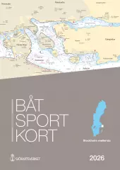
Covers the central Stockholm archipelago, including central Stockholm. The coverage area is bordered by the Vaxholm-Möja plain in the north, the island of Ornö in the south and Sandhamn / Revengegrundet in the east.
If you approach Stockholm via Sandhamn, this map set will take you all the way to the city center.
- 2026 version
- Waterproof paper map.
- Convenient size
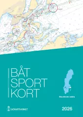
Waterproof map set from the Finnish Maritime Administration. A3 size spiral bound on waterproof pretex paper.
If you are approaching Stockholm from the south and going all the way to the city center, you will also need the Stockholm Mellersta map set.
- 2026 version
- Waterproof paper map.
- Convenient size
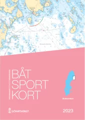
Area: Trosa – Västervik. New edition 2025 with approximately 200 updates. A large number of sea surveys have resulted in new depths and modified depth curves. Adjusted lighthouse sectors and new sea marks and buoys. Updated nature reserves.
EN: Swedish chart sets, Båtsportkort, are ordinary nautical charts made in a smaller format. Each chart set covers a certain part of the coast and there are currently 16 sets, covering the entire Swedish coast and the large lakes on the mainland. Båtsportkort nautical charts are made in A3 size on durable and water-repellent material. They always contain general maps of the area at the beginning. This is followed by pages about the area in the scale of the original nautical charts and with all the information. Towards the end you will always find harbor charts and special charts of the area and information texts. Also includes an excerpt from the most important symbols and abbreviations.
SE: Båtsportkort är ordinarie sjökort framtagna i ett mindre format können för båtlivet. Each boat sport card covers a certain coastal stretch and today there are 16 series that cover the entire Swedish coast along the mainland and the large coastal areas. Båtsportkorten is made in A3 format on a slip-resistant and water-resistant material. They always contain an overview map starting with the entire area. Then follow the pages with the sea map in the same scale and with the same information as the ordinary sea maps over the area. Mot selet finns hamnspecialer och informationstexter samt ett utdrag som describten sjökortens most important symbols och förkortningar.
- Map: Ostkusten
- Area: Trosa - Västervik
- Release year: 2025
- Publisher: Swedish Maritime Administration
- Language: Swedish
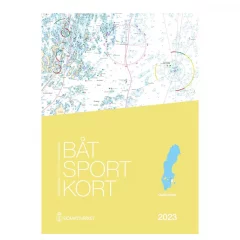
Waterproof map set from the Finnish Maritime Administration. A3 size spiral bound on waterproof pretex paper.
- 2024 version
- Waterproof paper map.
- Convenient size
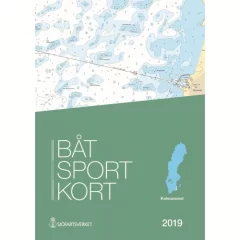
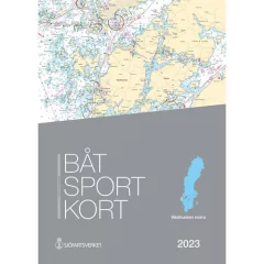
Swedish map series Kalmarsund.
- 2023 Edition
- Spiral bound A3
- Printed on water-repellent Pretex paper
Waterproof map set from the Finnish Maritime Administration. A3 size spiral bound on waterproof pretex paper.
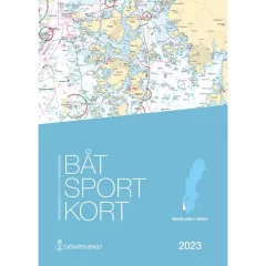
The coverage area is limited to the Swedish coast in the north to Haparanta and in the south to the Rataskär and Rata Storgrund areas.
- Published: 2023
- Waterproof paper map.
- Convenient size

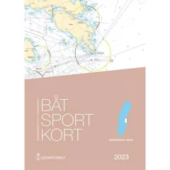
Area: Kullen – Simrishamn. New edition 2025. Approximately 200 updates. Several adjusted lighthouse sectors and changed nautical mark markings. A large number of oceanographic surveys have resulted in new depths and changed depth curves.
EN: Swedish chart sets, Båtsportkort, are ordinary nautical charts made in a smaller format. Each chart set covers a certain part of the coast and there are currently 16 sets, covering the entire Swedish coast and the large lakes on the mainland. Båtsportkort nautical charts are made in A3 size on durable and water-repellent material. They always contain general maps of the area at the beginning. This is followed by pages about the area in the scale of the original nautical charts and with all the information. Towards the end you will always find harbor charts and special charts of the area and information texts. Also includes an excerpt from the most important symbols and abbreviations.
SE: Båtsportkort är ordinarie sjökort framtagna i ett mindre format können för båtlivet. Each boat sport card covers a certain coastal stretch and today there are 16 series that cover the entire Swedish coast along the mainland and the large coastal areas. Båtsportkorten is made in A3 format on a slip-resistant and water-resistant material. They always contain an overview map starting with the entire area. Then follow the pages with the sea map in the same scale and with the same information as the ordinary sea maps over the area. Mot selet finns hamnspecialer och informationstexter samt ett utdrag som describten sjökortens most important symbols och förkortningar.
- Map: Sydkusten
- Area: Kullen - Simrishamn
- Release year: 2025
- Publisher: Swedish Maritime Administration
- Language: Swedish
Area: Måseskär – Kullen. New edition 2025 with approximately 250 updates. A large number of sea surveys have resulted in new depths and modified depth curves. Adjusted lighthouse sectors, sea marks and buoys. New piers and bridges.
EN: Swedish chart sets, Båtsportkort, are ordinary nautical charts made in a smaller format. Each chart set covers a certain part of the coast and there are currently 16 sets, covering the entire Swedish coast and the large lakes on the mainland. Båtsportkort nautical charts are made in A3 size on durable and water-repellent material. They always contain general maps of the area at the beginning. This is followed by pages about the area in the scale of the original nautical charts and with all the information. Towards the end you will always find harbor charts and special charts of the area and information texts. Also includes an excerpt from the most important symbols and abbreviations.
SE: Båtsportkort är ordinarie sjökort framtagna i ett mindre format können för båtlivet. Each boat sport card covers a certain coastal stretch and today there are 16 series that cover the entire Swedish coast along the mainland and the large coastal areas. Båtsportkorten is made in A3 format on a slip-resistant and water-resistant material. They always contain an overview map starting with the entire area. Then follow the pages with the sea map in the same scale and with the same information as the ordinary sea maps over the area. Mot selet finns hamnspecialer och informationstexter samt ett utdrag som describten sjökortens most important symbols och förkortningar.
- Map: Southern West Coast
- Area: Måseskär - Kullen
- Release year: 2025
- Publisher: Swedish Maritime Administration
- Language: Swedish
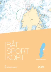
Area: Svinesund – Måseskär. Approximately 250 updates.
Several oceanographic surveys have resulted in new depths and modified depth curves.
Adjusted lighthouse sectors, seamarks and buoys. New piers and bridges and updated nature reserves.
EN: Swedish chart sets, Båtsportkort, are ordinary nautical charts made in a smaller format. Each chart set covers a certain part of the coast and there are currently 16 sets, covering the entire Swedish coast and the large lakes on the mainland. Båtsportkort nautical charts are made in A3 size on durable and water-repellent material. They always contain general maps of the area at the beginning. This is followed by pages about the area in the scale of the original nautical charts and with all the information. Towards the end you will always find harbor charts and special charts of the area and information texts. Also includes an excerpt from the most important symbols and abbreviations.
SE: Båtsportkort är ordinarie sjökort framtagna i ett mindre format können för båtlivet. Each boat sport card covers a certain coastal stretch and today there are 16 series that cover the entire Swedish coast along the mainland and the large coastal areas. Båtsportkorten is made in A3 format on a slip-resistant and water-resistant material. They always contain an overview map starting with the entire area. Then follow the pages with the sea map in the same scale and with the same information as the ordinary sea maps over the area. Mot selet finns hamnspecialer och informationstexter samt ett utdrag som describten sjökortens most important symbols och förkortningar.
- Map: West Coast North
- Area: Svinesund - Måseskär
- Release year: 2025
- Publisher: Swedish Maritime Administration
- Language: Swedish
Swedish map series Vänern.
- Spiral bound A3
- Printed on water-repellent Pretex paper.
Coverage area Mem - Vättern - Sjötorp - Mariestad
Spiral bound A3, printed on water-repellent Pretex paper.
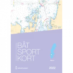
- Göta Canal map series
- Size A3
- Threaded
- Water-repellent material
- Plastic storage pocket
- Year 2022
Swedish map series Vänern.
- Spiral bound A3
- Printed on water-repellent Pretex paper.

Area: Svinesund – Måseskär.
Swedish chart sets, Båtsportkort, are ordinary nautical charts made in a smaller format. Each chart set covers a certain part of the coast and there are currently 16 sets, covering the entire Swedish coast and the large lakes on the mainland. Båtsportkort nautical charts are made in A3 size on durable and water-repellent material. They always contain general maps of the area at the beginning. This is followed by pages about the area in the scale of the original nautical charts and with all the information. Towards the end you will always find harbour charts and special charts of the area and information texts. Also includes an excerpt from the most important symbols and abbreviations.
Båtsportkort är ordinarie sjökort framtagna i ett minder format können för båtlivet. Each boat sport card covers a certain coastal stretch and today there are 16 series that cover the entire Swedish coast along the mainland and the large coastal areas. Båtsportkorten is made in A3 format on a slip-resistant and water-resistant material. They always contain an overview map starting with the entire area. Then follow the pages with the sea map in the same scale and with the same information as the ordinary sea maps over the area. Mot selet finns hamnspecialer och informationstexter samt ett utdrag som describten sjökortens most important symbols och förkortningar.
- Map: North of the West Coast
- Area: Svinesund – Måseskär
- Release year: 2023
- Language: Swedish


