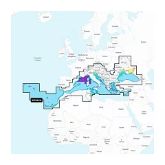
Navionics Platinum+ NPEU643L Chart, Mediterranean & Black Sea


- Navionics Mediterranean and Black Sea NPEU643L
- Detailed information about the Mediterranean and Black Seas
- MicroSD card (32GB, SD adapter included)
- Includes the Mediterranean and Black Sea regions
- 1 year of free updates
- Route guidance
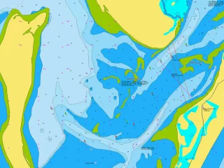
Integrated maps for a wide range of chartplotters
Navionics+ marine charts are a comprehensive solution that combines clear, reliable coastal/inland content with advanced guidance features, supporting a wide range of chartplotter brands.
Navionics chart data can be accessed in advance for free in the Navionics WebApp service.
Always ensure that the map card is compatible with your device before ordering.
Comprehensive mapping solution
Get detailed maps that include coastal features, lakes, and rivers, for a wide range of compatible chartplotters. Integrated coastal and inland lake content helps boaters worldwide.
Daily map updates
The charts are constantly updated with new and changed content. Thousands of updates are made every day. You also get a one-year subscription to get daily chart updates via the Navionics Chart Installer software.
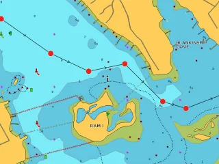
Route guidance between ports
Advanced route guidance technology2 calculates route suggestions between ports based on boat settings, chart data and most frequently traveled routes.
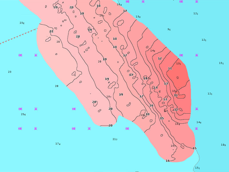
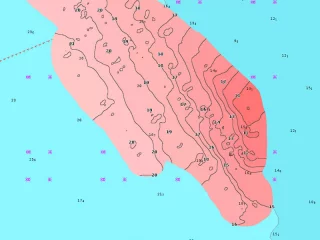
Curves up to 0.5m apart
Making both fishing and navigation easier, the curves drawn at intervals of up to 0.5 meters clearly show the bottom shapes on fishing maps and in detail, for example in marshes, canals, harbors and marinas.
Advanced map settings
Community edits
Downloadable community edits provide useful local information in the Navionics Boating app and allow you to view the data on your compatible chartplotter.
Plotter synchronization
Real-time SonarChart™ maps
More Premium Features with Navionics Platinum+ Chart Solutions:
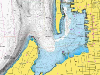
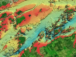
- Accurate shading
Downloadable shading5 shows the shapes of the base with colors and shadows, making it easier to interpret and clearer than just curved lines.
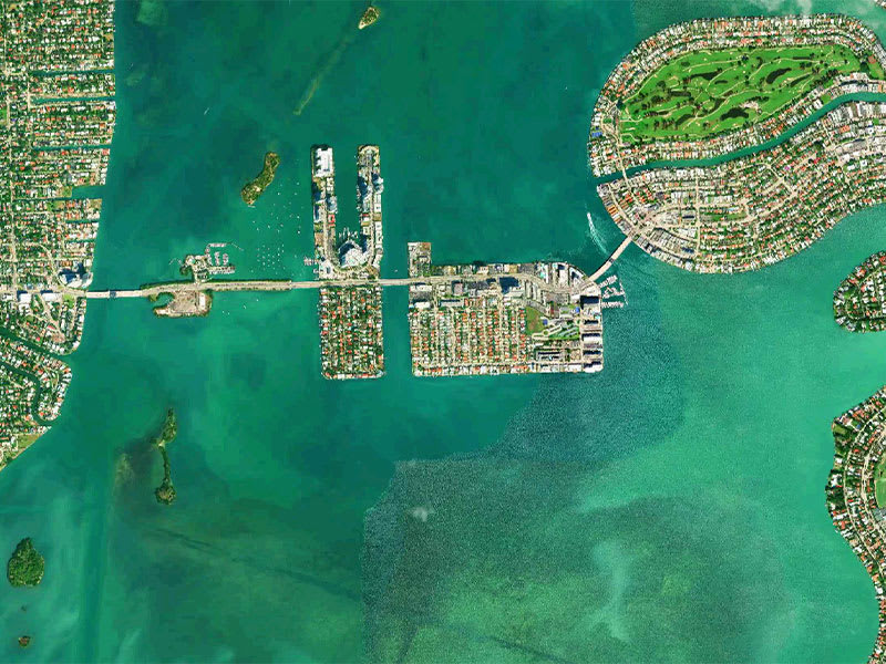
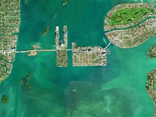
- Accurate satellite images
Downloadable high-resolution satellite imagery5 gives you a realistic view of your surroundings, which is especially handy when arriving in unfamiliar ports.
- Aerial photos
Ports, marinas, bridges, docks, boat ramps, dams and navigational landmarks are particularly clearly visible in aerial and surface imagery, improving situational awareness above the water surface.
- 3D view
Unique 3D views give you an additional perspective above and below the water surface to enhance situational awareness as key features are highlighted.
Tuotenr: 010-C1351-40
- Navionics Mediterranean and Black Sea NPEU643L
- Detailed information about the Mediterranean and Black Seas
- MicroSD card (32GB, SD adapter included)
- Includes the Mediterranean and Black Sea regions
- 1 year of free updates
- Route guidance
Integrated maps for a wide range of chartplotters
Navionics+ marine charts are a comprehensive solution that combines clear, reliable coastal/inland content with advanced guidance features, supporting a wide range of chartplotter brands.
Navionics chart data can be accessed in advance for free in the Navionics WebApp service.
Always ensure that the map card is compatible with your device before ordering.
Comprehensive mapping solution
Get detailed maps that include coastal features, lakes, and rivers, for a wide range of compatible chartplotters. Integrated coastal and inland lake content helps boaters worldwide.
Daily map updates
The charts are constantly updated with new and changed content. Thousands of updates are made every day. You also get a one-year subscription to get daily chart updates via the Navionics Chart Installer software.
Route guidance between ports
Advanced route guidance technology2 calculates route suggestions between ports based on boat settings, chart data and most frequently traveled routes.
Curves up to 0.5m apart
Making both fishing and navigation easier, the curves drawn at intervals of up to 0.5 meters clearly show the bottom shapes on fishing maps and in detail, for example in marshes, canals, harbors and marinas.
Advanced map settings
Community edits
Downloadable community edits provide useful local information in the Navionics Boating app and allow you to view the data on your compatible chartplotter.
Plotter synchronization
Real-time SonarChart™ maps
More Premium Features with Navionics Platinum+ Chart Solutions:
- Accurate shading
Downloadable shading5 shows the shapes of the base with colors and shadows, making it easier to interpret and clearer than just curved lines.
- Accurate satellite images
Downloadable high-resolution satellite imagery5 gives you a realistic view of your surroundings, which is especially handy when arriving in unfamiliar ports.
- Aerial photos
Ports, marinas, bridges, docks, boat ramps, dams and navigational landmarks are particularly clearly visible in aerial and surface imagery, improving situational awareness above the water surface.
- 3D view
Unique 3D views give you an additional perspective above and below the water surface to enhance situational awareness as key features are highlighted.
Tuotenr: 010-C1351-40

Suosittelemme sinulle


