Charts August Sale!
Charts August Sale! -ryhmän tuotteet
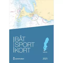
Area: Kullen – Simrishamn. New edition 2025. Approximately 200 updates. Several adjusted lighthouse sectors and changed nautical mark markings. A large number of oceanographic surveys have resulted in new depths and changed depth curves.
EN: Swedish chart sets, Båtsportkort, are ordinary nautical charts made in a smaller format. Each chart set covers a certain part of the coast and there are currently 16 sets, covering the entire Swedish coast and the large lakes on the mainland. Båtsportkort nautical charts are made in A3 size on durable and water-repellent material. They always contain general maps of the area at the beginning. This is followed by pages about the area in the scale of the original nautical charts and with all the information. Towards the end you will always find harbor charts and special charts of the area and information texts. Also includes an excerpt from the most important symbols and abbreviations.
SE: Båtsportkort är ordinarie sjökort framtagna i ett mindre format können för båtlivet. Each boat sport card covers a certain coastal stretch and today there are 16 series that cover the entire Swedish coast along the mainland and the large coastal areas. Båtsportkorten is made in A3 format on a slip-resistant and water-resistant material. They always contain an overview map starting with the entire area. Then follow the pages with the sea map in the same scale and with the same information as the ordinary sea maps over the area. Mot selet finns hamnspecialer och informationstexter samt ett utdrag som describten sjökortens most important symbols och förkortningar.
- Map: Sydkusten
- Area: Kullen - Simrishamn
- Release year: 2025
- Publisher: Swedish Maritime Administration
- Language: Swedish

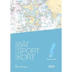
Area: Måseskär – Kullen. New edition 2025 with approximately 250 updates. A large number of sea surveys have resulted in new depths and modified depth curves. Adjusted lighthouse sectors, sea marks and buoys. New piers and bridges.
EN: Swedish chart sets, Båtsportkort, are ordinary nautical charts made in a smaller format. Each chart set covers a certain part of the coast and there are currently 16 sets, covering the entire Swedish coast and the large lakes on the mainland. Båtsportkort nautical charts are made in A3 size on durable and water-repellent material. They always contain general maps of the area at the beginning. This is followed by pages about the area in the scale of the original nautical charts and with all the information. Towards the end you will always find harbor charts and special charts of the area and information texts. Also includes an excerpt from the most important symbols and abbreviations.
SE: Båtsportkort är ordinarie sjökort framtagna i ett mindre format können för båtlivet. Each boat sport card covers a certain coastal stretch and today there are 16 series that cover the entire Swedish coast along the mainland and the large coastal areas. Båtsportkorten is made in A3 format on a slip-resistant and water-resistant material. They always contain an overview map starting with the entire area. Then follow the pages with the sea map in the same scale and with the same information as the ordinary sea maps over the area. Mot selet finns hamnspecialer och informationstexter samt ett utdrag som describten sjökortens most important symbols och förkortningar.
- Map: Southern West Coast
- Area: Måseskär - Kullen
- Release year: 2025
- Publisher: Swedish Maritime Administration
- Language: Swedish
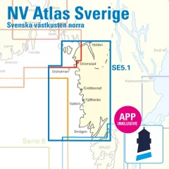
- S1 Halden to Lysekil 1: 240,000
- S2 Lysekil to Varberg 1: 240,000 (Pilot Chart Anholt-Færder-Jomfruland 1: 750,000 only in digital format)
- S3 Krokstrand to Svinesund 1: 40,000
- S3A Åbyfjorden to Brofjorden 1: 40,000
- S4 Svinesund to Dynekilen 1: 40,000
- S5 Dynekilen to Koster Fjord 1: 40,000 S6 Koster Fjord to Havstenssund 1: 40,000
- S7 Havstenssund to Bramskär 1: 40,000
- S8 Bramskär to Hamburgsund 1: 40,000
- S9 Hamburgsund to Smögen 1: 40,000
- S10 Smögen to Fiskebäckskil 1: 40,000
- S11 Gullmarn Fjord 1: 40,000
- S12 Koster Archipelago 1: 20,000
- S13 Grebbestad to Fjällbacka 1: 20,000
- S14 Fjällbacka to Dannemark 1: 20,000
- S15 Denmark to Sotekanal 1: 20,000
- S16 Smögen to Malmö 1: 20,000
- S17 Malmö to Lysekil 1: 20,000
- West Coast – North
- Port information
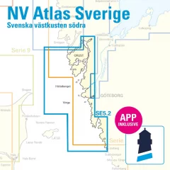
- S1 Halden to Lysekil 1: 240,000
- S2 Lysekil to Varberg 1: 240,000, (Pilot Chart Anholt-Færder-Jomfruland 1: 750,000 only in digital format)
- S3 North of Orust 1: 40,000
- S4 East of Orust 1: 40,000
- S5 North of Tjörn 1: 40,000
- S6 East of Tjörn 1: 40,000,
- S7 Fiskebäckskil to Käringön 1: 40,000
- S8 Käringön to Marstrand 1: 40,000
- S9 Marstrand to Sälö 1: 40,000
- S10 Sälö to Öckerö 1: 40,000
- S11 Öckerö to Vinga 1: 40,000
- S12 Vinga to Tistlarna 1: 40,000
- S13 Thistles to Malö 1: 40,000
- S14 Malö to Ringhals 1: 40,000
- S15 Ringhals to Varberg 1: 40,000
- S16A Northern River 1: 40,000
- S16C Kungsbackafjord 1: 40,000
- S3A Råbergsund 1: 10,000
- S16B Nordre Älv Flood barrage 1: 3,000
- S17 Lysekil to Gullholmen 1: 20,000
- S18 Gullholmen to Käringö Fjord 1: 20,000
- S19 Käringö Fjord to Kyrkesund 1: 20,000
- S20 Kyrkesund to Klädesholmen 1: 20,000
- S21 Marstrand 1: 20,000
- S22 Öckerö to Vinga 1: 20,000
- S23 Långedrag to Vrångö 1: 20,000
- West Coast – South
- Port and anchorage information
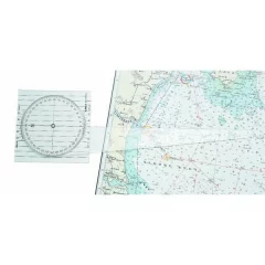
- Convenient nautical chart indicator plate for determining course and steering direction
- Integrated magnetic and meridian-based lines
- Transparent square base, ideal for chart table use
- Length: 140mm
- Width: 140mm
- Thickness: 1.5 mm
- Other features: shaft 377 mm
- Material: colorless transparent PETG
- Includes instructions for use
- Linex 2810
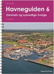
Port book covering the whole of Denmark and the west coast of Sweden from Skänör to Gothenburg.
- Norwegian and English-speaking
- Also included is the Falsterbo Canal
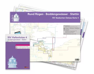
- Series 4 1:370,000
- S 25 Bornholm 1 : 140,000
- S 45 Hiddensee to Swinemünde 1 : 250,000
- S 46 Rügen to Bornholm 1 : 230,000
- S 36 The Bodden south of Zingst 1 : 60,000
- S 37 Strelasund North 1: 60,000
- S 38 Hiddensee to Jasmund 1 : 60,000
- S 39 Strelasund South 1: 40,000
- S 39A Stralsund 1 : 40,000
- S 40 Greifswalder Bodden West 1 : 60,000
- S 41 Greifswalder Bodden East 1 : 60,000
- S 42 Peenestrom South 1: 60,000
- S 43 Stettiner Haff 1 : 80,000
- S 43A Dievenow 1 : 60,000
- S 44 The Oder to Stettin-North 1 : 30,000
- S 44A The Oder to Stettin-South 1 : 30,000
- S 45A Arkona to Landtief 1 : 100,000
- S 25 Christiansø 1 : 12,000
- S 36 Am Bock 1 : 25,000
- S 39A Vitter Bodden 1: 30,000
- S 39A Ports of Stralsund 1 : 12,000
- S 41A Ruden to Wolgast 1 : 40,000
- S 42 Zecherin 1 : 40,000
- S 43A Dievenow Control 1 : 10,000
- S 43A Swinemünde 1 : 40,000
- -2023
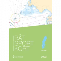
Coverage area Mem - Vättern - Sjötorp - Mariestad
Spiral bound A3, printed on water-repellent Pretex paper.
- Göta Canal map series
- Size A3
- Threaded
- Water-repellent material
- Plastic storage pocket
- Year 2022
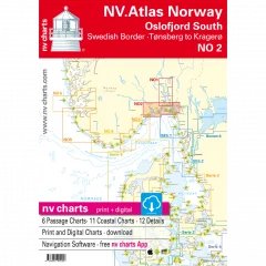
The NV Charts atlas NO2 covers the southern part of the Oslofjord. The NV Charts charts for the Norwegian coast are based on data from the Norwegian Hydrographic Office and also include the Norske Los harbour plans and numerous specially mapped details. The clear structure helps you quickly find approaches, harbours and anchorages, and important navigational information, which is also visible in the NV Charts app, is highlighted. Tide information is available both in tables and as a paper chart. The chart series impresses with its optimal dimensions and balanced sheet layout.
Area overview
The NO2 nautical chart takes you from the Swedish border straight to the bustling Oslofjord and all the way to historic Fredrikstad. From there, you can cross the fjord to Tønsberg and continue along the beautiful coast to the popular Kragerø. Of course, you can also use the detailed charts to sail the Telemark Canal or visit one of the many islands.
Order the NO1 map series if you want to visit Norway's modern capital. If you're heading towards the Skagerrak, we recommend the NO3 series, which takes you all the way to the shipping town of Kristiansand. For the Telemark Canal, we offer official Norwegian maps that are printed individually.
This map set includes:
- 6 general maps
- 11 regional maps
- 12 detailed maps
- Digital charts for navigation software and NV Charts (356-day license)
- Navigation instructions in English and Norwegian
- Port plans in paper and digital format


