Nautical Chart Series NV Atlas Norway NO2, Oslofjord South, Tönsberg-Kragerö
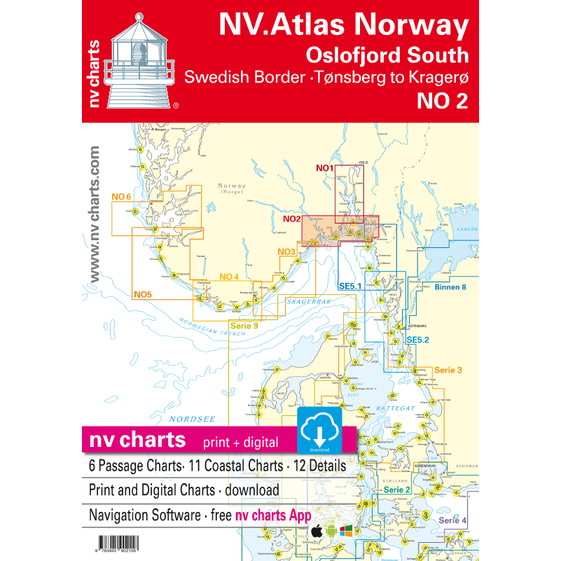
The NV Charts atlas NO2 covers the southern part of the Oslofjord. The NV Charts charts for the Norwegian coast are based on data from the Norwegian Hydrographic Office and also include the Norske Los harbour plans and numerous specially mapped details. The clear structure helps you quickly find approaches, harbours and anchorages, and important navigational information, which is also visible in the NV Charts app, is highlighted. Tide information is available both in tables and as a paper chart. The chart series impresses with its optimal dimensions and balanced sheet layout.
Area overview
The NO2 nautical chart takes you from the Swedish border straight to the bustling Oslofjord and all the way to historic Fredrikstad. From there, you can cross the fjord to Tønsberg and continue along the beautiful coast to the popular Kragerø. Of course, you can also use the detailed charts to sail the Telemark Canal or visit one of the many islands.
Order the NO1 map series if you want to visit Norway's modern capital. If you're heading towards the Skagerrak, we recommend the NO3 series, which takes you all the way to the shipping town of Kristiansand. For the Telemark Canal, we offer official Norwegian maps that are printed individually.
This map set includes:
- 6 general maps
- 11 regional maps
- 12 detailed maps
- Digital charts for navigation software and NV Charts (356-day license)
- Navigation instructions in English and Norwegian
- Port plans in paper and digital format
Tuotenr: 7422NV
Suosittelemme sinulle


