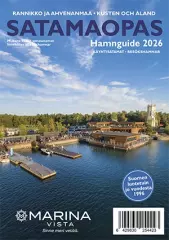
Finnish Port Charts
Large domestic harbor map magazines.Finnish Port Charts -ryhmän tuotteet
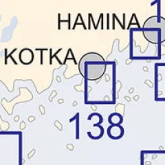
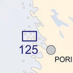
Port maps are on a scale of 1:10,000–1:25,000 and are intended to facilitate navigation in ports and other confined spaces. Port maps are also included in other maps. Port maps are straight map sheets.
- Scale: 1:10,000
- Size: 82 × 112 cm
- Outer appearance/binding appearance: straight map sheet
- Series: Harbor Map
- Library class: 69.6302
- ISBN: 978-952-266-235-4
- EAN: 9789522662354
- ID: F203710
- Publisher: Karttakeskus
- Language: Finnish, English, German
- Year of publication: 2016
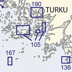
The Finnish Transport Agency's port maps are on a scale of 1:10,000–1:25,000 and are intended to facilitate navigation in ports and other confined spaces. Port maps are also included in other maps. Port maps are straight map sheets.
- Scale: 1:20,000
- Size: 82 × 112 cm
- Appearance/binding: straight map sheet
- Series: Harbor Map
- Library class: 69.6302
- ISBN: 978-952-266-139-5
- EAN: 9789522661395
- ID: F203417
- Publisher: Karttakeskus
- Language: Finnish, English, German
- Year of publication: 2013
The Finnish Transport Agency's port maps are on a scale of 1:10,000–1:25,000 and are intended to facilitate navigation in ports and other confined spaces. Port maps are also included in other maps. Port maps are straight map sheets.
- Scale: 1:10,000
- Size: 82 × 112 cm
- Appearance/binding: straight map sheet
- Series: Harbor Map
- Library class: 69.6302
- ISBN: 978-952-255-785-8
- EAN: 9789522557858
- ID: F202531
- Publisher: John Nurminen Marine
- Language: Finnish, English, German
- Year of publication: 2015
The Finnish Transport Agency's port maps are on a scale of 1:10,000–1:25,000 and are intended to facilitate navigation in ports and other confined spaces. Port maps are also included in other maps. Port maps are straight map sheets.
- Scale: 1:20,000
- Size: 82 × 112 cm
- Appearance/binding: straight map sheet
- Series: Harbor Map
- Library class: 69.6302
- ISBN: 978-952-266-141-8
- EAN: 9789522661418
- ID: F203540
- Publisher: Karttakeskus
- Language: Finnish, English, German
- Year of publication: 2017
The Finnish Transport Agency's port maps are on a scale of 1:10,000–1:25,000 and are intended to facilitate navigation in ports and other confined spaces. Port maps are also included in other maps. Port maps are straight map sheets.
- Scale: 1:25,000
- Size: 82 × 112 cm
- Outer appearance/binding appearance: straight map sheet
- Series: Harbor Map
- Library class: 69.6302
- ISBN: 978-952-255-803-9
- EAN: 9789522558039
- ID: F202796
- Publisher: John Nurminen Marine
- Language: Finnish, English, German
- Year of publication: 2014

The Finnish Transport Agency's port maps are on a scale of 1:10,000–1:25,000 and are intended to facilitate navigation in ports and other confined spaces. Port maps are also included in other maps. Port maps are straight map sheets.
- Scale: 1:25,000
- Size: 82 × 112 cm
- Appearance/binding: straight map sheet
- Series: Harbor Map
- Library class: 69.6302
- ISBN: 978-952-266-146-3
- EAN: 9789522661463
- ID: F203541
- Publisher: Karttakeskus
- Language: Finnish, English, German
- Year of publication: 2016
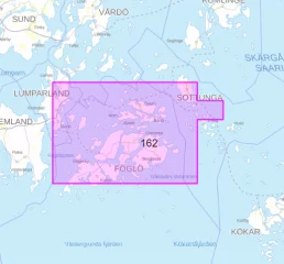
- Area: Långnäs–Sottunga
- Scale: 1:25000
- Publication year: 2025 (published April 17, 2025)
- Size: 82 × 112 cm
- Type: map sheet
- Languages: FI, EN, EN
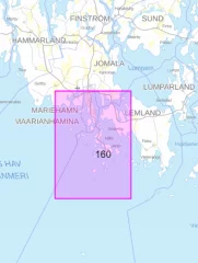
- Area: Mariehamn
- Scale: 1:25000
- Publication year: 2025 (published April 17, 2025)
- Size: 82 × 112 cm
- Type: map sheet
- Languages: FI, EN, EN

The Finnish Transport Agency's port maps are on a scale of 1:10,000–1:25,000 and are intended to facilitate navigation in ports and other confined spaces. Port maps are also included in other maps. Port maps are straight map sheets.
- Scale: 1:20,000
- Size: 82 × 112 cm
- Outer appearance/binding appearance: straight map sheet
- Series: Harbor Map
- Library class: 69.6302
- ISBN: 978-952-266-128-9
- EAN: 9789522661289
- ID: F203105
- Publisher: Karttakeskus
- Language: Finnish, English, German
- Edition: 2.
- Year of publication: 2021
The Finnish Transport Agency's port maps are on a scale of 1:10,000–1:25,000 and are intended to facilitate navigation in ports and other confined spaces. Port maps are also included in other maps. Port maps are straight map sheets.
- Scale: 1:25,000
- Size: 82 × 112 cm
- Outer appearance/binding appearance: straight map sheet
- Series: Harbor Map
- Publisher: Karttakeskus
- Language: Finnish, English, German
- Year of publication: 2017
The Finnish Transport Agency's port maps are on a scale of 1:10,000–1:25,000 and are intended to facilitate navigation in ports and other confined spaces. Port maps are also included in other maps. Port maps are straight map sheets.
- Scale: 1:20,000
- Appearance/binding: straight map sheet
- Series: Harbor Map
- Library class: 69.6302
- ISBN: 978-952-266-247-7
- EAN: 9789522662477
- ID: F203798
- Publisher: Karttakeskus
- Language: Finnish, English, German
- Year of publication: 2017
Current edition. Corrected until 20.4.2013. Scale 1:25 000, inserts 1:10 000 or 1:5 000
Mercator Projection, WGS 84 (EUREF-FIN), IALA A
- A Lovskär
- A1 Pärnäinen
- B Askgrund
- C Parainen
- C1 Brunäshålet
- C2 Tervsund
Note : For information to mariners related to the map after the publication date, see www.liikennevirasto.fi/merikartat
- Measures 82 cm x 111.5 cm
- ISBN 978-952-266-121-0
The Finnish Transport Agency's port maps are on a scale of 1:10,000–1:25,000 and are intended to facilitate navigation in ports and other confined spaces. Port maps are also included in other maps. Port maps are straight map sheets.
- Scale: 1:20,000
- Size: 82 × 112 cm
- Outer appearance/binding appearance: straight map sheet
- Series: Harbor Map
- Library class: 69.6302
- ISBN: 978-952-255-804-6
- EAN: 9789522558046
- ID: F202795
- Publisher: John Nurminen Marine
- Language: Finnish, English, German
- Year of publication: 2021

The Finnish Transport Agency's port maps are on a scale of 1:10,000–1:25,000 and are intended to facilitate navigation in ports and other confined spaces. Port maps are also included in other maps. Port maps are straight map sheets.
- Scale: 1:20-25,000
- Size: 82 × 112 cm
- Outer appearance/binding appearance: straight map sheet
- Series: Harbor Map
- Library class: 69.6302
- ISBN: 978-952-266-233-0
- EAN: 9789522662330
- ID: F203708
- Publisher: Karttakeskus
- Language: Finnish, English, German
- Year of publication: 2017