Boating Chart Kustavi Naantali Uusikaupunki (2023)
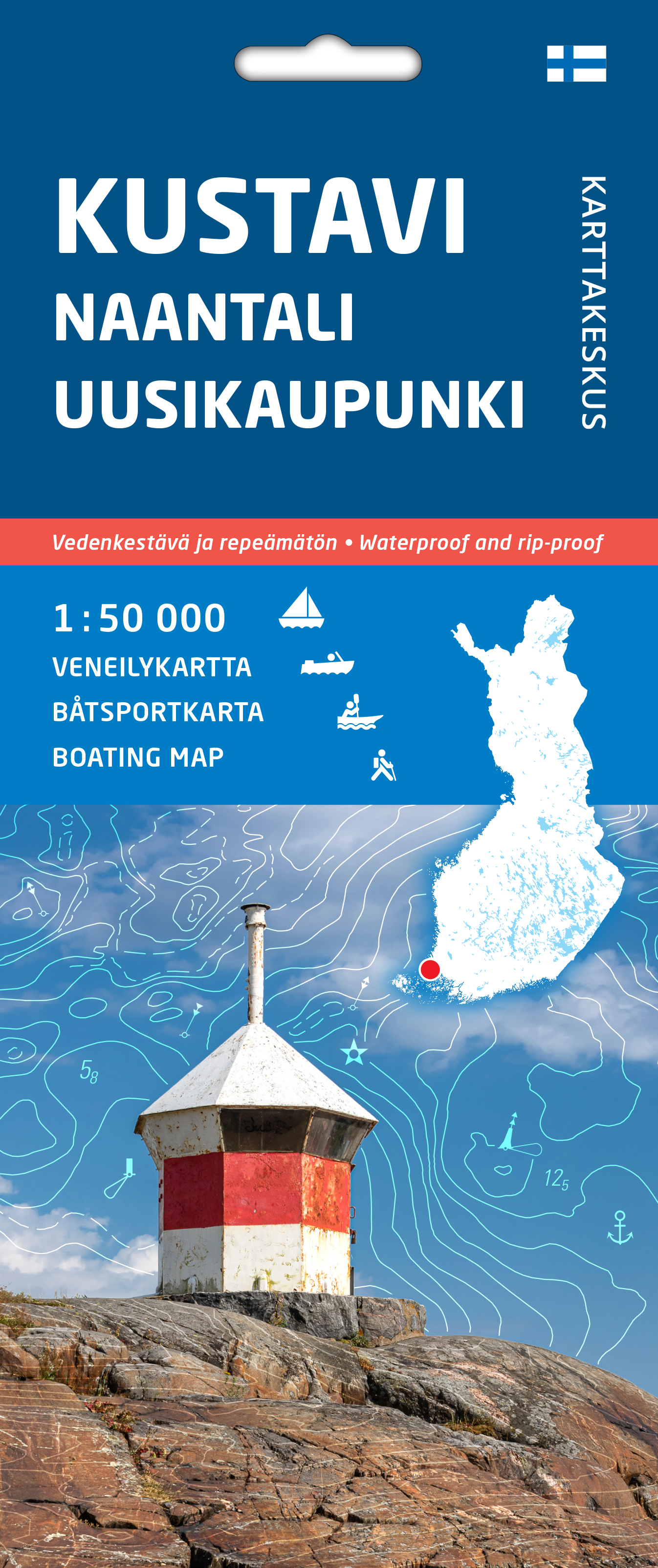

- Area: Kustavi-Naantali-Uusikaupunki
- Scale: 1:50,000
- Waterproof and tear-resistant material
- Double-sided, very comprehensive information about the area
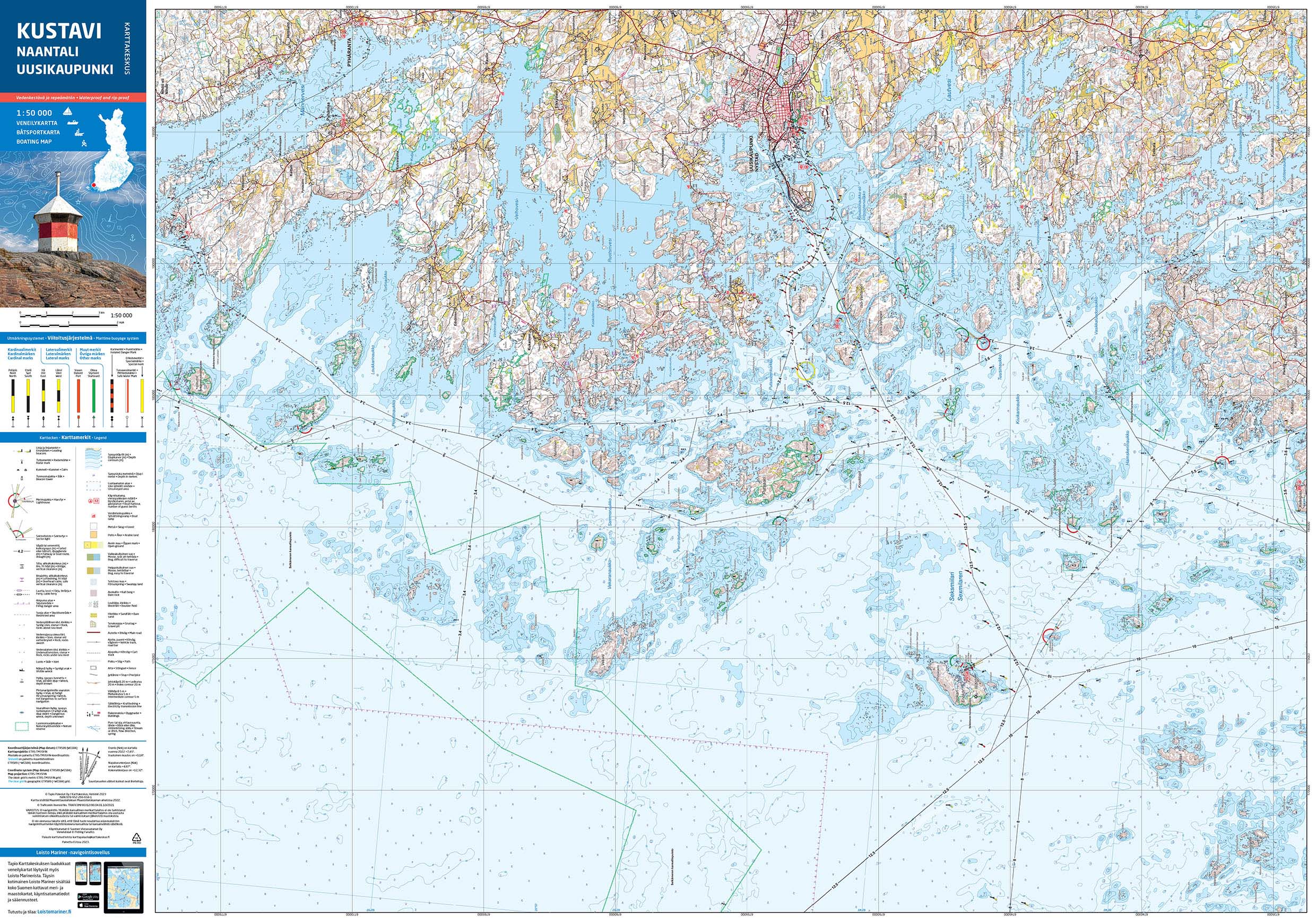
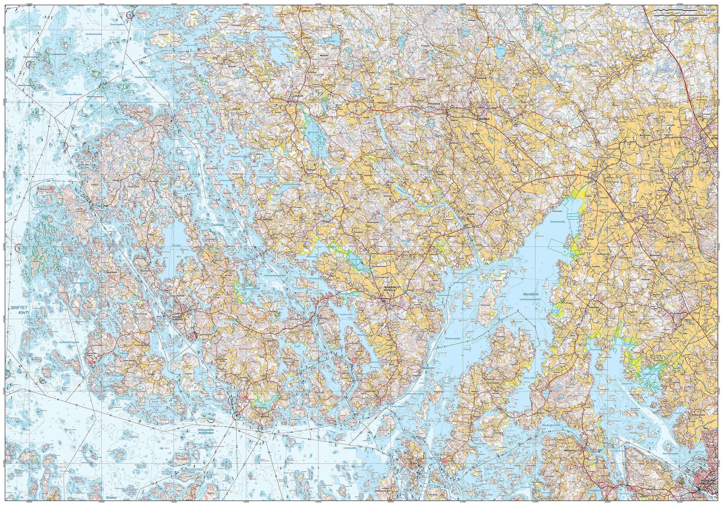
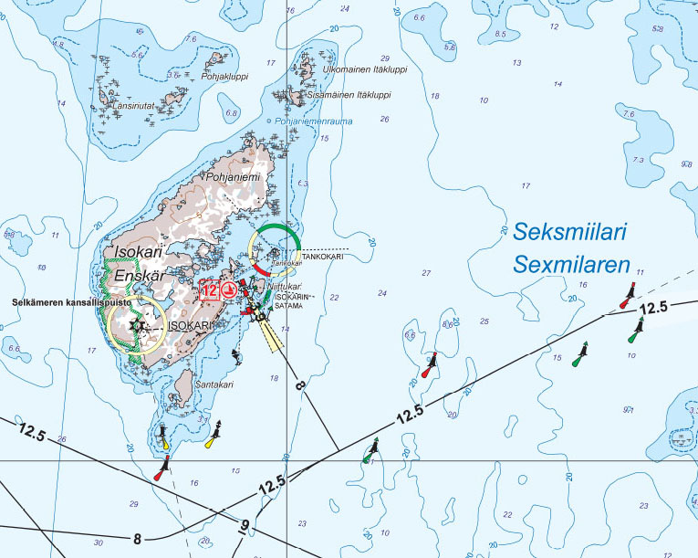
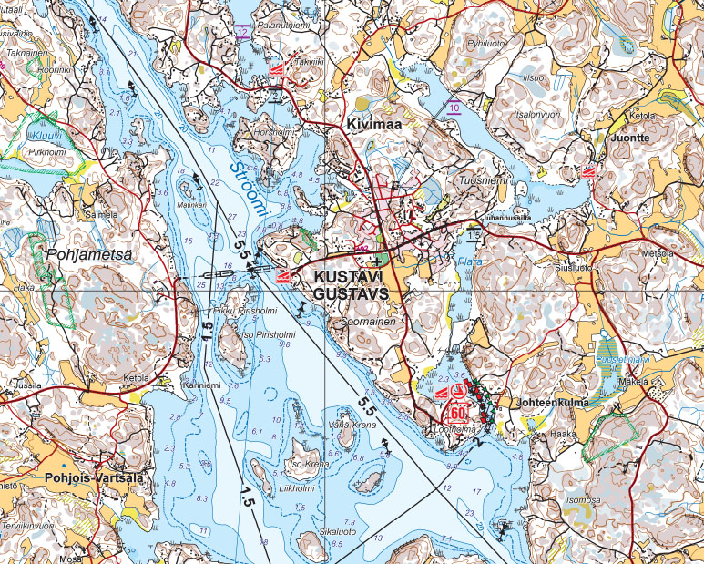
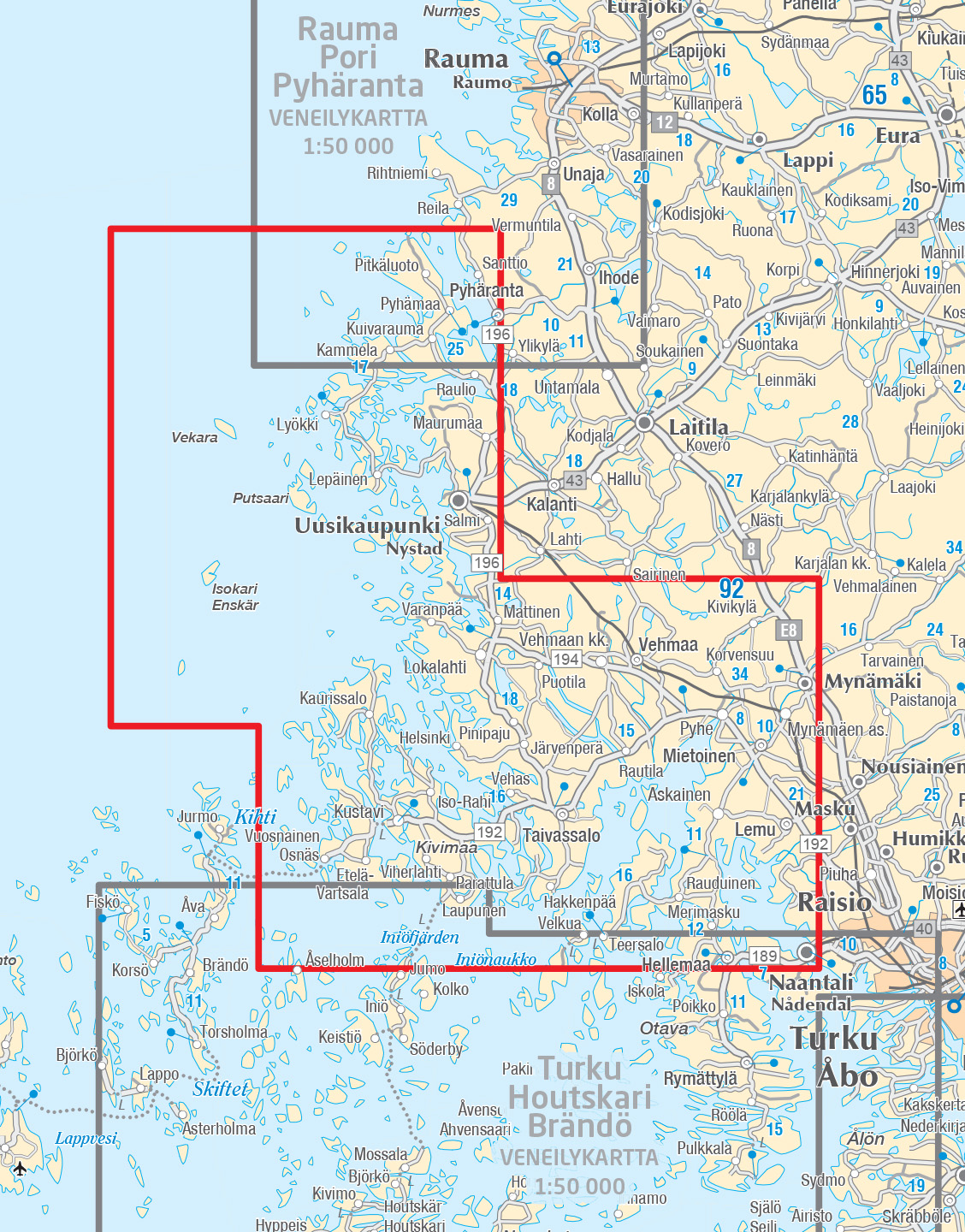
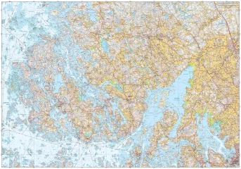
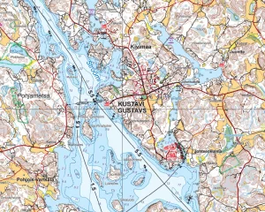
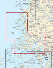
The double-sided map sheet Kustavi Naantali Uusikaupunki 1:50 000 covers the coast and archipelago from the east of Naantali to the north of Pyhäranta. The waters of Kustavi and Taivassalo are located in the middle of the area. In the south, Merimasku, Velkua and Iniö Aukko are visible. In the west, the map extends to Kihti Selka and the islands of the Bothnian Sea coast, such as Isokari, Vekara and Pyhämaa. The southern part of the Bothnian Sea National Park is located in the map area.
The new waterproof boating maps from the Finnish Map Centre depict the terrain and objects of land areas, ports of call, and various protected and restricted areas in greater detail than before. The navigation information includes, among other things, waterways with their depths, depth information, sea marks, and reefs and rocks. The maps are perfect travel companions for boaters and kayakers.
The map set is made of waterproof and tear-resistant material. When folded, the compact map is easy to handle and store on the boat. The maps are printed on both sides, so they cover almost twice the area compared to previous boating maps. When unfolded, the map shows a wide area and is especially suitable for route planning and use in combination with digital maps.
The boating information on the maps is based on the Finnish Transport and Communications Agency Traficom data from 2022, and has been supplemented with data from the National Land Survey of Finland's terrain database and other data. The scale of the maps in the maritime area is more accurate than before, at 1:50,000.
Tuotenr: 150576
- Area: Kustavi-Naantali-Uusikaupunki
- Scale: 1:50,000
- Waterproof and tear-resistant material
- Double-sided, very comprehensive information about the area
The double-sided map sheet Kustavi Naantali Uusikaupunki 1:50 000 covers the coast and archipelago from the east of Naantali to the north of Pyhäranta. The waters of Kustavi and Taivassalo are located in the middle of the area. In the south, Merimasku, Velkua and Iniö Aukko are visible. In the west, the map extends to Kihti Selka and the islands of the Bothnian Sea coast, such as Isokari, Vekara and Pyhämaa. The southern part of the Bothnian Sea National Park is located in the map area.
The new waterproof boating maps from the Finnish Map Centre depict the terrain and objects of land areas, ports of call, and various protected and restricted areas in greater detail than before. The navigation information includes, among other things, waterways with their depths, depth information, sea marks, and reefs and rocks. The maps are perfect travel companions for boaters and kayakers.
The map set is made of waterproof and tear-resistant material. When folded, the compact map is easy to handle and store on the boat. The maps are printed on both sides, so they cover almost twice the area compared to previous boating maps. When unfolded, the map shows a wide area and is especially suitable for route planning and use in combination with digital maps.
The boating information on the maps is based on the Finnish Transport and Communications Agency Traficom data from 2022, and has been supplemented with data from the National Land Survey of Finland's terrain database and other data. The scale of the maps in the maritime area is more accurate than before, at 1:50,000.
Tuotenr: 150576
Suosittelemme sinulle


