Boating Planning Chart Archipelago Sea (2022)

- Area: Archipelago Sea
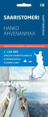
- Boating planning map
- Scale: 1:150,000
- Waterproof and tear-resistant material
When planning longer sailing trips or even a boating holiday, it is good to see large coastal areas at a glance. It is essential to get an overall picture of the waterways, suitable stages, stopping places and ports from the map. The new boating planning maps are perfect for this purpose.
The Archipelago Sea map covers the entire coast of southwestern Finland, the Archipelago Sea and the waters surrounding Åland. The map extends to Hanko and Teijo in the east, Uusikaupunki in the north and Signilskär west of Eckerö in the west. A planning map of the Gulf of Finland is also available.
The scale of the planning maps is 1:150,000 (1 cm on the map = 1.5 km / 0.81 mpk on the water), so one double-sided map sheet covers a large area. The maps present essential maritime information for planning: fairways with their navigation depths, general depth information, territorial water boundaries, lighthouses and ports of call with the number of guest berths. Fairway lines are also classified according to their navigation depth and bridges according to their clearance height. The content is supplemented by information on land areas from the GT road map.
More detailed information about ports of call can be found, for example, on the Vierassatamat.fi website.
The maps are made of waterproof and tear-resistant material. The folded map is easy to handle and store on a boat. The maps are based on data from the Finnish Transport and Communications Agency Traficom, which has been supplemented with other map data.
Tuotenr: 150572
- Area: Archipelago Sea
- Boating planning map
- Scale: 1:150,000
- Waterproof and tear-resistant material
When planning longer sailing trips or even a boating holiday, it is good to see large coastal areas at a glance. It is essential to get an overall picture of the waterways, suitable stages, stopping places and ports from the map. The new boating planning maps are perfect for this purpose.
The Archipelago Sea map covers the entire coast of southwestern Finland, the Archipelago Sea and the waters surrounding Åland. The map extends to Hanko and Teijo in the east, Uusikaupunki in the north and Signilskär west of Eckerö in the west. A planning map of the Gulf of Finland is also available.
The scale of the planning maps is 1:150,000 (1 cm on the map = 1.5 km / 0.81 mpk on the water), so one double-sided map sheet covers a large area. The maps present essential maritime information for planning: fairways with their navigation depths, general depth information, territorial water boundaries, lighthouses and ports of call with the number of guest berths. Fairway lines are also classified according to their navigation depth and bridges according to their clearance height. The content is supplemented by information on land areas from the GT road map.
More detailed information about ports of call can be found, for example, on the Vierassatamat.fi website.
The maps are made of waterproof and tear-resistant material. The folded map is easy to handle and store on a boat. The maps are based on data from the Finnish Transport and Communications Agency Traficom, which has been supplemented with other map data.
Tuotenr: 150572
Suosittelemme sinulle


