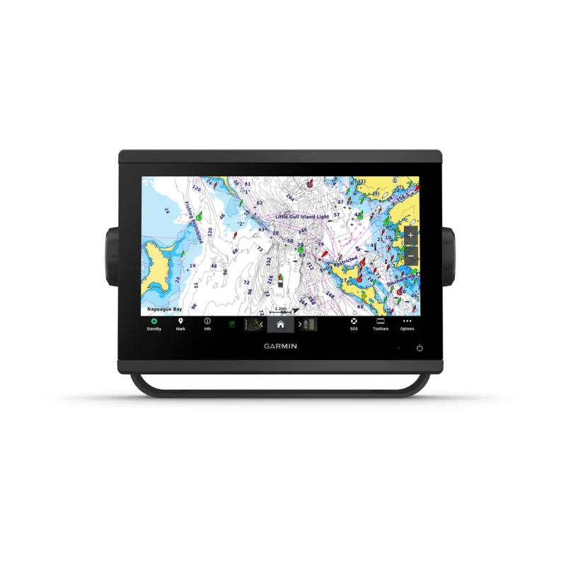
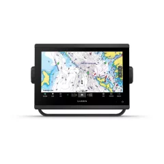
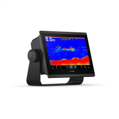
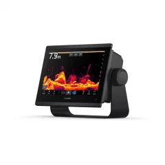
Garmin GPSMAP 923xsv chartplotter and sonar


- Screen size: 9'
- Touchscreen
- Sonar must be purchased separately
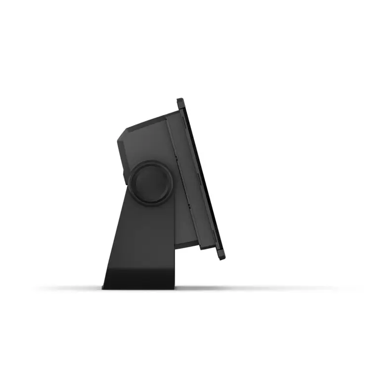
- Device dimensions: 23.3 x 16.2 x 7.6 cm
- Screen size: 19.9 x 11.2 cm
- Power input: 10 to 32 Vdc
- Maximum current consumption: 3.20A
- Typical current consumption (12 V dc): 1.37A
- Screen resolution, WxH: 1028 x 720 pixels
- Built-in GPS + GLONASS
- Highly sensitive receiver (10 Hz)
- Water rating: IPX7
- Weight: 1.6 kg
- Mounting options: Mounting, recessed or surface
- Display type: WXGA display
- Routes that can be saved: 100pcs
- Waypoints that can be saved: 5000pcs
- Automatic guidance: yes
- NMEA2000 and NMEA0183 compatible
- Supports memory cards: 2xMicroSD cards (on the back of the device)
- USB ports: yes
- Wireless remote control compatible: yes
- Video inputs: BNC 1pc
- Sailing characteristics
- DSC-compatible (displays position information reported by a DSC-compatible VHF radio): yes
- Supports FUSION-Link™ compatible radios
- AIS compatible (ability to track the location of a target vessel)
- OneHelm™ support
- BNC port for external antenna: No
Compatible maps:
- Garmin Navionics+
- Garmin Navionics Vision+
- Bluechart g3
- Bluechart g3 Vision
Sonar:
- 12-pin transducer ports: 1 pc
- Internal ClearVü: 260/455/800/1000/1200 kHz
- Internal SideVü Sonar: Internal 260/455/800/1000/1200 kHz
- Traditional sonar (dual frequency/beam): Internal (single channel CHIRP, 70/83/200 kHz, L, M, H CHIRP)
- Panoptix™ sonar support
- Livescope sonar support
Stylish 9-inch multifunction display with high-precision scanning sonar
Excellent performance and an updated IPS display, seamlessly integrates with your Garmin marine system.
- Easily integrates with multiple engines.
- Connect to compatible third-party devices with OneHelm™ digital connectivity.
- With top-notch network connectivity, you can easily expand your boating system.
- Compatible with Garmin's best navigation maps1.
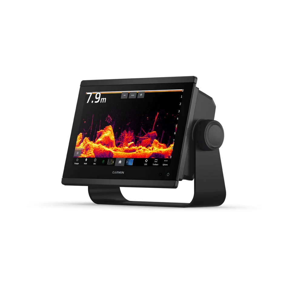
- Built-in sonar capabilities let you see below your boat
- High-precision scanning sonar
Panoptix and Livescope sonar support
Pair with easy-to-interpret real-time Panoptix or Livescope sonar (requires transducer, sold separately) to see your boat’s entire surroundings in real time.
Faster, sharper, smarter multifunction display
With improved processing power, a new streamlined shape, a borderless glass display, and a small footprint, this chartplotter is easy to retrofit into a wide variety of cockpits and boats.
Improved display optics
GPSMAP 9-inch and 12-inch chartplotters feature new, higher-resolution IPS displays for improved sunlight readability and visibility from all angles. They feature 50% more pixels than the previous generation of 9-inch GPSMAPs.
Garmin Marine Network
If you have multiple Garmin devices on your boat, you can share data, such as maps, user data, sonar, and IP cameras, between them.
NMEA2000 and NMEA0183 networks
Connect to autopilots, digital connections, weather services, FUSION-Link™ audio systems, media files, VHF radio and AIS devices on the same screen.
Integrated ANT technology
Connect to your favorite devices, including quatix marine watches, gWind 2 wireless transducers and gWind transducers, marine devices and wireless remote controls.
Motor connection
You can now connect your chartplotter to various engines, for example Yamaha engines.
Onehelm feature
This unique feature combines the functions and features of certain third-party devices, such as EmpirBus™ digital connectivity, into the same display.
Garmin Sailassist sailing features
View laylines, race start line markers, enhanced wind rose, heading and bearing to bottom, true wind data fields, tide/current/time slider, wind angle, current direction and speed, and wind speed.
Sailing poles
The polar chart lets you view important information, such as the required speeds at specific wind angles and speeds – so you know if you need to adjust your sail.
Send messages on Inreach devices
Pair your inReach satellite communicator5 with your chartplotter and type your own messages using the MFD’s on-screen keyboard. Use your contact list or add an email address, inReach address or phone number. You can also group messages by conversation, just like text messages.
Nautical charts and other maps
Upgrade your chartplotter with optional Garmin Navionics+™ or Garmin Navionics Vision+™ Premium charts, including coastal/inland content, daily updates and Auto Guidance+™ technology. Requires Garmin Active Captain app.
Active Captain app
Connect to the free, comprehensive ActiveCaptain app via built-in Wi-Fi® for features like OneChart™, smart notifications, software updates, and Garmin Helm™ digital connectivity.
Shallow Water Power Pole Anchor
When you connect Garmin chartplotters to a Force® trolling motor and compatible Power-Pole shallow water anchor system over the network, your chartplotter gets advanced boat management features6, including Smart Anchor Auto-Calc, Smart Anchor Shift, Auto-Retract, Anchor Drag Detection and Auto-Guided3 Anchoring at the End of the Route. Focus on fishing, not finding your way. Integration of these features requires purchase of C-Monster GATEWAY through Power-Pole
Power-Pole Charge integration
The Power-Pole CHARGE Marine Power Manager integrates with compatible Garmin chartplotters to help keep your battery running longer and stronger on the water. You can charge batteries while you're on the move, monitor power usage, select power destinations, manage emergency starts, and even transfer power between backup power sources right from your chartplotter screen.
Tuotenr: 13353
Valmistajan tuotenr: 010-02366-02
Lisävarusteet
- Screen size: 9'
- Touchscreen
- Sonar must be purchased separately
- Device dimensions: 23.3 x 16.2 x 7.6 cm
- Screen size: 19.9 x 11.2 cm
- Power input: 10 to 32 Vdc
- Maximum current consumption: 3.20A
- Typical current consumption (12 V dc): 1.37A
- Screen resolution, WxH: 1028 x 720 pixels
- Built-in GPS + GLONASS
- Highly sensitive receiver (10 Hz)
- Water rating: IPX7
- Weight: 1.6 kg
- Mounting options: Mounting, recessed or surface
- Display type: WXGA display
- Routes that can be saved: 100pcs
- Waypoints that can be saved: 5000pcs
- Automatic guidance: yes
- NMEA2000 and NMEA0183 compatible
- Supports memory cards: 2xMicroSD cards (on the back of the device)
- USB ports: yes
- Wireless remote control compatible: yes
- Video inputs: BNC 1pc
- Sailing characteristics
- DSC-compatible (displays position information reported by a DSC-compatible VHF radio): yes
- Supports FUSION-Link™ compatible radios
- AIS compatible (ability to track the location of a target vessel)
- OneHelm™ support
- BNC port for external antenna: No
Compatible maps:
- Garmin Navionics+
- Garmin Navionics Vision+
- Bluechart g3
- Bluechart g3 Vision
Sonar:
- 12-pin transducer ports: 1 pc
- Internal ClearVü: 260/455/800/1000/1200 kHz
- Internal SideVü Sonar: Internal 260/455/800/1000/1200 kHz
- Traditional sonar (dual frequency/beam): Internal (single channel CHIRP, 70/83/200 kHz, L, M, H CHIRP)
- Panoptix™ sonar support
- Livescope sonar support
Stylish 9-inch multifunction display with high-precision scanning sonar
Excellent performance and an updated IPS display, seamlessly integrates with your Garmin marine system.
- Easily integrates with multiple engines.
- Connect to compatible third-party devices with OneHelm™ digital connectivity.
- With top-notch network connectivity, you can easily expand your boating system.
- Compatible with Garmin's best navigation maps1.
- Built-in sonar capabilities let you see below your boat
- High-precision scanning sonar
Panoptix and Livescope sonar support
Pair with easy-to-interpret real-time Panoptix or Livescope sonar (requires transducer, sold separately) to see your boat’s entire surroundings in real time.
Faster, sharper, smarter multifunction display
With improved processing power, a new streamlined shape, a borderless glass display, and a small footprint, this chartplotter is easy to retrofit into a wide variety of cockpits and boats.
Improved display optics
GPSMAP 9-inch and 12-inch chartplotters feature new, higher-resolution IPS displays for improved sunlight readability and visibility from all angles. They feature 50% more pixels than the previous generation of 9-inch GPSMAPs.
Garmin Marine Network
If you have multiple Garmin devices on your boat, you can share data, such as maps, user data, sonar, and IP cameras, between them.
NMEA2000 and NMEA0183 networks
Connect to autopilots, digital connections, weather services, FUSION-Link™ audio systems, media files, VHF radio and AIS devices on the same screen.
Integrated ANT technology
Connect to your favorite devices, including quatix marine watches, gWind 2 wireless transducers and gWind transducers, marine devices and wireless remote controls.
Motor connection
You can now connect your chartplotter to various engines, for example Yamaha engines.
Onehelm feature
This unique feature combines the functions and features of certain third-party devices, such as EmpirBus™ digital connectivity, into the same display.
Garmin Sailassist sailing features
View laylines, race start line markers, enhanced wind rose, heading and bearing to bottom, true wind data fields, tide/current/time slider, wind angle, current direction and speed, and wind speed.
Sailing poles
The polar chart lets you view important information, such as the required speeds at specific wind angles and speeds – so you know if you need to adjust your sail.
Send messages on Inreach devices
Pair your inReach satellite communicator5 with your chartplotter and type your own messages using the MFD’s on-screen keyboard. Use your contact list or add an email address, inReach address or phone number. You can also group messages by conversation, just like text messages.
Nautical charts and other maps
Upgrade your chartplotter with optional Garmin Navionics+™ or Garmin Navionics Vision+™ Premium charts, including coastal/inland content, daily updates and Auto Guidance+™ technology. Requires Garmin Active Captain app.
Active Captain app
Connect to the free, comprehensive ActiveCaptain app via built-in Wi-Fi® for features like OneChart™, smart notifications, software updates, and Garmin Helm™ digital connectivity.
Shallow Water Power Pole Anchor
When you connect Garmin chartplotters to a Force® trolling motor and compatible Power-Pole shallow water anchor system over the network, your chartplotter gets advanced boat management features6, including Smart Anchor Auto-Calc, Smart Anchor Shift, Auto-Retract, Anchor Drag Detection and Auto-Guided3 Anchoring at the End of the Route. Focus on fishing, not finding your way. Integration of these features requires purchase of C-Monster GATEWAY through Power-Pole
Power-Pole Charge integration
The Power-Pole CHARGE Marine Power Manager integrates with compatible Garmin chartplotters to help keep your battery running longer and stronger on the water. You can charge batteries while you're on the move, monitor power usage, select power destinations, manage emergency starts, and even transfer power between backup power sources right from your chartplotter screen.
Tuotenr: 13353
Valmistajan tuotenr: 010-02366-02
Suosittelemme sinulle


