Garmin Navionics+ NSEU644L Chart, Baltic Sea + Finnish and Swedish Lakes
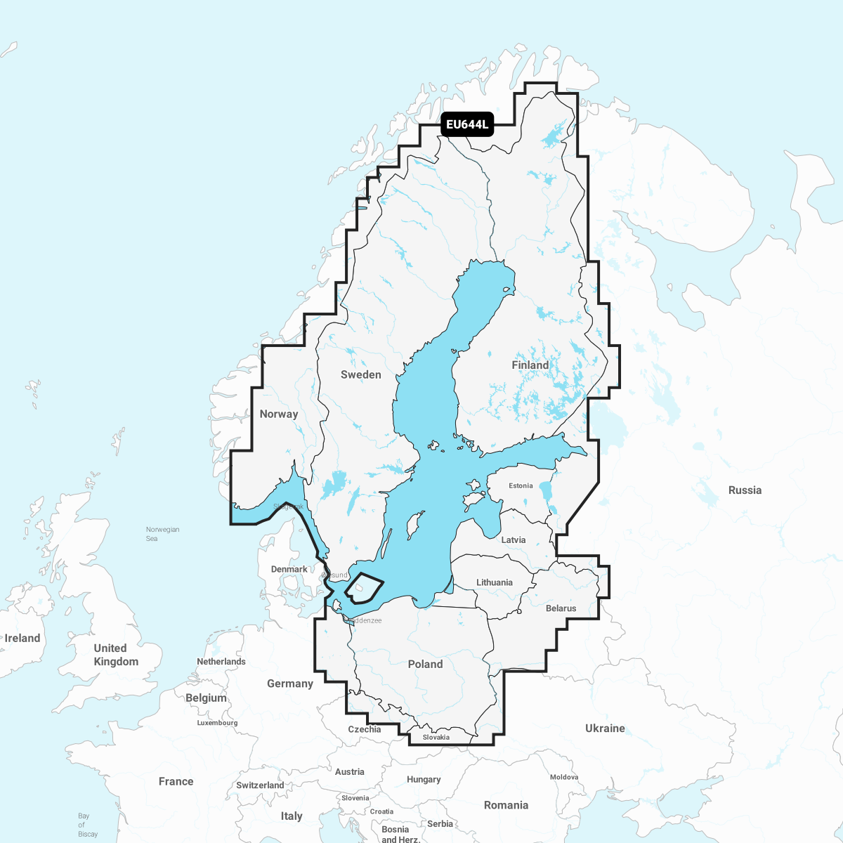

Chart Card NSEU644L. Garmin Navionics+ charts feature vibrant colors, a streamlined interface, and combined coastal/inland content, along with the popular Navionics®-style color palette. It lets you easily plan your route with the most popular marine chart provider on the market
Garmin Navionics+ NSEU644L
Detailed information on the Baltic Sea and the lakes of Scandinavia and Poland. The information covers the Gulf of Bothnia, the Gulf of Finland and the Gulf of Riga; the Masurian Lakes in Poland, Oderinhaffin, Lake Peipus; Mjøsa, Bandak and Norsjø in Norway; Vänern, Vättern, Siljan and Storavan in Sweden and Inarijärvi, Miekojärvi, Simojärvi and Kiantajärvi in ??Finland and many more. Includes the following ports: Oslo (Norway), Malmö and Stockholm (Sweden), Oulu and Helsinki (Finland), St. Petersburg and Kaliningrad (Russia) and Gdansk (Poland).
You can access the map material here .
Check map compatibility here or with customer service.
Comprehensive mapping solution for Garmin chartplotters
Daily map updates
Auto guidance+ technology
Depth of field shading
Curves up to 0.5m apart
Shallow water shading
Active captain community
Tuotenr: 14408
Valmistajan tuotenr: 010-C1273-20
Suosittelemme sinulle


