Harbour Guide 10: The High Coast - Arholma
- New book, 1st edition.
- Swedish-speaking
- 206 harbours and natural harbors between the High Coast and Arholma
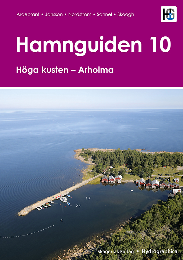
A comprehensive and well-illustrated harbour guide from the High Coast in the north to Arholma in the south. Contains 206 well-known and lesser-known natural and guest harbours. Each harbour is presented with a detailed harbour map, helicopter photo and harbour information. The book also contains tips for getting around the area.
The map data is unique. Each map is produced by Hydrographica, which means that the map data is produced from 3D aerial photographs and verified with on-site measurements. Helicopter images provide an overview of the ports, their surroundings, facilities, inlets, hazards and mooring opportunities. Notable shoals and rocks are marked on the images.
In addition to sea and waterway charts, Hamnguid's books include advanced topographic maps of the areas, based on laser scanning to measure contours and create a 3D image of the area using shading. These help assess where it is best to anchor, whether the islands are open and sensitive to wind.
Tuotenr: 88150
Valmistajan tuotenr: HG10
- New book, 1st edition.
- Swedish-speaking
- 206 harbours and natural harbors between the High Coast and Arholma
A comprehensive and well-illustrated harbour guide from the High Coast in the north to Arholma in the south. Contains 206 well-known and lesser-known natural and guest harbours. Each harbour is presented with a detailed harbour map, helicopter photo and harbour information. The book also contains tips for getting around the area.
The map data is unique. Each map is produced by Hydrographica, which means that the map data is produced from 3D aerial photographs and verified with on-site measurements. Helicopter images provide an overview of the ports, their surroundings, facilities, inlets, hazards and mooring opportunities. Notable shoals and rocks are marked on the images.
In addition to sea and waterway charts, Hamnguid's books include advanced topographic maps of the areas, based on laser scanning to measure contours and create a 3D image of the area using shading. These help assess where it is best to anchor, whether the islands are open and sensitive to wind.
Tuotenr: 88150
Valmistajan tuotenr: HG10
Suosittelemme sinulle


