Harbour Guide 9: Göta Canal, Lake Vänern and Lake Vättern

- Published 2020
- Swedish-speaking
- 255 harbours and natural harbours from the areas of Göta älv, Vänern, Dalslands kanal, Vikingaleden, Göta kanal and Vättern.
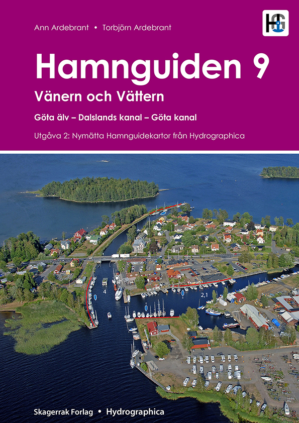
A comprehensive and well-illustrated harbour guide for the areas of Göta älv, Vänern, Dalslands kanal, Vikingaleden, Göta kanal and Vättern. Contains 255 well-known and lesser-known natural and guest harbours. natural and guest harbours from the above-mentioned areas. Each harbour is presented with a detailed harbour map, helicopter photo and harbour information. In addition, the book contains tips for moving around the area.
The map data is unique. Each map is produced by Hydrographica, which means that the map data is produced from 3D aerial photographs and verified with on-site measurements. Helicopter images provide an overview of the ports, their surroundings, facilities, inlets, hazards and mooring opportunities. Notable shoals and rocks are marked on the images.
In addition to sea and waterway charts, Hamnguid's books include advanced topographic maps of the areas, based on laser scanning to measure contours and create a 3D image of the area using shading. These help assess where it is best to anchor, whether the islands are open and sensitive to wind.
Tuotenr: 88149
Valmistajan tuotenr: 978-82-7997-221-1
- Published 2020
- Swedish-speaking
- 255 harbours and natural harbours from the areas of Göta älv, Vänern, Dalslands kanal, Vikingaleden, Göta kanal and Vättern.
A comprehensive and well-illustrated harbour guide for the areas of Göta älv, Vänern, Dalslands kanal, Vikingaleden, Göta kanal and Vättern. Contains 255 well-known and lesser-known natural and guest harbours. natural and guest harbours from the above-mentioned areas. Each harbour is presented with a detailed harbour map, helicopter photo and harbour information. In addition, the book contains tips for moving around the area.
The map data is unique. Each map is produced by Hydrographica, which means that the map data is produced from 3D aerial photographs and verified with on-site measurements. Helicopter images provide an overview of the ports, their surroundings, facilities, inlets, hazards and mooring opportunities. Notable shoals and rocks are marked on the images.
In addition to sea and waterway charts, Hamnguid's books include advanced topographic maps of the areas, based on laser scanning to measure contours and create a 3D image of the area using shading. These help assess where it is best to anchor, whether the islands are open and sensitive to wind.
Tuotenr: 88149
Valmistajan tuotenr: 978-82-7997-221-1
Suosittelemme sinulle


