Tuoteryhmät
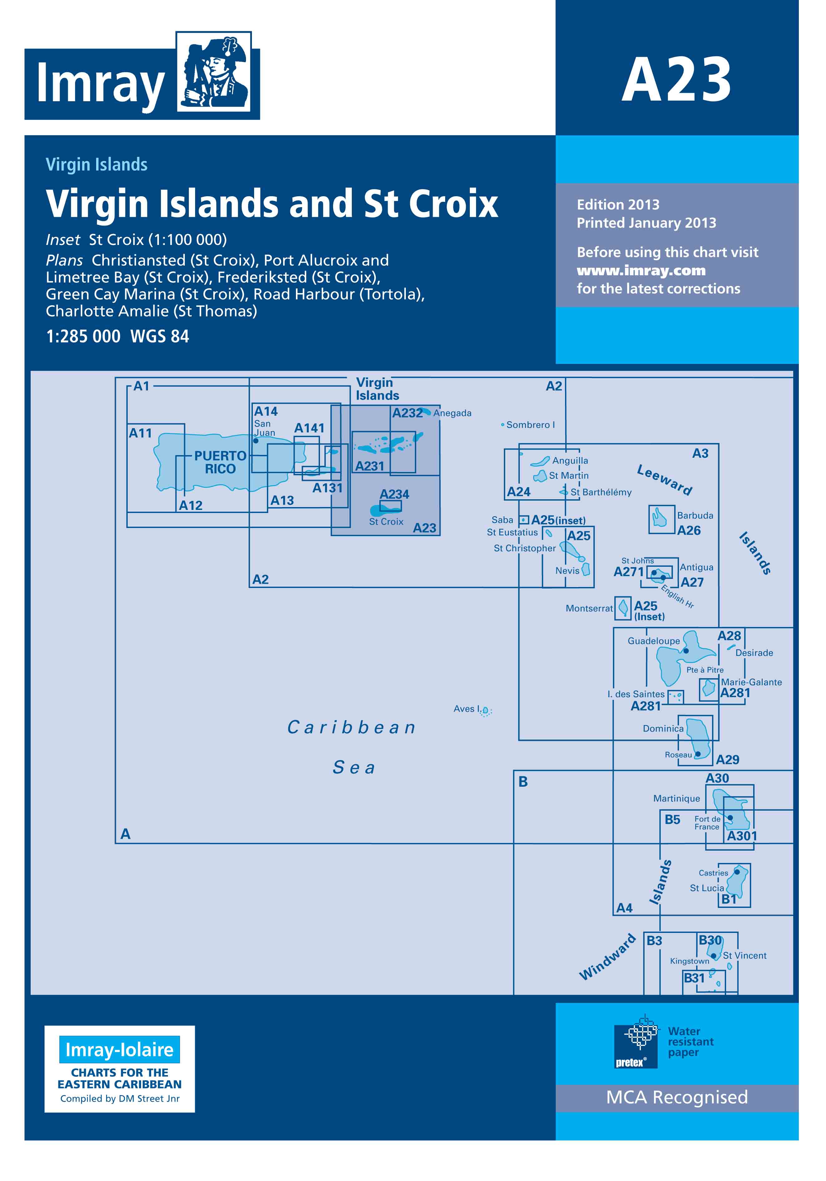
Imray Nautical Chart A23: St Croix
-40%
-40%
- Scale: 1:285,000.
Imray's nautical chart for the Caribbean around the island of St. Croix. Includes an additional map of St. Croix (1:100,000).
Included map plans:
Christiansted (St. Croix)
Port Alucroix and Limetree Bay (St. Croix)
Frederiksted (St. Croix)
Green Cay Marina (St. Croix)
Road Harbour (Tortola)
Charlotte Amalie (St. Thomas)
Tuotenr: IMRA23
Kampanjahinta
17,40 €29,00 €/ kpl
Yhteensä sis. alv 25.5%
Helsinki LauttasaariAvailablehyllypaikka: 1
Vantaa PorttipuistoNot currently available
VerkkokauppaAvailabledelivery time 1 - 3 working days
Toimituksen hinta: 5,90 €Matkahuolto's Near Parcel
- Scale: 1:285,000.
Imray's nautical chart for the Caribbean around the island of St. Croix. Includes an additional map of St. Croix (1:100,000).
Included map plans:
Christiansted (St. Croix)
Port Alucroix and Limetree Bay (St. Croix)
Frederiksted (St. Croix)
Green Cay Marina (St. Croix)
Road Harbour (Tortola)
Charlotte Amalie (St. Thomas)
Tuotenr: IMRA23
Suosittelemme sinulle
Maksutavat


