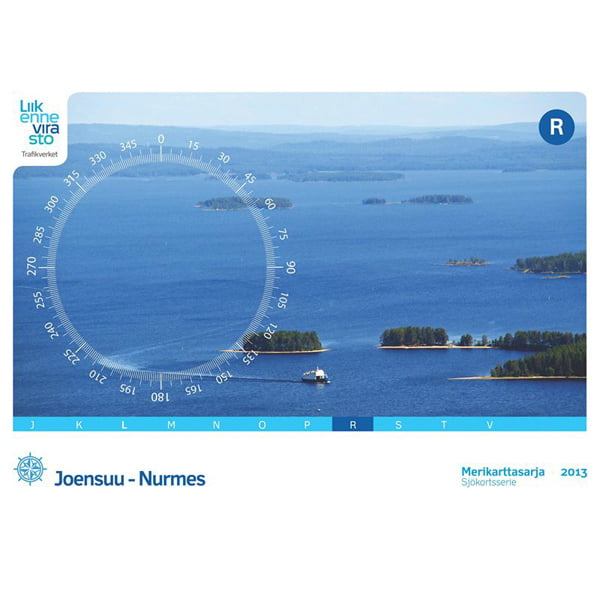
Inland Water Chart Series R, Joensuu-Nurmes (2013)


- Map series R
- Joensuu-Nurmes area
- Scale: 1:40,000/1:20,000
- Size: 46 × 34 cm
- Number of pages: 52
- Appearance/binding: wire-bound
- Series: Inland Water Chart Series
- Library class: 69.6302
- ISBN : 978-952-266-102-9
- EAN : 9789522661029
- ID: F203001
- Publisher: Karttakeskus
- Language: Finnish, English, German
- Year of publication: 2013
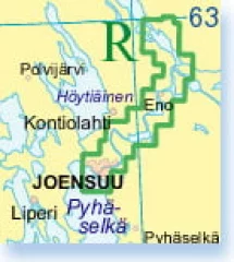
The 2013 edition of the Lakeland nautical chart series R is the first blue nautical chart for the Pielinen region. The area covered by the series has expanded from the previous Pielisjoki to the Pielinen. The new series replaces the inland water charts 424, 425 and 426 that were previously on sale in Pielinen.
The scale of the R-series, produced in a small series size (46 × 34 cm), is 1:40,000 in Pielinen and 1:20,000 in Pielisjoki. The scales of special maps are even more precise.
Many changes have been made to the R-series compared to the previous edition. For example, all depth information for Pielinen has been updated and most of the Pielisjoki has been updated. Similarly, the terrain information has been renewed for the entire series area, and the pier information has been updated.
The Finnish Transport Agency's lake area nautical chart series are intended for all types of boating. In addition to the normal map pages, the chart series contain a large number of special charts that facilitate navigation in certain difficult-to-navigate areas. The chart series are spiral-bound atlases, and are packed in a plastic pocket. The coordinate system of the atlas is EUREF - FIN (WGS84). The inland water nautical chart series are divided regionally as follows:
- J Vesijärvi–Päijänne 1:40,000
- K Keitele and Keitele's canal 1:40,000
- L Lappeenranta–Savonlinna 1:40,000
- M Savonlinna–Kuopio 1:40,000
- N Tampere–Currents 1:30,000
- O Tampere–Hämeenlinna 1:30,000
- P Valkeakoski–Längelmäki–Hauho 1:30,000
- R Joensuu–Nurmes 1:20,000 / 1:40,000
- S Saimaa Canal 1:10,000
- T Oulujärvi 1:40 000
- V Savonlinna–Joensuu 1:40,000
Tuotenr: FBR
Lisävarusteet
- Map series R
- Joensuu-Nurmes area
- Scale: 1:40,000/1:20,000
- Size: 46 × 34 cm
- Number of pages: 52
- Appearance/binding: wire-bound
- Series: Inland Water Chart Series
- Library class: 69.6302
- ISBN : 978-952-266-102-9
- EAN : 9789522661029
- ID: F203001
- Publisher: Karttakeskus
- Language: Finnish, English, German
- Year of publication: 2013
The 2013 edition of the Lakeland nautical chart series R is the first blue nautical chart for the Pielinen region. The area covered by the series has expanded from the previous Pielisjoki to the Pielinen. The new series replaces the inland water charts 424, 425 and 426 that were previously on sale in Pielinen.
The scale of the R-series, produced in a small series size (46 × 34 cm), is 1:40,000 in Pielinen and 1:20,000 in Pielisjoki. The scales of special maps are even more precise.
Many changes have been made to the R-series compared to the previous edition. For example, all depth information for Pielinen has been updated and most of the Pielisjoki has been updated. Similarly, the terrain information has been renewed for the entire series area, and the pier information has been updated.
The Finnish Transport Agency's lake area nautical chart series are intended for all types of boating. In addition to the normal map pages, the chart series contain a large number of special charts that facilitate navigation in certain difficult-to-navigate areas. The chart series are spiral-bound atlases, and are packed in a plastic pocket. The coordinate system of the atlas is EUREF - FIN (WGS84). The inland water nautical chart series are divided regionally as follows:
- J Vesijärvi–Päijänne 1:40,000
- K Keitele and Keitele's canal 1:40,000
- L Lappeenranta–Savonlinna 1:40,000
- M Savonlinna–Kuopio 1:40,000
- N Tampere–Currents 1:30,000
- O Tampere–Hämeenlinna 1:30,000
- P Valkeakoski–Längelmäki–Hauho 1:30,000
- R Joensuu–Nurmes 1:20,000 / 1:40,000
- S Saimaa Canal 1:10,000
- T Oulujärvi 1:40 000
- V Savonlinna–Joensuu 1:40,000
Tuotenr: FBR
Suosittelemme sinulle


