New
New group products

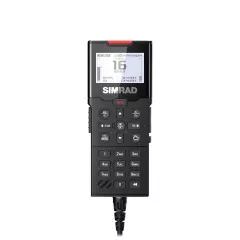
The Simrad HS100 is a wired extra handset for RS100 and RS100B VHF radios. It lets you operate the radio from a second position on board, for example the helm and the saloon, without touching the radio's black box.
The handset has a large, clear monochrome dot-matrix display with adjustable backlighting. The inverted night mode keeps light emission low in the dark, and the backlight can sync over the NMEA 2000 network so it dims together with the rest of your electronics.
The alphanumeric keypad makes it easy to enter channels, favourites and a handset name. Channel scan and favourites speed up everyday use, and the 60-second audio rewind helps when you miss a call. With the RS100 the handset also works as an on-board intercom.
Up to four wired handsets and four speakers can be added to one system. This item is the handset only. The SP100 speaker is sold separately.
- Wired extra handset for Simrad RS100 and RS100B VHF radios
- Large FSTN dot-matrix display, 256 × 160 pixels, white LED backlight
- 10 backlight levels, day and night mode (inverted night display)
- Backlight sync over NMEA 2000
- Alphanumeric keypad and handset naming
- Channel scan and favourites
- 60-second audio rewind
- On-board intercom use with the RS100
- Up to 4 wired handsets and 4 speakers per system
- Includes handset and cradle; SP100 speaker and connecting cable sold separately

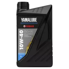
The oil is developed for marine use, where load and engine speed vary. The formulation protects against wear, oxidation, foaming and corrosion, and its detergent and dispersant additives help keep the engine's internal parts clean. The corrosion protection also works while the engine is idle. The oil exceeds API SJ requirements.
Part numbers and references:
• Yamaha OEM number: YMD630600101
Always check the recommended oil grade and quantity in your engine's owner's manual. Genuine Yamalube oil.
• For Yamaha four-stroke outboards and WaveRunner personal watercraft
• Exceeds API SJ requirements
• Protects against wear, oxidation, foaming and corrosion
• Detergent and dispersant additives keep the engine clean
• Part number: YMD630600101
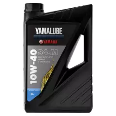
The oil is developed for marine use, where load and engine speed vary. The formulation protects against wear, oxidation, foaming and corrosion, and its detergent and dispersant additives help keep the engine's internal parts clean. The corrosion protection also works while the engine is idle. The oil exceeds API SJ requirements.
Part numbers and references:
• Yamaha OEM number: YMD630600501
Always check the recommended oil grade and quantity in your engine's owner's manual. Genuine Yamalube oil.
- Genuine Yamalube S4-M, semi-synthetic 10W-40
- For Yamaha four-stroke outboards and WaveRunner personal watercraft
- Exceeds API SJ requirements
- Protects against wear, oxidation, foaming and corrosion
- Detergent and dispersant additives keep the engine clean
- Part number: YMD630600501
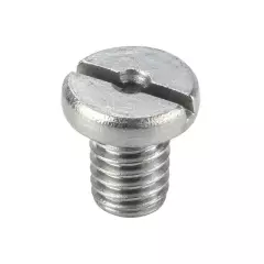
The Yamaha gearcase oil plug M8 is a genuine drain and fill plug for the gearcase of many Yamaha outboards.
The plug is used as a drain or fill plug when changing the gearcase oil, depending on the engine and gearcase. The thread is M8 x 1.25 and the slotted head takes a flat screwdriver. The gasket is sold separately and should be checked or replaced at every oil change.
Part numbers and references:
- Yamaha OEM number: 903400800200, 9034008M0400
- Other Yamaha references: 90340-08014-00, 90340-08125-00, 90340-08M04-00
- Aftermarket numbers: Sierra Marine 18-2371, Mallory Marine 9-72653
- Mercury reference: 22-81924M
Please check fitment against your engine model and model year before ordering. Genuine Yamaha part.
- Genuine Yamaha part
- M8 x 1.25 thread
- For draining and filling gearcase oil
- Straight slotted head (screwdriver)
- Gasket sold separately
- The same plug is also listed under other Yamaha, Mercury and aftermarket numbers
- Yamaha OEM: 903400800200, 9034008M0400
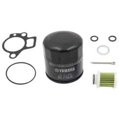
The Yamaha 100-hour service kit F30B–F70A is a genuine service kit for Yamaha four-stroke outboards. It bundles the key parts needed for scheduled maintenance.
The parts in the kit are matched to the service needs of the listed engine models, which makes it easy to gather the correct parts before a service. Engine oil, gearcase oil, spark plugs, impeller and other service parts are not included and are added separately when needed.
Kit contents:
- 1 × oil filter
- 1 × fuel filter
- 1 × fuel filter O-ring
- 1 × thermostat gasket
- 1 × engine oil drain plug gasket
- 2 × gaskets for the gearcase oil drain/fill plugs
- 1 × propeller cotter pin
Compatible models:
- F30B
- F40F
- F40G
- F50H
- F60F
- F70A
Part numbers and references:
- Yamaha OEM number: 6BTW006B0000
Please check fitment against your engine model and model year before ordering. Genuine Yamaha part.
• Fits: F30B–F70A
• Includes filters, gaskets and propeller cotter pin
• Does not include oils, spark plugs or impeller
• Yamaha OEM: 6BTW006B0000
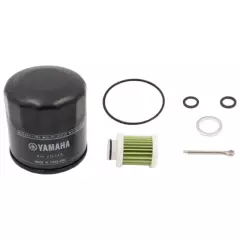
The parts in the kit are matched to the service needs of the listed engine models, which makes it easy to gather the correct parts before a service. Engine oil, gearcase oil, spark plugs, impeller and other service parts are not included and are added separately when needed.
Kit contents:
• 1 × oil filter
• 1 × fuel filter
• 1 × fuel filter O-ring
• 1 × engine oil drain plug gasket
• 2 × gaskets for the gearcase oil drain/fill plugs
• 1 × propeller cotter pin
Compatible models:
• F80D
• F100F
• F115B
• F130A
Part numbers and references:
• Yamaha OEM number: 6HVW006B0000
Please check fitment against your engine model and model year before ordering. Genuine Yamaha part.
- Genuine Yamaha 100-hour service kit
- Fits: F80D–F130A
- Includes filters, gaskets and propeller cotter pin
- Does not include oils, spark plugs or impeller
- Yamaha OEM: 6HVW006B0000
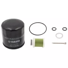
The parts in the kit are matched to the service needs of the listed engine models, which makes it easy to gather the correct parts before a service. Engine oil, gearcase oil, spark plugs, impeller and other service parts are not included and are added separately when needed.
Kit contents:
• 1 × oil filter
• 1 × fuel filter
• 1 × fuel filter gasket
• 1 × engine oil drain plug gasket
• 2 × gaskets for the gearcase oil drain/fill plugs
• 1 × propeller cotter pin
Compatible models:
• F150G
• F175A
• F175C
• F200C
• F200F
• F200G
• F225B
Part numbers and references:
• Yamaha OEM number: 6HPW006B0000
Please check fitment against your engine model and model year before ordering. Genuine Yamaha part.
- Genuine Yamaha 100-hour service kit
- Fits: F150G–F225B
- Includes filters, gaskets and propeller cotter pin
- Does not include oils, spark plugs or impeller
- Yamaha OEM: 6HPW006B0000
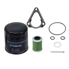
The parts in the kit are matched to the service needs of the listed engine models, which makes it easy to gather the correct parts before a service. Engine oil, gearcase oil, spark plugs, impeller and other service parts are not included and are added separately when needed.
Kit contents:
• 1 × oil filter
• 1 × fuel filter
• 1 × fuel filter O-ring
• 1 × thermostat gasket
• 1 × engine oil drain plug gasket
• 2 × gaskets for the gearcase oil drain/fill plugs
• 1 × propeller cotter pin
Compatible models:
• F100H
• F150D
• F150F
Part numbers and references:
• Yamaha OEM number: 63PW006B0000
Please check fitment against your engine model and model year before ordering. Genuine Yamaha part.
- Genuine Yamaha 100-hour service kit
- Fits: F100H–F150F
- Includes filters, gaskets and propeller cotter pin
- Does not include oils, spark plugs or impeller
- Yamaha OEM: 63PW006B0000
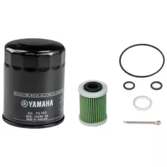
The parts in the kit are matched to the service needs of the listed engine models, which makes it easy to gather the correct parts before a service. Engine oil, gearcase oil, spark plugs, impeller and other service parts are not included and are added separately when needed.
Kit contents:
• 1 × oil filter
• 1 × fuel filter
• 1 × fuel filter gasket
• 1 × engine oil drain plug gasket
• 2 × gaskets for the gearcase oil drain/fill plugs
• 1 × propeller cotter pin
Compatible models:
• F225F
• F225NCB
• F250D
• F250NCB
• F250NSB
• F250NSB2
• F300B
• F300NCB
• F300NSB
• F300NSB2
• F350N
Part numbers and references:
• Yamaha OEM number: 6CLW006B0000
Please check fitment against your engine model and model year before ordering. Genuine Yamaha part.
- Genuine Yamaha 100-hour service kit
- Fits: F225F–F350N
- Includes filters, gaskets and propeller cotter pin
- Does not include oils, spark plugs or impeller
- Yamaha OEM: 6CLW006B0000
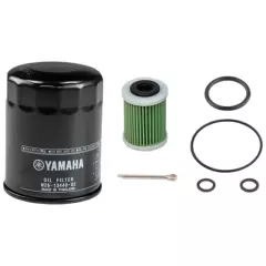
The parts in the kit are matched to the service needs of the listed engine models, which makes it easy to gather the correct parts before a service. Engine oil, gearcase oil, spark plugs, impeller and other service parts are not included and are added separately when needed.
Kit contents:
• 1 × oil filter
• 1 × fuel filter
• 1 × fuel filter gasket/O-ring
• 2 × O-rings
• 1 × extra O-ring
• 1 × propeller cotter pin
Compatible models:
• F375A / XF375A
• F400XTO
• F425A / XF425A
• F450XTO
Part numbers and references:
• Yamaha OEM number: 6GRW006B0000
Please check fitment against your engine model and model year before ordering. Genuine Yamaha part.
- Genuine Yamaha 100-hour service kit
- Fits: F375A–F450XTO
- Includes filters, gaskets and propeller cotter pin
- Does not include oils, spark plugs or impeller
- For Yamaha's large XTO outboards
- Yamaha OEM: 6GRW006B0000
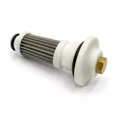
The filter traps particles and contaminants from the engine oil and keeps the lubrication system in good condition. Replace it according to the engine's service interval and the manufacturer's recommendations, typically at every oil change.
Compatible models:
• F9.9 / T9.9 – 1990–2003
• Mercury/Mariner 9.9 4T – 1995–2002, serial number H000058–H017099
• Mercury/Mariner 8 Bodensee 4T
Part numbers and references:
• Yamaha OEM number: 6G8134400000
• Aftermarket numbers: Sierra Marine / SeaStar 18-7901
Please check fitment against your engine model and model year before ordering. Genuine Yamaha part.
- Genuine Yamaha oil filter
- Fits: F8A–F9.9B
- Keeps the engine oil and lubrication system clean
- Replace at the service interval
- Also fits certain Mercury/Mariner 8–9.9 hp engines
- Yamaha OEM: 6G8134400000
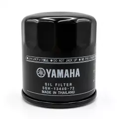
The filter traps particles and contaminants from the engine oil and keeps the lubrication system in good condition. Replace it according to the engine's service interval and the manufacturer's recommendations, typically at every oil change.
Compatible models:
• F9.9 – model code 66N, 2000–2008
• F15A – model code 66M / 69A, 2000–2007
• F20A – model code 65P / 65W, 2002–2006
• F25A – model code 65P / 65W, 2002–2006
• F30A – model code 69H, 2001–2009
• F40A – model code 66W, 2001–2002
• F40B – model code 67C, 2001–2009
• F40C – model code 60K, 2002
• F40E – model code 67C, 2005
• F40F – model code 6BG, 2009–
• F50A – model code 62Y, 2000–2007
• F50D – model code 60A, 2003
• F60A – model code 69W, 2002–2007
• F60C – model code 6C5, 2005–2006
• F80A – model code 67G, 2000–2006
• F80B – model code 6D7, 2005–2018
• F80C – model code 6CK, 2009–2012
• F100A – model code 67F, 2000–2006
• F100B – model code 60C, 2003–2012
• F100C – model code 60D, 2003
• F100D – model code 6D9, 2005–2018
• F115A – model code 68V, 2000–2015
• F115B – model code 6EK, 2014–
• F130A – model code 6EM, 2015–
Part numbers and references:
• Yamaha OEM number: 5GH134407200
• Further Yamaha OEM numbers in the same filter family: 5GH134407200, 5GH134407100, 5GH134407000, 5GH134400000, 5GH134403000
• Other OEM references – Mercury: 822626Q04, 822626Q2, 822626A2, 8226261, 8M0162830, 822626T2
• Other OEM references – Tohatsu Marine: 3BJ-07615-0, 3R0-07615-1, 3R0-07615-0
• Aftermarket numbers – EMP: 35-57804
• Aftermarket numbers – Mallory: 9-57804
• Aftermarket numbers – Sierra Marine / SeaStar: 18-79111, 18-7914
• Previous Yamaha numbers: 5GH-13440-70
Please check fitment against your engine model and model year before ordering. Genuine Yamaha part.
• Fits: F9.9C–F115A
• Keeps the engine oil and lubrication system clean
• Replace at the service interval
• Yamaha OEM: 5GH134407200
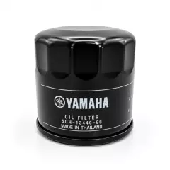
The filter traps particles and contaminants from the engine oil and keeps the lubrication system in good condition. Replace it according to the engine's service interval and the manufacturer's recommendations, typically at every oil change.
Compatible models:
• F15C – 2007–
• F20B – 2007–2018
• F20G – 2019–
• F25D – 2010–2016
• F25G – 2017–
• F30B – 2010–
• F40D – 2009–2012
• F40F – 2013–
• F50F – 2005–2012
• F50H – 2013–
• F60C – 2006–2012
• F60F – 2013–
• F70A – 2010–
Part numbers and references:
• Yamaha OEM number: 5GH134409000, 5GH134408000, 5JW134400000, 5GH134402000, 5GH134405000, 5GH134406000, 5GH134406100
• Previous Yamaha numbers: 5GH-13440-61
• Aftermarket numbers: Sierra Marine / SeaStar 18-8700
Please check fitment against your engine model and model year before ordering. Genuine Yamaha part.
- Genuine Yamaha oil filter
- Fits: F15C–F20B, F30B–F70A
- Keeps the engine oil and lubrication system clean
- Replace at the service interval
- Yamaha OEM: 5GH134409000, 5GH134408000, 5JW134400000, 5GH134402000, 5GH134405000, 5GH134406000, 5GH134406100
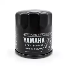
The filter traps particles and contaminants from the engine oil and keeps the lubrication system in good condition. Replace it according to the engine's service interval and the manufacturer's recommendations, typically at every oil change.
Compatible models:
• F9.9 – 66N, 1998–1999
• F15 – 66M, 1998
• F20 – 65W, 1998–2001
• F25 – 65W, 1998–2001
• F40 – 66W, 1999
• F40 – 67C, 2000
• F50 – 62Y, 1995–1999
• F80 – 67G, 1999
• F100 – 67F, 1999
Part numbers and references:
• Yamaha OEM number: 3FV134403100, 3FV134403000, N21134400000, 3FV134400000
• Previous Yamaha numbers: 3FV-13440-30
• Aftermarket numbers: EMP 35-57800, EMP 35-57804, Sierra Marine 18-7902
• Mercury references: 822626Q03, 822626Q1, 822626A1, 822626, 8M0162832, 822626T1, 8M0154774, 8M0162831, 822626K03, 851847A02
Please check fitment against your engine model and model year before ordering. Genuine Yamaha part.
- Genuine Yamaha oil filter
- Fits: Early F15–F25, F40–F100A
- Keeps the engine oil and lubrication system clean
- Replace at the service interval
- Yamaha OEM: 3FV134403100, 3FV134403000, N21134400000, 3FV134400000
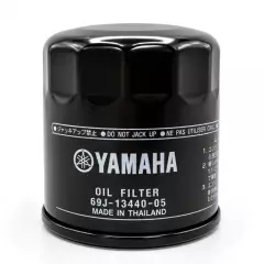
The filter traps particles and contaminants from the engine oil and keeps the lubrication system in good condition. Replace it according to the engine's service interval and the manufacturer's recommendations, typically at every oil change.
Compatible models:
• F150 – 63P, 2004–2014
• F150 – 6BM, 2012–
• F150 – 63P, 2015–
• F150 – 6HP, 2017–
• F175 – 6FA, 2014–
• F175 – 6HS, 2017–
• F200 – 60L, 2002–2007
• F200 – 6DA, 2013–
• F200 – 6DV, 2013–
• F225 – 69J, 2002–2007
• F225 – 6AS, 2007–
• F225 – 6BB, 2009–2015
• F250 – 6P2, 2005–2013
• F250 – 6BR, 2009–2011
• Mercury 225 EFI 4T
• Mariner 225 EFI 4T
Part numbers and references:
• Yamaha OEM number: 69J134400500, 69J134400400, 69J134400300
• Previous Yamaha numbers: 69J-13440-04
• Aftermarket numbers: EMP 35-57817, Recmar REC35-822626Q15, Sierra 18-7906, Sierra 18-7906-1
Please check fitment against your engine model and model year before ordering. Genuine Yamaha part.
• Fits: F150A–F250B
• Keeps the engine oil and lubrication system clean
• Replace at the service interval
• Also fits Mercury/Mariner 225 EFI 4T engines
• Yamaha OEM: 69J134400500, 69J134400400, 69J134400300
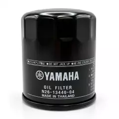
The filter traps particles and contaminants from the engine oil and keeps the lubrication system in good condition. Replace it according to the engine's service interval and the manufacturer's recommendations, typically at every oil change.
Compatible models:
• F225 – 6CL, 2011–
• F225 – 6HB, 2018–
• F225 – 6CL, 2019–
• F250 – 6CG, 2011–
• F250 – 6HD, 2018–
• F300 – 6BJ, 2008–2011
• F300 – 6CE, 2011–
• F300 – 6JA, 2018–2019
• F350 – 6AW, 2008–
Part numbers and references:
• Yamaha OEM number: N26134400400, N26134400300, N26134400200, N26134400000
• Mercury OEM: 8M0154771
• Previous Yamaha numbers: N26-13440-03
• Aftermarket numbers: EMP 35-57809, Sierra Marine 18-7954
Please check fitment against your engine model and model year before ordering. Genuine Yamaha part.
- Genuine Yamaha oil filter
- Fits: F225–F350
- Keeps the engine oil and lubrication system clean
- Replace at the service interval
- Yamaha OEM: N26134400400, N26134400300, N26134400200, N26134400000
Compatible models:
- 4A
- 4B
- 5C
- 6C
- 6D
- 8C
- F4A
- F8A
- F8B
- F9.9A
- FT9.9A
- F9.9BA
Part numbers and references:
- Yamaha OEM number: 646242510200, 646242510100
- Mercury OEM: 16248, 8M0157133, 80365M
- Tohatsu OEM: 346-02230-0, 346-02237-1, 369-02230-0, 369-02230-1
- Parsun OEM: F4-05000300
- Aftermarket numbers: EMP 35-35406, EMP 35-35410, Sea-X 121-9-37969, Sierra Marine 18-7712, 18-7713
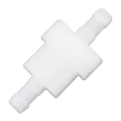
- Genuine Yamaha fuel filter
- Fits: F4–F9.9
- In-line, hose-mounted type
- Keeps the fuel clean
- Can also serve as an oil filter on certain 2-stroke / HPDI models with a separate oil tank
- Yamaha OEM: 646242510200, 646242510100
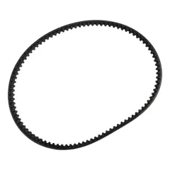
The timing belt drives the camshaft and keeps the valve timing in phase with the crankshaft. A worn or damaged belt can affect engine operation, so the belt's condition should be checked at the service interval and replaced when needed.
Compatible models:
• F20A
• F25A
• F30A
• F40B
Part numbers and references:
• Yamaha OEM number: 65W462410000
• Yamaha reference: 65W-46241-00
Please check fitment against your engine model and model year before ordering. Genuine Yamaha part.
- Genuine Yamaha timing belt
- Fits: F20A / F25A / F30A / F40B
- For the camshaft drive
- Inspect and replace at the service interval
- Yamaha OEM: 65W462410000
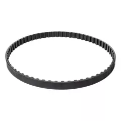
The timing belt drives the camshaft and keeps the valve timing in phase with the crankshaft. A worn or damaged belt can affect engine operation, so the belt's condition should be checked at the service interval and replaced when needed.
Compatible models:
• F20 – 6DN, 2011–2017
• T25 / FT25 – 6BL, 2009–2019
• F25 – 6BP, 2009–2018
• F30 – 6BT, 2009–2019
• F40 – 6AK, 2006–2019
• F40 – 6BG, 2009–2019
• F40 – 6CY, 2011–2019
• F50 – 6C1, 2005–2019
• FT50 / T50 – 6C2, 2005–2019
• F60 – 6C5, 2005–2019
• FT60 / T60 – 6C6, 2005–2019
• F70 – 6CJ, 2011–2019
Part numbers and references:
• Yamaha OEM number: 6C5462410000
• Yamaha reference: 6C5-46241-00
Please check fitment against your engine model and model year before ordering. Genuine Yamaha part.
- Genuine Yamaha timing belt
- Fits: F25D / F30B / F40D–F / F50F / F60C / F70A
- For the camshaft drive
- Inspect and replace at the service interval
- Replacement interval 1,000 hours or 5 years
- Yamaha OEM: 6C5462410000


