Finnish Coastal Maps
Large Finnish coastal map sheets.Finnish Coastal Maps group products
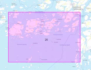
- Area: Korppoo-Högsåra
- Altitude system: N2000
- Scale: 1:50,000
- Publication year: 2025 (updated 30.11.2025)
- ISBN 978-952-311-576-7
- Size: 82 × 112 cm
- Type: map sheet
- Languages: FI, EN, EN
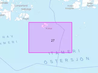
- Area: Kökar-Utö
- Altitude system: N2000
- Scale: 1:50,000
- Publication year: 2025 (updated 30.11.2025)
- ISBN 978-952-311-581-1
- Size: 82 × 112 cm
- Type: map sheet
- Languages: FI, EN, EN
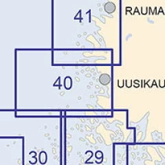
The Finnish Transport Agency's coastal charts are intended for archipelago and coastal navigation.
The scale of the maps is 1:50,000 and the maps are straight in appearance. The maps cover the Gulf of Finland – Archipelago Sea – Gulf of Bothnia, i.e. the entire coast of the Finnish maritime area.
Shallow water is shown in blue. The maps are clearer and easier to read than ever, and best of all, the map coordinates are directly compatible with a GPS tracking device.
Blue nautical charts are published in the internationally used WGS -84 coordinate system. Obsolete green nautical charts will remain in the current coordinate system in the Finnish national KKJ system.
Coastal maps are also suitable for the wall! Size: 82 cm x 112 cm (coastal maps are vertical or horizontal depending on the region!)
- Scale: 1:50000, 1:20000
- Publication year: 30.4.2024
- Size: 82 × 112 cm
- Appearance/binding: straight map sheet
- Series: Coastal Map
- Language: Finnish, English, German
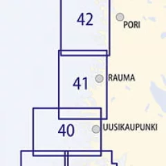
The Finnish Transport Agency's coastal charts are intended for archipelago and coastal navigation.
The scale of the maps is 1:50,000 and the maps are straight in appearance. The maps cover the Gulf of Finland – Archipelago Sea – Gulf of Bothnia, i.e. the entire coast of the Finnish maritime area.
Shallow water is shown in blue. The maps are clearer and easier to read than ever, and best of all, the map coordinates are directly compatible with a GPS tracking device.
Blue nautical charts are published in the internationally used WGS -84 coordinate system. Obsolete green nautical charts will remain in the current coordinate system in the Finnish national KKJ system.
Coastal maps are also suitable for the wall! Size: 82 cm x 112 cm (coastal maps are vertical or horizontal depending on the region!)
- Scale: 1:50,000
- Publication year: 30.4.2024
- Size: 82 × 112 cm
- Appearance/binding: straight map sheet
- Series: Coastal Map
- Language: Finnish, English, German
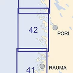
The Finnish Transport Agency's coastal charts are intended for archipelago and coastal navigation.
The scale of the maps is 1:50,000 and the maps are straight in appearance. The maps cover the Gulf of Finland – Archipelago Sea – Gulf of Bothnia, i.e. the entire coast of the Finnish maritime area.
Shallow water is shown in blue. The maps are clearer and easier to read than ever, and best of all, the map coordinates are directly compatible with a GPS tracking device.
Blue nautical charts are published in the internationally used WGS -84 coordinate system. Obsolete green nautical charts will remain in the current coordinate system in the Finnish national KKJ system.
Coastal maps are also suitable for the wall! Size: 82 cm x 112 cm (coastal maps are vertical or horizontal depending on the region!)
- Scale: 1:50,000
- Size: 82 × 112 cm
- Outer appearance/binding appearance: straight map sheet
- Series: Coastal Map
- Language: Finnish, English, German
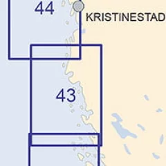
The Finnish Transport Agency's coastal charts are intended for archipelago and coastal navigation.
The scale of the maps is 1:50,000 and the maps are straight in appearance. The maps cover the Gulf of Finland – Archipelago Sea – Gulf of Bothnia, i.e. the entire coast of the Finnish maritime area.
Shallow water is shown in blue. The maps are clearer and easier to read than ever, and best of all, the map coordinates are directly compatible with your GPS tracking device.
Blue nautical charts are published in the internationally used WGS -84 coordinate system. Obsolete green nautical charts will remain in the current coordinate system in the Finnish national KKJ system.
Coastal maps are also suitable for the wall! Size: 82 cm x 112 cm (coastal maps are vertical or horizontal depending on the region!)
- Scale: 1:50,000
- Release year: 10.12.2023
- Size: 82 × 112 cm
- Outer appearance/binding appearance: straight map sheet
- Series: Coastal Map
- Language: Finnish, English, German
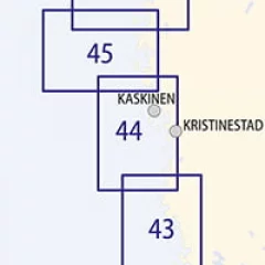
The Finnish Transport Agency's coastal charts are intended for archipelago and coastal navigation.
The scale of the maps is 1:50,000 and the maps are straight in appearance. The maps cover the Gulf of Finland – Archipelago Sea – Gulf of Bothnia, i.e. the entire coast of the Finnish maritime area.
Shallow water is shown in blue. The maps are clearer and easier to read than ever, and best of all, the map coordinates are directly compatible with a GPS tracking device.
Blue nautical charts are published in the internationally used WGS -84 coordinate system. Obsolete green nautical charts will remain in the current coordinate system in the Finnish national KKJ system.
Coastal maps are also suitable for the wall! Size: 82 cm x 112 cm (coastal maps are vertical or horizontal depending on the region!)
- Scale: 1:50,000
- Release year: 10.12.2023
- Size: 82 × 112 cm
- Outer appearance/binding appearance: straight map sheet
- Series: Coastal Map
- Language: Finnish, English, German
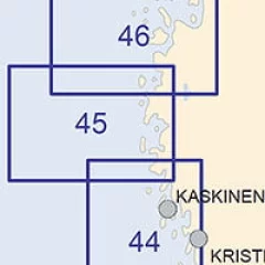
The Finnish Transport Agency's coastal charts are intended for archipelago and coastal navigation.
The scale of the maps is 1:50,000 and the maps are straight in appearance. The maps cover the Gulf of Finland – Archipelago Sea – Gulf of Bothnia, i.e. the entire coast of the Finnish maritime area.
Shallow water is shown in blue. The maps are clearer and easier to read than ever, and best of all, the map coordinates are directly compatible with a GPS tracking device.
Blue nautical charts are published in the internationally used WGS -84 coordinate system. Obsolete green nautical charts will remain in the current coordinate system in the Finnish national KKJ system.
Coastal maps are also suitable for the wall! Size: 82 cm x 112 cm (coastal maps are vertical or horizontal depending on the region!)
- Scale: 1:50,000
- Release year: 30.11.2022
- Size: 82 × 112 cm
- Appearance/binding: straight map sheet
- Series: Coastal Map
- Language: Finnish, English, German
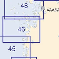
The Finnish Transport Agency's coastal charts are intended for archipelago and coastal navigation.
The scale of the maps is 1:50,000 and the maps are straight in appearance. The maps cover the Gulf of Finland – Archipelago Sea – Gulf of Bothnia, i.e. the entire coast of the Finnish maritime area.
Shallow water is shown in blue. The maps are clearer and easier to read than ever, and best of all, the map coordinates are directly compatible with a GPS tracking device.
Blue nautical charts are published in the internationally used WGS -84 coordinate system. Obsolete green nautical charts will remain in the current coordinate system in the Finnish national KKJ system.
Coastal maps are also suitable for the wall! Size: 82 cm x 112 cm (coastal maps are vertical or horizontal depending on the region!)
- Scale: 1:50,000
- Release year: 30.11.2022
- Size: 82 × 112 cm
- Appearance/binding: straight map sheet
- Series: Coastal Map
- Language: Finnish, English, German
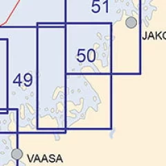
The Finnish Transport Agency's coastal charts are intended for archipelago and coastal navigation.
The scale of the maps is 1:50,000 and the maps are straight in appearance. The maps cover the Gulf of Finland – Archipelago Sea – Gulf of Bothnia, i.e. the entire coast of the Finnish maritime area.
Shallow water is shown in blue. The maps are clearer and easier to read than ever, and best of all, the map coordinates are directly compatible with a GPS tracking device.
Blue nautical charts are published in the internationally used WGS -84 coordinate system. Obsolete green nautical charts will remain in the current coordinate system in the Finnish national KKJ system.
Coastal maps are also suitable for the wall! Size: 82 cm x 112 cm (coastal maps are vertical or horizontal depending on the region!)
- Scale: 1:50,000
- Year of publication: 2015 (updated 30.4.2015)
- Size: 82 × 112 cm
- Appearance/binding: straight map sheet
- Series: Coastal Map
- Language: Finnish, English, German
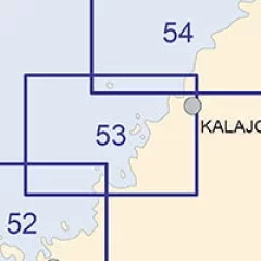
The Finnish Transport Agency's coastal charts are intended for archipelago and coastal navigation.
The scale of the maps is 1:50,000 and the maps are straight in appearance. The maps cover the Gulf of Finland – Archipelago Sea – Gulf of Bothnia, i.e. the entire coast of the Finnish maritime area.
Shallow water is shown in blue. The maps are clearer and easier to read than ever, and best of all, the map coordinates are directly compatible with a GPS tracking device.
Blue nautical charts are published in the internationally used WGS -84 coordinate system. Obsolete green nautical charts will remain in the current coordinate system in the Finnish national KKJ system.
Coastal maps are also suitable for the wall! Size: 82 cm x 112 cm (coastal maps are vertical or horizontal depending on the region!)
- Scale: 1:50,000
- Publication year: 31.1.2022
- Size: 82 × 112 cm
- Outer appearance/binding appearance: straight map sheet
- Series: Coastal Map
- Language: Finnish, English, German
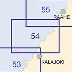
The Finnish Transport Agency's coastal charts are intended for archipelago and coastal navigation.
The scale of the maps is 1:50,000 and the maps are straight in appearance. The maps cover the Gulf of Finland – Archipelago Sea – Gulf of Bothnia, i.e. the entire coast of the Finnish maritime area.
Shallow water is shown in blue. The maps are clearer and easier to read than ever, and best of all, the map coordinates are directly compatible with a GPS tracking device.
Blue nautical charts are published in the internationally used WGS -84 coordinate system. Obsolete green nautical charts will remain in the current coordinate system in the Finnish national KKJ system.
Coastal maps are also suitable for the wall! Size: 82 cm x 112 cm (coastal maps are vertical or horizontal depending on the region!)
- Scale: 1:50,000
- Release year: 30.11.2021
- Size: 82 × 112 cm
- Outer appearance/binding appearance: straight map sheet
- Series: Coastal Map
- Language: Finnish, English, German
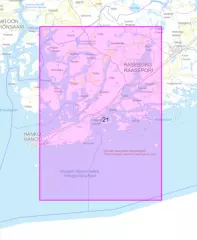
Shallow water is shown in blue. The maps are clearer and easier to read than ever, and best of all, the map coordinates are directly compatible with a GPS tracking device.
Blue nautical charts are published in the internationally used WGS -84 coordinate system. Obsolete green nautical charts will remain in the current coordinate system in the Finnish national KKJ system.
Coastal maps are also suitable for the wall! Size: 82 cm x 112 cm (coastal maps are vertical or horizontal depending on the region!)
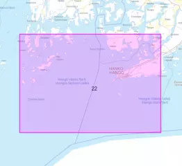
- Area: Hanko - Jussarö
- Scale: 1:50,000
- N2000 vertical reference system
- Publication year: 2026 (10.4.2026)
- Size: 82 × 112 cm
- Type: map sheet
- Languages: FI, EN, EN
The Finnish Transport Agency's coastal charts are intended for archipelago and coastal navigation.
The scale of the maps is 1:50,000 and the maps are straight in appearance. The maps cover the Gulf of Finland – Archipelago Sea – Gulf of Bothnia, i.e. the entire coast of the Finnish maritime area.
Shallow water is shown in blue. The maps are clearer and easier to read than ever, and best of all, the map coordinates are directly compatible with a GPS tracking device.
Blue nautical charts are published in the internationally used WGS -84 coordinate system. Obsolete green nautical charts will remain in the current coordinate system in the Finnish national KKJ system.
Coastal maps are also suitable for the wall! Size: 82 cm x 112 cm (coastal maps are vertical or horizontal depending on the region!)
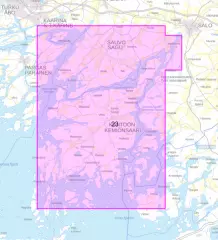
- Area: Högsåra - Hanko
- Scale: 1:50,000
- N2000 vertical reference system
- Publication year: 2026 (10.4.2026)
- Size: 82 × 112 cm
- Type: map sheet
- Languages: FI, EN, EN
The Finnish Transport Agency's coastal charts are intended for archipelago and coastal navigation.
The scale of the maps is 1:50,000 and the maps are straight in appearance. The maps cover the Gulf of Finland – Archipelago Sea – Gulf of Bothnia, i.e. the entire coast of the Finnish maritime area.
Shallow water is shown in blue. The maps are clearer and easier to read than ever, and best of all, the map coordinates are directly compatible with a GPS tracking device.
Blue nautical charts are published in the internationally used WGS -84 coordinate system. Obsolete green nautical charts will remain in the current coordinate system in the Finnish national KKJ system.
Coastal maps are also suitable for the wall! Size: 82 cm x 112 cm (coastal maps are vertical or horizontal depending on the region!)
- Area: Kemiö
- Scale: 1:50,000
- N2000 vertical reference system
- Publication year: 2026 (10.4.2026)
- ISBN: 978-952-311-590-3
- Size: 82 × 112 cm
- Type: map sheet
- Languages: FI, EN, EN

- Area: Porkkala, Porkkala
- Altitude system: N2000
- Scale: 1:50,000
- Publication year: 2026 (updated 6.10.2026)
- ISBN 978-952-311-594-1
- Size: 82 × 112 cm
- Type: map sheet
- Languages: FI, EN, EN
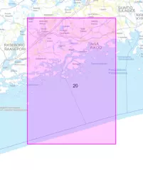
- Area: Jussarö - Porkkalanselkä
- Altitude system: N2000
- Scale: 1:50,000
- Publication year: 2026 (updated 6.10.2026)
- ISBN 978-952-311-600-9
- Size: 82 × 112 cm
- Type: map sheet
- Languages: FI, EN, EN
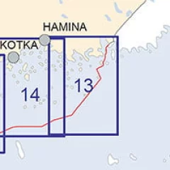
The Finnish Transport Agency's coastal charts are intended for archipelago and coastal navigation.
The scale of the maps is 1:50,000 and the maps are straight in appearance. The maps cover the Gulf of Finland – Archipelago Sea – Gulf of Bothnia, i.e. the entire coast of the Finnish maritime area.
Shallow water is shown in blue. The maps are clearer and easier to read than ever, and best of all, the map coordinates are directly compatible with a GPS tracking device.
Blue nautical charts are published in the internationally used WGS -84 coordinate system. Obsolete green nautical charts will remain in the current coordinate system in the Finnish national KKJ system.
Coastal maps are also suitable for the wall! Size: 82 cm x 112 cm (coastal maps are vertical or horizontal depending on the region!)
- Area: Kuorsalo-Virolahti
- Scale: 1:50,000
- Publication year: 2014 (updated 10.6.2014)
- Size: 82 × 112 cm
- Type: map sheet
- Languages: FI, EN, EN
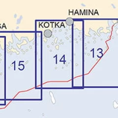
The Finnish Transport Agency's coastal charts are intended for archipelago and coastal navigation.
The scale of the maps is 1:50,000 and the maps are straight in appearance. The maps cover the Gulf of Finland – Archipelago Sea – Gulf of Bothnia, i.e. the entire coast of the Finnish maritime area.
Shallow water is shown in blue. Shallow water is shown in blue . The maps are clearer and easier to read than ever, and best of all, the map coordinates are directly compatible with your GPS tracking device.
Blue nautical charts are published in the internationally used WGS -84 coordinate system. Obsolete green nautical charts will remain in the current coordinate system in the Finnish national KKJ system.
Coastal maps are also suitable for the wall! Size: 82 cm x 112 cm (coastal maps are vertical or horizontal depending on the region!)
- Area: Kotka - Hamina
- Scale: 1:50,000
- Publication year: 2016 (updated 20.11.2016)
- Size: 82 × 112 cm
- Type: map sheet
- Languages: FI, EN, EN
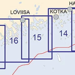
The Finnish Transport Agency's coastal charts are intended for archipelago and coastal navigation.
The scale of the maps is 1:50,000 and the maps are straight in appearance. The maps cover the Gulf of Finland – Archipelago Sea – Gulf of Bothnia, i.e. the entire coast of the Finnish maritime area.
Shallow water is shown in blue. The maps are clearer and easier to read than ever, and best of all, the map coordinates are directly compatible with a GPS tracking device.
Blue nautical charts are published in the internationally used WGS -84 coordinate system. Obsolete green nautical charts will remain in the current coordinate system in the Finnish national KKJ system.
Coastal maps are also suitable for the wall! Size: 82 cm x 112 cm (coastal maps are vertical or horizontal depending on the region!)
- Area: Tiiskeri-Kaunissaari
- Scale: 1:50,000
- Publication year: 2017 (updated 30.11.2017)
- Size: 82 × 112 cm
- Type: map sheet
- Languages: FI, EN, EN


