New group
New group -ryhmän tuotteet
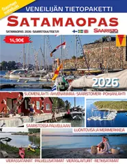
- In Finnish, Swedish, English
- 144 pages
- Publisher: Saaristouuutiset.fi
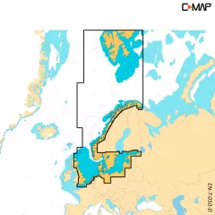
C-MAP DISCOVER X offers a completely new, dynamic charting experience. You have access to the latest vector data, state-of-the-art day and night modes and the most accurate C-MAP High-Res Bathymetry basemap. Newly introduced is the Map Inspector tool, which displays the most important information quickly and clearly. DISCOVER X integrates seamlessly with the Simrad Companion App. Versatile features such as customizable depth shading, tide and current information, subscription-free autorouting and 12 months of free online updates make navigation easier and safer.
Next Generation Charts
A next-generation mapping experience that makes navigation clearer than ever.
Optimized map data and a new presentation method provide the best possible overview on the water.
You always see the information you need without unnecessary clutter, at all zoom levels.
Excellent day and night modes ensure easy and safe use in all weather conditions, regardless of the time of day.
Smooth App Integration
Seamless integration with the Simrad Companion App.
You can plan routes, view journeys, and create waypoints in the app and sync them directly to your NSX device.
You can also access NSX device guides, instructions, and other materials directly from the app.
The future is connected navigation, and C-MAP and Simrad keep you ready for it.
The Best of C-MAP
The latest map data provides everything you need to navigate the water.
High-quality vector maps are based on official hydrographic data and make navigation accurate and reliable.
High-Res Bathymetry shows shallows, ledges, mounds and other bottom features with up to 1 foot accuracy.
Subscription-free autorouting automatically calculates the shortest and safest route based on map data and boat settings.
Customizable depth shading helps highlight desired depths and makes fishing even more efficient.
Detailed port and approach information brings confidence when entering new ports and waterways.
New Map Inspector Tool
The new Map Inspector feature displays the information you need quickly and with one tap.
Tide and current information makes it easier to plan your day.
Accurate port maps include floor plans, berth locations, restricted areas and other important information for thousands of ports.
Includes 12 months of free map updates.
Key features:
Next Generation Charts
Smooth App Integration
Map Inspector Tool
Large vector maps
High-Res Bathymetry
Customizable depth shading
State-of-the-art day and night modes
Tide and current information
Detailed port maps
Approach and port information
Subscription-free autorouting
12 months of free updates
Ready for the connected future
- Finland, Sweden, Norway and the Baltic Sea
- Compatible only with Simrad NSX, NSS 4 and B&G Zeus S, SR series devices
- MicroSD card 16GB (SD adapter included)
- Free map updates for 12 months
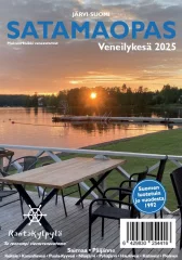
The guide provides up-to-date information and a clear map of every official port. There are over 500 ports included: guest marinas, service marinas and excursion marinas.
- Area: Lake Finland (Päijänne, Keitele, Kansallisvesi, Puula-Kyyvesi, Näsijärvi, Pyhäjärvi, Vanajavesi, Mallasvesi, Roine, Längelmävesi, Saimaa)
- Additionally, instructions in English and German on how to interpret port information
- Total 271 pages.
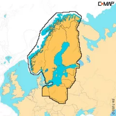
C-MAP DISCOVER X offers a completely new, dynamic charting experience. You have access to the latest vector data, state-of-the-art day and night modes and the most accurate C-MAP High-Res Bathymetry basemap. Newly introduced is the Map Inspector tool, which displays the most important information quickly and clearly. DISCOVER X integrates seamlessly with the Simrad Companion App. Versatile features such as customizable depth shading, tide and current information, subscription-free autorouting and 12 months of free online updates make navigation easier and safer.
Next Generation Charts
A next-generation mapping experience that makes navigation clearer than ever.
Optimized map data and a new presentation method provide the best possible overview on the water.
You always see the information you need without unnecessary clutter, at all zoom levels.
Excellent day and night modes ensure easy and safe use in all weather conditions, regardless of the time of day.
Smooth App Integration
Seamless integration with the Simrad Companion App.
You can plan routes, view journeys, and create waypoints in the app and sync them directly to your NSX device.
You can also access NSX device guides, instructions, and other materials directly from the app.
The future is connected navigation, and C-MAP and Simrad keep you ready for it.
The Best of C-MAP
The latest map data provides everything you need to navigate the water.
High-quality vector maps are based on official hydrographic data and make navigation accurate and reliable.
High-Res Bathymetry shows shallows, ledges, mounds and other bottom features with up to 1 foot accuracy.
Subscription-free autorouting automatically calculates the shortest and safest route based on map data and boat settings.
Customizable depth shading helps highlight desired depths and makes fishing even more efficient.
Detailed port and approach information brings confidence when entering new ports and waterways.
New Map Inspector Tool
The new Map Inspector feature displays the information you need quickly and with one tap.
Tide and current information makes it easier to plan your day.
Accurate port maps include floor plans, berth locations, restricted areas and other important information for thousands of ports.
Includes 12 months of free map updates.
Key features:
Next Generation Charts
Smooth App Integration
Map Inspector Tool
Large vector maps
High-Res Bathymetry
Customizable depth shading
State-of-the-art day and night modes
Tide and current information
Detailed port maps
Approach and port information
Subscription-free autorouting
12 months of free updates
Ready for the connected future
- Finland, Sweden, Norway and the Baltic Sea
- Compatible only with Simrad NSX, NSS 4 and B&G Zeus S, SR series devices
- MicroSD card 16GB (SD adapter included)
- Free map updates for 12 months
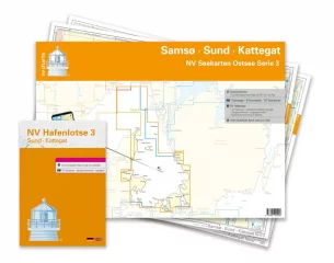
Saksalaisen NV Verlagin karttasarja from the Samsø-Sund-Kattegat area. 2023 Painos. Merikarttsarja contains the following karttasivut.
Series 3 1 : 520,000
Skagerrak 1:520,000
S 30 Kattegat Südwest 1 : 200,000
S 30A Kattegat Südost 1 : 200,000
S 31 Kattegat Mitte West 1 : 200,000
S 31A Kattegat Mitte Ost 1 : 200,000
S 32 Kattegat North 1 : 180,000
S 26 Sund North 1 : 80,000
S 27 Isefjord 1 : 65,000
S 27A Roskilde Fjord North 1 : 42,000
S 27B Roskilde Fjord South 1 : 42,000
S 28 Samsø Belt 1 :108,000
S 29 Aarhus Bay 1 :100,000
S 34 Randers & Mariager Fjord 1 : 56,000
S 35 Sund Nordansteuerung 1 : 65,000
S 26 Helsingør 1 : 25,000
S 27B Gershøj Selsø Control 1 : 25,000
S 33 Ansteuerung Frederikshavn 1 : 40,000
S 33 Frederikshavn 1 : 20,000
S 33 Ansteuerung Hals 1 : 45,000
S 34 Udbyhøj 1 : 18,000
S 34 Hadsund Brücke 1 : 16,000
S 35 Hallands Väderö 1 : 40,000
-2023
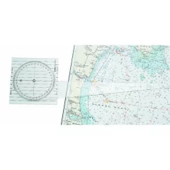
- Convenient nautical chart indicator plate for determining course and steering direction
- Integrated magnetic and meridian-based lines
- Transparent square base, ideal for chart table use
- Length: 140mm
- Width: 140mm
- Thickness: 1.5 mm
- Other features: shaft 377 mm
- Material: colorless transparent PETG
- Includes instructions for use
- Linex 2810
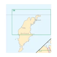
Northern Gotland. Also includes a map of Visby harbor.
- Swedish archipelago map
- Area North Gotland (Also Visby harbor map)
- 1:120,000
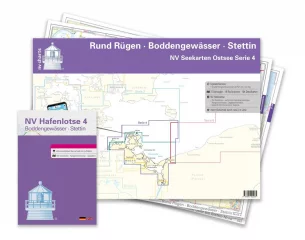
- Series 4 1:370,000
- S 25 Bornholm 1 : 140,000
- S 45 Hiddensee to Swinemünde 1 : 250,000
- S 46 Rügen to Bornholm 1 : 230,000
- S 36 The Bodden south of Zingst 1 : 60,000
- S 37 Strelasund North 1: 60,000
- S 38 Hiddensee to Jasmund 1 : 60,000
- S 39 Strelasund South 1: 40,000
- S 39A Stralsund 1 : 40,000
- S 40 Greifswalder Bodden West 1 : 60,000
- S 41 Greifswalder Bodden East 1 : 60,000
- S 42 Peenestrom South 1: 60,000
- S 43 Stettiner Haff 1 : 80,000
- S 43A Dievenow 1 : 60,000
- S 44 The Oder to Stettin-North 1 : 30,000
- S 44A The Oder to Stettin-South 1 : 30,000
- S 45A Arkona to Landtief 1 : 100,000
- S 25 Christiansø 1 : 12,000
- S 36 Am Bock 1 : 25,000
- S 39A Vitter Bodden 1: 30,000
- S 39A Ports of Stralsund 1 : 12,000
- S 41A Ruden to Wolgast 1 : 40,000
- S 42 Zecherin 1 : 40,000
- S 43A Dievenow Control 1 : 10,000
- S 43A Swinemünde 1 : 40,000
- -2023
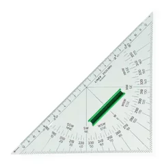
Straight-edged navigation triangle with handle and monochrome print, manufactured by Linex. Material: 2.75 mm clear Dunilon plastic.
- Size: 280x200mm
- Material: 2.75 mm clear Dunilon plastic
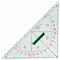
A straight-edged triangle with a handle and two-color printing made by Linex.
- Long side: 320mm
- Short sides: 225mm
- Material: 2.75 mm clear Dunilon plastic.
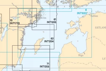
See a more detailed map demarcation on the Finnish Maritime Administration's virtual Se på Sjökort service. by clicking here
- Scale: 1 : 500000
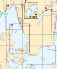
See a more detailed map demarcation on the Finnish Maritime Administration's virtual Se på Sjökort service. by clicking here
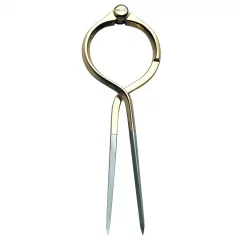
All-brass one-handed divider.
- Solid brass
- Maximum width: 7"
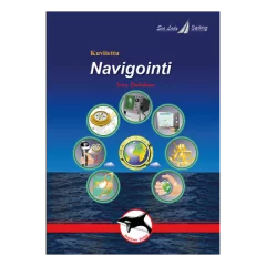
A Finnish-language, illustrated book on practical navigation skills for all boaters. A clear work that is suitable for reading by every boating enthusiast. The book is 95 pages long and has over 120 pictures. It is made of wire-bound, high-quality paper that is durable even in boating conditions. The book has been translated into Finnish by sailing instructor Jaakko Satsi from the Sea Lady Sailing sailing school. The author of the original work: Ivar Dedekam.
The book covers all common navigation methods:
- Traditional navigation
- Electronic navigation: GPS/plotter systems, radar and AIS system
- Basics of astronomical navigation
- Suitable for motorboaters and sailboaters
- Language: Finnish
The book covers all common navigation methods: Traditional navigation, electronic navigation: GPS/plotter systems, radar and AIS system, basics of astronomical navigation
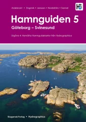
A very comprehensive and well-illustrated port guide to the west coast of Sweden
Includes 371 natural and guest harbors between Tistlarna in the south and Svinesund in the north. Each harbor is presented with a detailed harbor map, helicopter photo and harbor information.
The 4th edition is a completely revised edition of the previous ones, the first of which was published in 2007. The map material is unique. Each map is produced by Hydrographica, which means that the map material has been produced from 3D aerial photographs and verified with on-site measurements. Helicopter photos provide an overview of the ports, their surroundings, facilities, inlets, dangerous places and mooring possibilities. Notable shoals and rocks are marked on the images.
Hamnguiden 5 is divided into a general and a maritime section. The general section describes the history and nature of the area and gives tips for activities in the area. The maritime section focuses on safe navigation, where it is best to anchor and what to pay special attention to. Side moorings in natural harbors have become more common and this book tells about 1000 different places where it is possible.
In addition to sea and waterway charts, Hamnguid's books include advanced topographic maps of the areas, based on laser scanning to measure contours and create a 3D image of the area using shading. These help assess where it is best to anchor, whether the islands are open and sensitive to wind.
- 4 edition
- Swedish-speaking
- 371 ports and natural harbors in the area Tistlarna - Svinesund
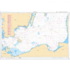
General map of Sweden, southern Baltic Sea.
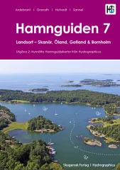
A very comprehensive and well-illustrated port guide to the east coast of Sweden
Each port is presented with a detailed port map, helicopter photo and port information.
The first section of the book presents all of the more than 250 natural harbors and about 40 guest harbors between Landsort and Påskallavik. This first-class map material is produced by Hydrographica, which means that the map material has been produced from 3D aerial photographs and verified with on-site measurements. Helicopter photos provide an overview of the harbors, their surroundings, facilities, inlets, dangerous places and mooring opportunities. Important shoals and rocks are marked in the images.
The second part of the book presents 140 guest harbours and about 20 natural harbours from Påskallavik to Skanör , as well as the islands of Gotland, Öland and Bornholm. This material is not produced by Hydrographica, but contains new images and updated harbour information for the harbours in the region compared to the 1st edition.
In addition to sea and waterway charts, the materials produced by Hydrographica include advanced topographic maps of the areas, based on laser scanning to measure contours and a 3D image of the area created with shading. These help assess where it is best to anchor, whether islands are open and sensitive to wind.
- 2nd edition
- Swedish-speaking
- Two-piece
- Part one: Landsort - Påskallavik. Includes over 250 natural harbors and about 40 guest harbors
- Part two: Påskallavik - Skanör. Also the islands of Gotland, Öland and Bornholm. Includes 140 guest harbours and about 20 natural harbours
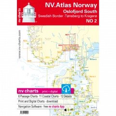
The NV Charts atlas NO2 covers the southern part of the Oslofjord. The NV Charts charts for the Norwegian coast are based on data from the Norwegian Hydrographic Office and also include the Norske Los harbour plans and numerous specially mapped details. The clear structure helps you quickly find approaches, harbours and anchorages, and important navigational information, which is also visible in the NV Charts app, is highlighted. Tide information is available both in tables and as a paper chart. The chart series impresses with its optimal dimensions and balanced sheet layout.
Area overview
The NO2 nautical chart takes you from the Swedish border straight to the bustling Oslofjord and all the way to historic Fredrikstad. From there, you can cross the fjord to Tønsberg and continue along the beautiful coast to the popular Kragerø. Of course, you can also use the detailed charts to sail the Telemark Canal or visit one of the many islands.
Order the NO1 map series if you want to visit Norway's modern capital. If you're heading towards the Skagerrak, we recommend the NO3 series, which takes you all the way to the shipping town of Kristiansand. For the Telemark Canal, we offer official Norwegian maps that are printed individually.
This map set includes:
- 6 general maps
- 11 regional maps
- 12 detailed maps
- Digital charts for navigation software and NV Charts (356-day license)
- Navigation instructions in English and Norwegian
- Port plans in paper and digital format
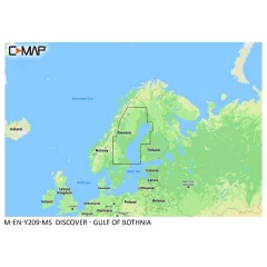
Whether you’re out on the water for pleasure boating, fishing or sailing, C-MAP DISCOVER offers a wide range of coverage and all the essential features to help you make the most of your time on the water. DISCOVER includes C-MAP’s most accurate High-Res Bathymetry basemap, including Genesis data. It also includes rich vector maps, customizable depth shading, tide and current information, and free Easy Routing. Purchase includes 12 months of free online updates.
Compatible with Lowrance, Simrad and B&G chartplotters.
Features:
Versatile vector maps
Clear and up-to-date map navigation based on observed data produced by official hydrographic offices.
High-Res Bathymetry
A high-resolution basemap layer helps identify shallows, ridges, mounds, and ridges. Also included is a single layer of quality-assured Genesis data.
Customizable depth shading
Set a clear safety depth, keep the view like a paper map, or create shading that suits your needs.
Easy Routing
Automatic routing calculates the shortest and safest route based on map data and boat settings. No subscription required.
Tide and current information
View water level and current forecasts to help you plan your day, whether you're cruising, fishing, or sailing.
Detailed port maps
Easy and safe landing at the new port. The maps include detailed port floor plans, berth locations, restricted areas and other essential navigation information.
Accurate entry and approach information
Exceptionally detailed presentation brings confidence when approaching ports and fairways. The perfect finishing touch to a long journey, sailing trip or fishing day.
Online updates
Keep your maps up to date with 12 months of free online updates.
Compatible device series:
B&G
Vulcan series
Zeus 2
Zeus 3
Zeus 3S
Simrad
Cruise
GO
NSS Evo2
NSS Evo3
NSS Evo3S
NSO Evo2
NSO Evo3
NSO Evo3S
Lowrance
Hook Reveal
Hook 2
Eagle
Elite FS
Elite Ti / Ti2
HDS Carbon
HDS Gen2
HDS Gen3
HDS Live
HDS Pro
- Gulf of Bothnia (Botnia)
- Compatible with B&G, Simrad and Lowrance (see below for exact models)
- MicroSD card 16GB (SD adapter included)
- Includes free Genesis Live custom map recording feature on supported devices.
- Free map updates for 12 months
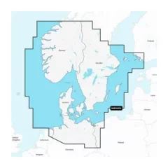
With SD/MicroSD card. Detailed coverage of the Skagerrak and Kattegat and their inlets.
The map card includes
From Kristiansund on the Scandinavian coast in Norway to Gävle in Sweden; Åland; Turku, Finland; Gotland and the Bornholm Islands; Szczecin Lagoon; to the Kiel Canal and all of Denmark. Ports include Oslo, Norway; Malmö and Stockholm, Sweden; Copenhagen and Århus, Denmark and Hamburg, Germany. Lakes include Vänern, Vättern, Mjörn, Sommen and Uddjuar in Sweden and Mjøsa, Bandak, Flåvatn, Norsjø and the Telemark Canal in Norway.
The comprehensive Navionics+ electronic chart provides clear and reliable information for coastal and offshore navigation. Advanced guidance features and compatibility with multiple chartplotter brands.
Navionics chart data can be accessed in advance for free in the Navionics WebApp service.
Always ensure that the map card is compatible with your device before ordering.
- Customize your map view with different map layers and overlay combinations.
- Advanced route guidance technology allows you to navigate along suggested routes from port to port. Route guidance is designed to assist in route planning and should not be relied upon 100%, but rather used as an aid.
- Selectable map options allow you to highlight shallow areas, adjust contour density, or select a fishing area.
- One year of free updates. Even daily updates are available through the Navionics® chart installation software.
- By continuing your Navionics subscription after one year, you will continue to receive daily updates.
- Navionics Southern Scandinavia and Northern Germany EU645L
- Scandinavian coastal areas
- MicroSD card (32GB, SD adapter included)
- Navionics product code: NAEU645L
- Compatibility: Raymarine, Simrad, B&G, Lowrance.. (Not Garmin)
- The map compatible with Garmin devices is Garmin Navionics+ 645L