Swedish Map Series
Map series from the Swedish coast and inland waters.Swedish Map Series -ryhmän tuotteet
Swedish map series Kalmarsund.
- 2023 Edition
- Spiral bound A3
- Printed on water-repellent Pretex paper
Coverage area Mem - Vättern - Sjötorp - Mariestad
Spiral bound A3, printed on water-repellent Pretex paper.
- Göta Canal map series
- Size A3
- Threaded
- Water-repellent material
- Plastic storage pocket
- Year 2022
Swedish map series Vänern.
- Spiral bound A3
- Printed on water-repellent Pretex paper.

Waterproof map set from the Finnish Maritime Administration. A3 size spiral bound on waterproof pretex paper.
The coverage area is limited to Örskär and Grundkallen in the north, to Horrsten Lighthouse in the south. In the east, the map series covers the Åland Sea and also part of Åland up to Mariehamn.
When approaching Stockholm from the north via Furusund, the Stockholm Norra map series ends at Vaxholm. If you plan to go all the way to central Stockholm, you will also need the Stockholm Mellersta map series.
- Published: 2026
- Waterproof paper map
- Size: A3
Waterproof map set from the Finnish Maritime Administration. A3 size spiral bound on waterproof pretex paper.
The coverage area is limited to the Swedish coast in the north to Haparanta and in the south to the Rataskär and Rata Storgrund areas.
- Published: 2023
- Waterproof paper map.
- Convenient size
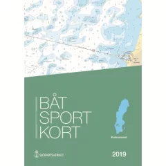
Area: Trosa – Västervik. New edition 2025 with approximately 200 updates. A large number of sea surveys have resulted in new depths and modified depth curves. Adjusted lighthouse sectors and new sea marks and buoys. Updated nature reserves.
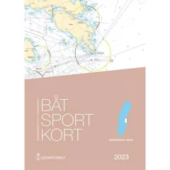
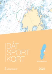
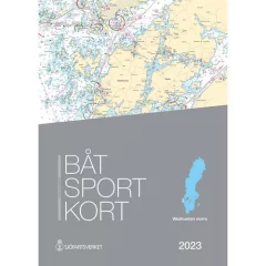
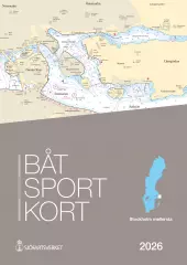
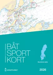
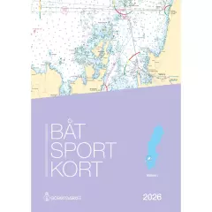
EN: Swedish chart sets, Båtsportkort, are ordinary nautical charts made in a smaller format. Each chart set covers a certain part of the coast and there are currently 16 sets, covering the entire Swedish coast and the large lakes on the mainland. Båtsportkort nautical charts are made in A3 size on durable and water-repellent material. They always contain general maps of the area at the beginning. This is followed by pages about the area in the scale of the original nautical charts and with all the information. Towards the end you will always find harbor charts and special charts of the area and information texts. Also includes an excerpt from the most important symbols and abbreviations.
SE: Båtsportkort är ordinarie sjökort framtagna i ett mindre format können för båtlivet. Each boat sport card covers a certain coastal stretch and today there are 16 series that cover the entire Swedish coast along the mainland and the large coastal areas. Båtsportkorten is made in A3 format on a slip-resistant and water-resistant material. They always contain an overview map starting with the entire area. Then follow the pages with the sea map in the same scale and with the same information as the ordinary sea maps over the area. Mot selet finns hamnspecialer och informationstexter samt ett utdrag som describten sjökortens most important symbols och förkortningar.
- Map: Ostkusten
- Area: Trosa - Västervik
- Release year: 2025
- Publisher: Swedish Maritime Administration
- Language: Swedish

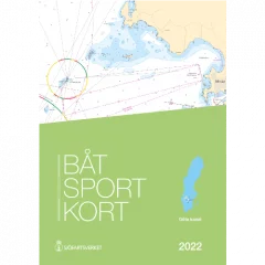
Area: Kullen – Simrishamn. New edition 2025. Approximately 200 updates. Several adjusted lighthouse sectors and changed nautical mark markings. A large number of oceanographic surveys have resulted in new depths and changed depth curves.
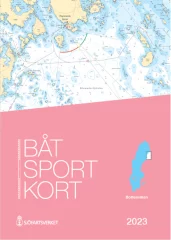
EN: Swedish chart sets, Båtsportkort, are ordinary nautical charts made in a smaller format. Each chart set covers a certain part of the coast and there are currently 16 sets, covering the entire Swedish coast and the large lakes on the mainland. Båtsportkort nautical charts are made in A3 size on durable and water-repellent material. They always contain general maps of the area at the beginning. This is followed by pages about the area in the scale of the original nautical charts and with all the information. Towards the end you will always find harbor charts and special charts of the area and information texts. Also includes an excerpt from the most important symbols and abbreviations.
SE: Båtsportkort är ordinarie sjökort framtagna i ett mindre format können för båtlivet. Each boat sport card covers a certain coastal stretch and today there are 16 series that cover the entire Swedish coast along the mainland and the large coastal areas. Båtsportkorten is made in A3 format on a slip-resistant and water-resistant material. They always contain an overview map starting with the entire area. Then follow the pages with the sea map in the same scale and with the same information as the ordinary sea maps over the area. Mot selet finns hamnspecialer och informationstexter samt ett utdrag som describten sjökortens most important symbols och förkortningar.
- Map: Sydkusten
- Area: Kullen - Simrishamn
- Release year: 2025
- Publisher: Swedish Maritime Administration
- Language: Swedish
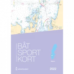
Area: Måseskär – Kullen. New edition 2025 with approximately 250 updates. A large number of sea surveys have resulted in new depths and modified depth curves. Adjusted lighthouse sectors, sea marks and buoys. New piers and bridges.
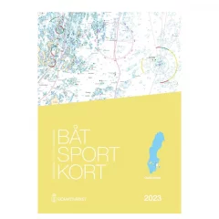
EN: Swedish chart sets, Båtsportkort, are ordinary nautical charts made in a smaller format. Each chart set covers a certain part of the coast and there are currently 16 sets, covering the entire Swedish coast and the large lakes on the mainland. Båtsportkort nautical charts are made in A3 size on durable and water-repellent material. They always contain general maps of the area at the beginning. This is followed by pages about the area in the scale of the original nautical charts and with all the information. Towards the end you will always find harbor charts and special charts of the area and information texts. Also includes an excerpt from the most important symbols and abbreviations.
SE: Båtsportkort är ordinarie sjökort framtagna i ett mindre format können för båtlivet. Each boat sport card covers a certain coastal stretch and today there are 16 series that cover the entire Swedish coast along the mainland and the large coastal areas. Båtsportkorten is made in A3 format on a slip-resistant and water-resistant material. They always contain an overview map starting with the entire area. Then follow the pages with the sea map in the same scale and with the same information as the ordinary sea maps over the area. Mot selet finns hamnspecialer och informationstexter samt ett utdrag som describten sjökortens most important symbols och förkortningar.
- Map: Southern West Coast
- Area: Måseskär - Kullen
- Release year: 2025
- Publisher: Swedish Maritime Administration
- Language: Swedish
Waterproof map set from the Finnish Maritime Administration. A3 size spiral bound on waterproof pretex paper.
- 2024 version
- Waterproof paper map.
- Convenient size

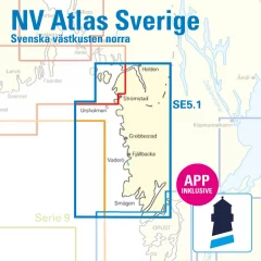
Area: Svinesund – Måseskär.
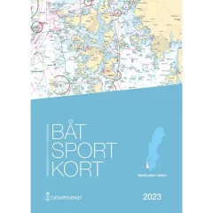
Swedish chart sets, Båtsportkort, are ordinary nautical charts made in a smaller format. Each chart set covers a certain part of the coast and there are currently 16 sets, covering the entire Swedish coast and the large lakes on the mainland. Båtsportkort nautical charts are made in A3 size on durable and water-repellent material. They always contain general maps of the area at the beginning. This is followed by pages about the area in the scale of the original nautical charts and with all the information. Towards the end you will always find harbour charts and special charts of the area and information texts. Also includes an excerpt from the most important symbols and abbreviations.
Båtsportkort är ordinarie sjökort framtagna i ett minder format können för båtlivet. Each boat sport card covers a certain coastal stretch and today there are 16 series that cover the entire Swedish coast along the mainland and the large coastal areas. Båtsportkorten is made in A3 format on a slip-resistant and water-resistant material. They always contain an overview map starting with the entire area. Then follow the pages with the sea map in the same scale and with the same information as the ordinary sea maps over the area. Mot selet finns hamnspecialer och informationstexter samt ett utdrag som describten sjökortens most important symbols och förkortningar.
- Map: North of the West Coast
- Area: Svinesund – Måseskär
- Release year: 2023
- Language: Swedish
- S1 Halden to Lysekil 1: 240,000
- S2 Lysekil to Varberg 1: 240,000 (Pilot Chart Anholt-Færder-Jomfruland 1: 750,000 only in digital format)
- S3 Krokstrand to Svinesund 1: 40,000
- S3A Åbyfjorden to Brofjorden 1: 40,000
- S4 Svinesund to Dynekilen 1: 40,000
- S5 Dynekilen to Koster Fjord 1: 40,000 S6 Koster Fjord to Havstenssund 1: 40,000
- S7 Havstenssund to Bramskär 1: 40,000
- S8 Bramskär to Hamburgsund 1: 40,000
- S9 Hamburgsund to Smögen 1: 40,000
- S10 Smögen to Fiskebäckskil 1: 40,000
- S11 Gullmarn Fjord 1: 40,000
- S12 Koster Archipelago 1: 20,000
- S13 Grebbestad to Fjällbacka 1: 20,000
- S14 Fjällbacka to Dannemark 1: 20,000
- S15 Denmark to Sotekanal 1: 20,000
- S16 Smögen to Malmö 1: 20,000
- S17 Malmö to Lysekil 1: 20,000
- West Coast – North
- Port information
- S1 Halden to Lysekil 1: 240,000
- S2 Lysekil to Varberg 1: 240,000, (Pilot Chart Anholt-Færder-Jomfruland 1: 750,000 only in digital format)
- S3 North of Orust 1: 40,000
- S4 East of Orust 1: 40,000
- S5 North of Tjörn 1: 40,000
- S6 East of Tjörn 1: 40,000,
- S7 Fiskebäckskil to Käringön 1: 40,000
- S8 Käringön to Marstrand 1: 40,000
- S9 Marstrand to Sälö 1: 40,000
- S10 Sälö to Öckerö 1: 40,000
- S11 Öckerö to Vinga 1: 40,000
- S12 Vinga to Tistlarna 1: 40,000
- S13 Thistles to Malö 1: 40,000
- S14 Malö to Ringhals 1: 40,000
- S15 Ringhals to Varberg 1: 40,000
- S16A Northern River 1: 40,000
- S16C Kungsbackafjord 1: 40,000
- S3A Råbergsund 1: 10,000
- S16B Nordre Älv Flood barrage 1: 3,000
- S17 Lysekil to Gullholmen 1: 20,000
- S18 Gullholmen to Käringö Fjord 1: 20,000
- S19 Käringö Fjord to Kyrkesund 1: 20,000
- S20 Kyrkesund to Klädesholmen 1: 20,000
- S21 Marstrand 1: 20,000
- S22 Öckerö to Vinga 1: 20,000
- S23 Långedrag to Vrångö 1: 20,000
- West Coast – South
- Port and anchorage information
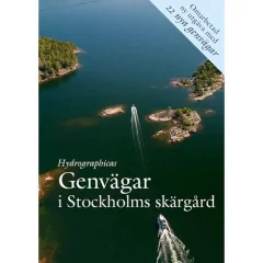
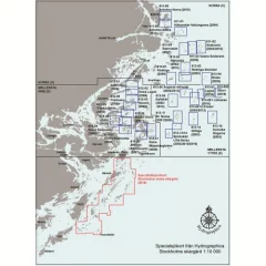
In this book, Hydrographica has used its technology to map and present 107 shortcuts that most people consider to be impassable or very difficult. In most cases, however, they are not as difficult as rumors suggest, and with Hydrographica's new book, it is possible to try many new routes that previously seemed impossible. Each route description is illustrated with a detailed sea chart, helicopter photo and text explanation. This book will be as important on board as the nature-harbour guide Hamnguiden 8 – Arholma – Landsort . Published by Hydrographica.
- Stockholm archipelago
- 107 shortcuts
- Helicopter image and text description
- Language: Swedish
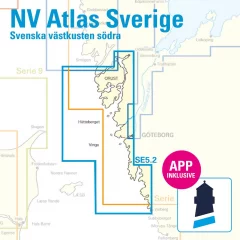
Area: Svinesund – Måseskär. Approximately 250 updates.
Several oceanographic surveys have resulted in new depths and modified depth curves.
Adjusted lighthouse sectors, seamarks and buoys. New piers and bridges and updated nature reserves.
EN: Swedish chart sets, Båtsportkort, are ordinary nautical charts made in a smaller format. Each chart set covers a certain part of the coast and there are currently 16 sets, covering the entire Swedish coast and the large lakes on the mainland. Båtsportkort nautical charts are made in A3 size on durable and water-repellent material. They always contain general maps of the area at the beginning. This is followed by pages about the area in the scale of the original nautical charts and with all the information. Towards the end you will always find harbor charts and special charts of the area and information texts. Also includes an excerpt from the most important symbols and abbreviations.
SE: Båtsportkort är ordinarie sjökort framtagna i ett mindre format können för båtlivet. Each boat sport card covers a certain coastal stretch and today there are 16 series that cover the entire Swedish coast along the mainland and the large coastal areas. Båtsportkorten is made in A3 format on a slip-resistant and water-resistant material. They always contain an overview map starting with the entire area. Then follow the pages with the sea map in the same scale and with the same information as the ordinary sea maps over the area. Mot selet finns hamnspecialer och informationstexter samt ett utdrag som describten sjökortens most important symbols och förkortningar.
- Map: West Coast North
- Area: Svinesund - Måseskär
- Release year: 2025
- Publisher: Swedish Maritime Administration
- Language: Swedish
Waterproof map set from the Finnish Maritime Administration. A3 size spiral bound on waterproof pretex paper.
Covers the central Stockholm archipelago, including central Stockholm. The coverage area is bordered by the Vaxholm-Möja plain in the north, the island of Ornö in the south and Sandhamn / Revengegrundet in the east.
If you approach Stockholm via Sandhamn, this map set will take you all the way to the city center.
- 2026 version
- Waterproof paper map.
- Convenient size
Waterproof map set from the Finnish Maritime Administration. A3 size spiral bound on waterproof pretex paper.
If you are approaching Stockholm from the south and going all the way to the city center, you will also need the Stockholm Mellersta map set.
- 2026 version
- Waterproof paper map.
- Convenient size
Swedish map series Vänern.
- Spiral bound A3
- Printed on water-repellent Pretex paper.
The maps included in the collection are:
- 615-12 Monk
- 615-13 Runmarö - Vidskären
- 615-14 Rågskär
- 615-15 Bullerö
- 616-01 Hamnskär - Ormskär
- 616-02 Långviksskär - Hallskär
- 616-03 Biskopsö - Finnskär
- 616-04 Huvudskär
- 616-05 Gillinge
- 616-06/07 Villinge/Norsten
- 616-08 Norra Fjärdlång
- 616-09 South Fjärdlång
- 616-10/11 Jungfruskär/Skeppskobben
• Completely waterproof
• Southern Islands region
Lådna - Husaröleden - Möjaskärgården
The product is made to a very high quality, as it is printed on durable and completely waterproof plastic, and has a lid that makes the product durable.
Previously, the area consisted of 11 separate sheets, but the area has now been expanded and combined, covering 430 km², almost double the area of ??previous maps. Extensive new surveys have been carried out in the area, and almost the entire central islands are covered in a new 48-page detailed map at a scale of 1:10,000.
As with the southern region map, this new Stockholm Central Islands map is printed on synthetic paper, which is very durable. Those who are used to collecting Hydrographica charts will be pleased to know that the new areas correspond to almost 9 of the previous A2 charts.
- Lådna - Cottage
- A3 size
- Completely waterproof
- Central Islands region
- Scale: 1:10,000


