Black November - Electronics
Black November - Electronics group products


Garmin ECHOMAP Ultra 2 122sv – 12" chartplotter and sonar for demanding fishing
The Garmin ECHOMAP Ultra 2 122sv is a premium 12-inch chartplotter and sonar for active and demanding fishing. A large, bright touchscreen, ultra-high-definition UHD sonar, and extensive mapping and networking capabilities make it an excellent choice for anglers who want the best possible visibility and control on the water.
Bright 12” touchscreen
The large 12-inch touchscreen is easy to read even in direct sunlight. The larger display area allows for multiple views to be used simultaneously and makes interpreting maps and sonar images even easier.
GT56UHD-TM transom mount transducer included
All the tools for successful fishing. ECHOMAP Ultra 2 122sv comes with the GT56UHD-TM transducer , which offers a highly accurate and versatile sonar package:
- Traditional Garmin CHIRP sonar
- ClearVü™ UHD scanning sonar
- SideVü™ UHD scanning sonar
You can see the bottom structures, vegetation and fish with exceptional detail, almost photographically.
LiveScope™ sonar support
The device supports Garmin LiveScope™ sonar , which lets you see fish and structure in motion in real time (LiveScope transducers sold separately).
Accurate maps and navigation
Supports Garmin Navionics+™ and Garmin Navionics Vision+™ charts , which provide:
- extensive inland and coastal coverage
- daily map updates
- Auto Guidance+™ technology for route planning
Wireless connections and smart features
- Wireless sharing of sonar, waypoints and routes
- Saving screenshots
- ActiveCaptain® mobile app (software updates, Garmin Quickdraw™ maps)
Multi-band GPS
Multi-band GNSS improves positioning accuracy, especially in areas where GPS signals are weak or reflected.
Wide compatibility
- NMEA 2000®
- Fusion Link™
- Garmin Force® trolling motor
Bright and accurate colors
The bright and high-contrast color palettes of the UHD scanning sonar make it easy to identify targets, structures and fish, even in challenging conditions.
ActiveCaptain® app
By pairing your chartplotter with the ActiveCaptain® mobile app, you get access to:
- software updates
- screen recording
- Garmin Quickdraw™ Community Maps
Compatible with Force® trolling motor
Wireless connection to a Garmin Force® trolling motor allows you to navigate to waypoints, draw and track routes directly from your chartplotter.
Easy to remove and transport
The included quick-release mounting bracket makes installing and removing the device quick and easy.
In the package:
- ECHOMAP Ultra 122sv
- GT56UHD-TM sonar transducer
- Power cord
- Mounting bracket and quick-release bracket
- Sunshade
- Hardware
- Guides
- Display: 10"
- Touchscreen
- Dimensions: 29.5 x 19.5 x 9.8 cm
- Weight: 1.8 kg
- Waterproof rating: IPX7
- Display type: WXGA, IPS
- Screen size (W x H): 21.7 x 13.6 cm
- Screen resolution: 1280 x 800 px
- Operation: Touch screen and buttons
- Mounting: Mounting or recessed
Maps and memory
- Memory card slots: 2 x microSD
- Waypoints: 5,000
- Posting points: 50,000
- Saved tracks: 50
- Routes: 100
Positioning and sensors
- GPS / GNSS: GPS, GLONASS, Galileo, BeiDou
- Internal receiver: Yes (10 Hz)
- Multi-band GPS: Yes
- WAAS support: Yes
- NMEA 2000® compatible: Yes
- NMEA 0183: No
Map support
- Internal maps:
- No preinstalled maps
- Optional map support:
- Garmin Navionics+™
- Garmin Navionics Vision+™
- BlueChart® g3
- BlueChart® g3 Vision
- TOP 100K
- Standard maps
- Garmin Quickdraw Contours™
Chartplotter functions
- AIS compatible: Yes
- DSC compatible: Yes
- ActiveCaptain® compatible: Yes
- Fusion-Link™ support: Yes
- Sailing features: Yes
Electrical information
- Power supply: 9–18 Vdc
- Typical current consumption (12V): 2.3-2.5A
- Maximum current consumption (12 V): 5 A
- Maximum power: ~34–36 W
Sonar – technical features
- Displays sonar: Yes
- Power: 600W
- Traditional sonar:
- Internal single-channel CHIRP
- Frequencies: 70 / 83 / 200 kHz (Low, Medium, High CHIRP)
- ClearVü™: 260 / 455 / 800 / 1000 / 1200 kHz
- SideVü™: 260 / 455 / 800 / 1000 / 1200 kHz
- Panoptix™ compatible: Yes
- LiveScope™ compatible: Yes
- Includes: GT56UHD-TM transducer
- The transducer offers Garmin CHIRP traditional sonar as well as Ultra High-Definition ClearVü and SideVü scanning sonar.
Connections and connections
- NMEA 2000® ports: 1
- Garmin Marine Network™: 2 ports (large connector)
- Transducer connection: 12-pin scanning sonar
- Wi-Fi®: Yes
- ANT®: Yes
- Bluetooth®: No


Versatile chartplotter and sonar with a large 12-inch touchscreen display that is clearly readable even in bright sunlight and includes a wealth of excellent fishing features. In addition to the touchscreen, the device has shortcut keys on the right bezel, meaning the device offers both options for use depending on the situation or user preferences. The device supports Garmin Navionics+™ and Garmin Navionics Vision+™ charts and the transducer adds highly accurate scanning sonar, as well as traditional CHIRP sonar. The device is therefore designed especially for fishermen and boaters who value accurate map information, advanced sounding and many compatibility options with other boat devices.
- Screen size: 12'
- Touchscreen and buttons
- Sonar must be purchased separately
- Dimensions: 34.1 x 22.9 x 9.8cm
- Weight: 2.5 kg
- Waterproof rating: IPX7, which means the device can withstand immersion in water up to 1 meter deep for 30 minutes.
Touchscreen:
- Display type: WXGA, IPS, which offers wide viewing angles and good image quality.
- Screen size: 26.1 x 16.3 cm; diagonal 30.7 cm.
- Screen resolution: 1280 x 800 pixels.
- Mounting options: mounting bracket or flush mounting
- In addition, button operation, i.e. both touchscreen and button operation
- Supports memory cards: 2 microSD cards, allowing for expandable storage for map data, waypoints and other data.
- Waypoints: 5000 waypoints, which can include locations you want to save and return to later.
- Trackpoints: 50,000 trackpoints that can record your movements and routes on the water surface.
- Tracks: 50 saved tracks, which means the device can store 50 separate tracks from different trips.
- Routes: 100 routes, which can include planned routes that you can follow and share on your device.
- GPS support: The device supports multiple satellite systems, which improves location accuracy.
- GLONASS: A Russian satellite system that improves positioning accuracy, especially in challenging environments.
- Galileo: A European satellite system that supports more precise positioning.
- BeiDou: A Chinese satellite system that increases positioning accuracy.
- Internal receiver: Built-in receiver that supports the use of multiple satellite systems.
- Receiver: 10 Hz receiver, which means the device updates the location 10 times per second, improving accuracy and real-time.
- NMEA 2000® compatible: The device is compatible with the NMEA 2000 network, allowing it to be connected to other boat devices, such as heading sensors, engines and autopilots.
- WAAS support: Support for the Wide Area Augmentation System (WAAS), which improves GPS location accuracy, especially in the United States.
Compatible maps:
- BlueChart g3: Coastal charts that provide detailed information about sea areas and navigational features, such as channels, depths, and hazards.
- BlueChart g3 Vision: An additional feature of BlueChart g3 charts that provides 3D views, optimized route suggestions, and additional information such as ports and harbor charts.
- Garmin Navionics+™: A great choice for anglers, featuring detailed coastal and inland maps, as well as fishing location and depth information.
- Garmin Navionics Vision+™: Offers advanced features such as 3D chart and harbor imagery that enhance navigation and route planning.
- TOPO 100K: Terrain maps that cover large areas and provide detailed information about landforms such as mountains, lakes, and rivers.
- Garmin Quickdraw Contours: Garmin's proprietary mapping software that allows users to create their own maps and depth locations in real time.
Chartplotter functions:
- AIS compatible: Ability to track the location of target vessels, improving safety and navigation at sea.
- DSC-compatible: Displays position information from a DSC-compatible VHF radio, facilitating emergency management and communication.
- Supports FUSION-Link™ compatible radios: Ability to connect and control FUSION-Link compatible audio systems.
- ActiveCaptain compatible: The ActiveCaptain app lets you manage your device settings, receive updates, and share data with your smart device.
Electrical information:
- Power input: 9–18 Vdc.
- Typical current consumption (12 V dc): 2.5 A.
- Maximum current consumption (12 V dc): 5 A.
- Maximum power consumption (10 V dc): 36 W.
Contacts:
- NMEA 2000® ports: 1 port that allows the device to communicate with other NMEA 2000 compatible devices.
- Garmin Marine Network™ ports: 2 ports (large connector) allowing for expandability and connectivity to other Garmin devices.
- 12-pin transducer ports: Allows connection to a scanning sonar.
- ANT+™ (connection): Wireless connection to various ANT+ compatible devices, such as heart rate monitors or other sensors.
- Garmin Wi-Fi® Network (Local Connection): Ability to connect to a local Wi-Fi network for data sharing and device management.
Package contents:
- ECHOMAP Ultra 122sv
- Charging/data cable
- Mounting bracket and quick-release bracket
- Sunshade
- Hardware
- Guides

Versatile chartplotter and sonar with a large 10-inch touchscreen display that is clearly readable even in bright sunlight and includes a wealth of excellent fishing features. In addition to the touchscreen, the device has shortcut keys on the right bezel, meaning the device offers both options for use depending on the situation or user preferences. The device supports Garmin Navionics+™ and Garmin Navionics Vision+™ charts and the transducer adds highly accurate scanning sonar, as well as traditional CHIRP sonar. The device is therefore designed especially for fishermen and boaters who value accurate map information, advanced sounding and many compatibility options with other boat devices.
- Screen size: 10"
- Touchscreen and buttons
- Sonar must be purchased separately
- Dimensions: 29.5 x 19.5 x 9.8 cm
- Weight: 1.8 kg
- Waterproof rating: IPX7, which means the device can withstand immersion in water up to 1 meter deep for 30 minutes.
- Display type: WXGA, IPS, which offers wide viewing angles and good image quality.
- Screen size: 21.7 x 13.6 cm; diagonal 21.7 cm.
- Screen resolution: 1280 x 800 pixels.
- Mounting options: mounting bracket or flush mounting
- In addition, button operation, i.e. both touchscreen and button operation
- Supports memory cards: 2 microSD cards, allowing for expandable storage for map data, waypoints and other data.
- Waypoints: 5000 waypoints, which can include locations you want to save and return to later.
- Trackpoints: 50,000 trackpoints that can record your movements and routes on the water surface.
- Tracks: 50 saved tracks, which means the device can store 50 separate tracks from different trips.
- Routes: 100 routes, which can include planned routes that you can follow and share on your device.
- GPS support: The device supports multiple satellite systems, which improves location accuracy.
- GLONASS: A Russian satellite system that improves positioning accuracy, especially in challenging environments.
- Galileo: A European satellite system that supports more precise positioning.
- BeiDou: A Chinese satellite system that increases positioning accuracy.
- Internal receiver: Built-in receiver that supports the use of multiple satellite systems.
- Receiver: 10 Hz receiver, which means the device updates the location 10 times per second, improving accuracy and real-time.
- NMEA 2000® compatible: The device is compatible with the NMEA 2000 network, allowing it to be connected to other boat devices, such as heading sensors, engines and autopilots.
- WAAS support: Support for the Wide Area Augmentation System (WAAS), which improves GPS location accuracy, especially in the United States.
Compatible maps:
- BlueChart g3: Coastal charts that provide detailed information about sea areas and navigational features, such as channels, depths, and hazards.
- BlueChart g3 Vision: An additional feature of BlueChart g3 charts that provides 3D views, optimized route suggestions, and additional information such as ports and harbor charts.
- Garmin Navionics+™: A great choice for anglers, featuring detailed coastal and inland maps, as well as fishing location and depth information.
- Garmin Navionics Vision+™: Offers advanced features such as 3D chart and harbor imagery that enhance navigation and route planning.
- TOPO 100K: Terrain maps that cover large areas and provide detailed information about landforms such as mountains, lakes, and rivers.
- Garmin Quickdraw Contours: Garmin's proprietary mapping software that allows users to create their own maps and depth locations in real time.
Chartplotter functions:
- AIS compatible: Ability to track the location of target vessels, improving safety and navigation at sea.
- DSC-compatible: Displays position information from a DSC-compatible VHF radio, facilitating emergency management and communication.
- Supports FUSION-Link™ compatible radios: Ability to connect and control FUSION-Link compatible audio systems.
- ActiveCaptain compatible: The ActiveCaptain app lets you manage your device settings, receive updates, and share data with your smart device.
Electrical information:
- Power input: 9–18 Vdc.
- Typical current consumption (12 V dc): 2.3 A.
- Maximum current consumption (12 V dc): 5 A.
- Maximum power consumption (10 V dc): 34 W.
Contacts:
- NMEA 2000® ports: 1 port that allows the device to communicate with other NMEA 2000 compatible devices.
- Garmin Marine Network™ ports: 2 ports (large connector) allowing for expandability and connectivity to other Garmin devices.
- 12-pin transducer ports: Allows connection to a scanning sonar.
- ANT+™ (connection): Wireless connection to various ANT+ compatible devices, such as heart rate monitors or other sensors.
- Garmin Wi-Fi® Network (Local Connection): Ability to connect to a local Wi-Fi network for data sharing and device management.
Package contents:
- ECHOMAP Ultra 102sv
- Charging/data cable
- Mounting bracket and quick-release bracket
- Sunshade
- Hardware
- Guides

Top-notch sailing display!
Alpha and Axiom systems
Alpha display options
Optimal performance
- High visibility: Polarized sunglass-friendly displays with an ultra-wide viewing angle that can be viewed from a mast or remote location.
- Durable construction: Tested in extreme conditions and built with a unique HydroToughTM nano-coating that repels water and oils for reliable touchscreen control
- Fully scalable: Single power and data cable reduces cables running through the deck and mast. Supports daisy chaining of up to 4 Alpha displays
DAME winner 2023
Be a better sailor
- Tactical Awareness. Intuitively designed graphical gauge displays aimed at increasing tactical awareness and facilitating better decision-making on the water.
- SailPointTM Target. SailPoint™ mode provides a visual reference to the target wind angle, allowing you to achieve maximum VMG in headwinds or tailwinds.
- Fully scalable. Single power and data cable reduces cables running through the deck and mast. Supports daisy chaining of up to 4 Alpha displays
In the package
- Alpha 9 Performance display
- Sunscreen
- Waterproof seal
- Installation accessories
- Bulkhead bracket
- Screen size: 9"
- Touchscreen
- Easy connectivity
- Ultra-bright, high-contrast sailing display
- Power cable sold separately
- Dimensions: 148.9 x 235.9 x 34mm (W x H x D
- Weight: 1.2kg
- Operating voltage: 12/24V
- Operating voltage range: 10.8–32 V dc
- Current: 1.02 A (nominal) @ 12 V dc / 0.52 A (nominal) @ 24 V dc
- Power consumption: 12 W (maximum)
- Fuses: 8A
- High-performance Alpha displays require an Axiom chartplotter to function
- Data connections: 1 x daisy chain connector + 1 x power/RayNet Ethernet connector
- Viewing angles: 85 + / 85 + (both vertical and horizontal)
- Manufacturer's warranty 2 years, 1 additional year when product is registered with Raymarine within 90 days of purchase


Top-notch sailing display
Alpha and Axiom systems
Alpha display options
Optimal performance
- High visibility: Polarized sunglass-friendly displays with an ultra-wide viewing angle that can be viewed from a mast or remote location.
- Durable construction: Tested in extreme conditions and built with a unique HydroToughTM nano-coating that repels water and oils for reliable touchscreen control
- Fully scalable: Single power and data cable reduces cables running through the deck and mast. Supports daisy chaining of up to 4 Alpha displays
DAME winner 2023:
Be a better sailor
- Tactical Awareness: Intuitively designed graphical gauge displays aimed at increasing tactical awareness and facilitating better decision-making on the water.
- SailPointTM Target: SailPoint™ mode provides a visual reference to the target wind angle, allowing you to achieve maximum VMG in headwind or tailwind.
- Fully scalable: Single power and data cable reduces cables running through the deck and mast. Supports daisy chaining of up to 4 Alpha displays
Package contents
- Alpha 7 Performance display
- Sunscreen
- Waterproof seal
- Installation accessories
- Bulkhead bracket
- Screen size: 7"
- Touchscreen
- Easy connectivity
- Power cable sold separately
- Dimensions: 120.1 x 188.4 x 32mm (W x H x D
- Weight: 700g
- Operating voltage: 12/24V
- Operating voltage range: 10.8–32 V dc
- Ultra-bright, high-contrast sailing display
- Current: 0.84 A (nominal) @ 12 V dc / 0.43 A (nominal) @ 24 V dc
- Power consumption: 10 W (maximum)
- Fuses: 8A
- High-performance Alpha displays require an Axiom chartplotter to function
- Data connections: 1 x daisy chain connector + 1 x power/RayNet Ethernet connector
- Viewing angles: 85 + / 85 + (both vertical and horizontal)
- Manufacturer's warranty 2 years, 1 additional year when product is registered with Raymarine within 90 days of purchase

The Raymarine Axiom+ 12 is a touchscreen chartplotter without sonar.
Equipped with the all-new LightHouse 3 operating system and lightning-fast, quad-core performance, Axiom will transform your time on the water.
Axiom is expandable, allowing you to add features as you need them. Axiom supports all Raymarine accessories, including Quantum radar, CHIRP sonar, FLIR thermal imaging cameras, audio, gauges, cameras and the Evolution autopilot. Standard Wi-Fi and Bluetooth connectivity allows you to connect to Raymarine’s latest tablet and smartphone apps.
The Axiom comes with surface and pendant mount kits, mounting hardware, power/data cable, and installation instructions.
The Axiom 12 offers a wide range of features that make navigation easier and more efficient. Its intuitive interface allows users to quickly access maps, sonar data, radar images, traffic information, weather forecasts and more with just a few taps or swipes of the screen. Integrated Wi-Fi makes it easy to stay up to date with the latest updates without having to connect any cables or wires. Plus, you can even stream music directly from your smartphone or tablet using Bluetooth technology!
- Screen size: 12'
- Touchscreen
- No transducer capability
- New easy-to-use software
- Extensive accessory connections such as VHF, AIS, radar, camera, etc.
- Stylish glass front panel
- Wide support for different maps
- WiFi and Bluetooth connectivity. You can mirror the image to a compatible tablet, giving you an 'extra screen' for example in the overhead cabin
- New quad-core processor and 10 Hz/72 channel GPS receiver make map view smoother
- Manufacturer's warranty 2 years, 1 additional year when product is registered with Raymarine within 90 days of purchase

Wind, echo and log systems in one complete package
The perfect all-in-one package
Perfect integration with Raymarine devices
i50/i60 key features
- Includes depth, speed and wind gauges and sensors
- Includes SeaTalkNG cable kit for easy installation
- The I50 gauges feature oversized numbers for easy viewing day or night
- I60 Wind with analog angle indicator and LCD speed readout
- Red backlight improves night vision
- Compatible with SeaTalkNG, NMEA2000 and SeaTalk networks
- Compact footprint
- Low power consumption
- Surface mount or optional suspension bracket mounting kit
In the package
- i50 Tridata meter
- i60 Anemometer
- Wind sensor
- P319 transducer
- P120 Log sensor
- Cables
- Dimensions: 110 mm x 115 mm x 44 mm (W x H x D)
- Connections: 2 x SeaTalkng connections (SeaTalk compatible), transducer connections
- Operating voltage: 12V
- Operating voltage range: 10 V dc – 16 V dc
- Power consumption: < 1 W typical (display only), 2.4 W maximum (sensor connected)
- Includes depth, speed and wind gauges and sensors
- Includes SeaTalkNG cable kit for easy installation
- The I50 gauges feature oversized numbers for easy viewing day or night
- I60 Wind with analog angle indicator and LCD speed readout
- Red backlight improves night vision
- Compatible with SeaTalkNG, NMEA2000 and SeaTalk networks
- Compact footprint
- Low power consumption
- Surface mount or optional suspension bracket mounting kit

Raymarine Element 12 S – Chartplotter and Sonar LightHouse with Northern Europe map
The Raymarine Element 12 S is a powerful and easy-to-use chartplotter and fishfinder with a 12-inch display, suitable for sailors, powerboaters and fishermen alike. Its keypad control makes it easy to use, and the LightHouse Sport OS operating system adapts perfectly to your individual needs.
Powerful navigation and accurate GPS
The Element 12 S's built-in 10Hz GPS/GNSS antenna ensures fast and accurate positioning. It supports multiple satellite systems including GPS, GLONASS and Beidou, so your location is always accurate, no matter where you are. The preloaded Raymarine LightHouse chart covers Northern Europe, making navigation safe and easy.
The device supports multiple chart formats, including Navionics and C-MAP, and also allows you to create your own depth maps of uncharted areas with the RealBathy feature.
Excellent display quality and performance
The Raymarine Element 12 S display is designed for boating in demanding conditions:
- Bright 12-inch display with 1500 nits of brightness for good visibility even in sunlight.
- The wide viewing angle (89° in all directions) allows for a clear view from all angles.
- WVGA resolution (1280 x 800) and 24-bit color depth provide excellent image quality for charts and sonar views.
- The powerful quad-core processor ensures fast map updates and smooth operation, making the device reliable in all situations.
Sonar features
Although the Element 12 S is primarily a chartplotter, its built-in High CHIRP sonar offers a variety of sonar features:
- See water depth and bottom shapes clearly.
- Identify schools of fish and bottom structures, which also makes it a favorite with fishermen.
- Create accurate depth curves for uncharted areas with RealBathy™.
The sonar transducer is not included in the package, so you can choose the Raymarine CPT-S series transducer that best suits your needs separately.
Versatile connection options
The Element 12 S is compatible with the NMEA2000 standard, allowing easy integration with additional devices such as:
- AIS receivers
- Autopilots
- Sailing instruments
- Engines and
- With VHF radios.
Additionally, the device's RayNet Ethernet connection and MicroSDXC card slot ensure broad compatibility and storage options.
Why choose Raymarine Element 12 S
- Ease of use: Straightforward keyboard controls and LightHouse Sport OS make navigation simple.
- Durability: The device's IPX6/IPX7 protection rating and wide operating temperature range (-25 °C ... +55 °C) ensure reliability in all weather conditions.
- Versatile map features: Support for multiple map formats and the ability to create your own maps.
- Excellent performance: A powerful processor and bright display provide a seamless user experience.
The Raymarine Element 12 S is the perfect companion for all boaters who value reliability, accuracy and ease of use. Order yours today and take your boating or fishing hobby to the next level!
- Screen size: 12"
- No touchscreen
- Sonar must be purchased separately
- Chartplotter/sounder multifunction display
- Includes Raymarine Lighthouse chart card covering all of Northern Europe
- Dimensions (with mounting bracket): Height: 225.19 mm, Width: 373.40 mm, Depth: 149.40 mm
- Dimensions: (surface/flush): Height: 215.20 mm, width: 357.20 mm, depth: 149.40 mm
- Antenna: built-in
- GNSS compatibility: GPS, GLONASS, Beidou
- Signal reception: automatic
- Time from cold start to valid navigation: < 2 minutes
- Operating frequency: 1574 - 1605 MHz
- Screen resolution: WVGA 1280 x 800
- Display type: Key-operated
- Screen viewing angle: Top 89° / Bottom 89° / Left 89° / Right 89°
- Aspect ratio: 8:5
- Color depth: 24-bit
- Illumination: 1500 nits
- Protection class: IPX6 / IPX7
- Operating temperature: -25...+55 °C
- Storage temperature: -30...+70 °C
- Operating voltage: 12 V DC (8–16 V DC)
- Power consumption: 25 W
- Fuse rating: line fuse 5 A, thermal cut-out 3A
- Accessory connections: USB Micro B
- Ethernet connection: RayNet (10/100 Mbits/s)
- External storage: 1 MicroSDXC card slot
- SeaTalk/NMEA2000 interface: 1 x DeviceNet (male connector built into power cable)
- Sensor: 1 x 15-pin connector
- Geodetic datum: WGS-84
- Channels: track up to 28 satellites simultaneously
- Manufacturer's warranty 2 years, 1 additional year when product is registered with Raymarine within 90 days of purchase

Upgrade your boat's electrical components with the GNX Wired Sail Pack 43,
which includes everything you need, such as 43 mm transducers for measuring depth, temperature and water velocity
Includes GNX™ Wind and GNX 20 marine instruments, gWind™ Wired wind transducer , and GDT™ 43 and GST™ 43 sonar transducers with 43 mm fittings and adapters to share data over a NMEA 2000® network. GNX Wind and GNX 20 devices feature a highly visible, adhesive-bonded black-and-white LCD display. The gWind wind transducer’s dual-fin technology and three-blade propeller provide accurate true wind speed (TWS) and true wind angle (TWA) measurements. Accurate information such as water depth, water speed, and water temperature. Easy plug-and-play installation over a NMEA 2000 network
GNX Wind device
GNX Wind provides wind data that you can use to make decisions with confidence. The GNX Wind features a highly visible, adhesive-backlit, black-and-white LCD display with customizable backlight colors. It also displays two data fields and a digital wind rose simultaneously over a NMEA 2000 network, including true and apparent wind, autopilot, and boat speed. Low power consumption (350 mW during the day without backlight and 400 mW at night with medium backlight) makes it ideal for boats. Customizable user settings allow you to customize the display layout to your liking. Display configurations include over 15 key boating parameters related to wind, speed, and navigation. GNX Wind uses ANT® technology to connect to and stream wind data to the gWind Wired wind sensor and a compatible quatix GPS marine smartwatch or Garmin Nautix sunglass display.
gWind wind sensor
The gWind wind sensor is an easy-to-install solution. Accurate wind signals are transmitted directly to the GNX Wind device or compatible GPSMAP chartplotter. The wind sensor features the renowned Nexus dual-fin technology and a three-blade propeller, ensuring accurate wind speed and angle measurements even in light winds.
GNX 20 marine display
The easy-to-read GNX 20 display, featuring black digits on a white or colored background, clearly displays water depth, boat speed, water temperature and over 50 other boating parameters via NMEA 2000. Customizable user settings let you choose from 5 display configurations to best suit your boat or powerboat (including single, dual and triple functions). Graph modes let you display wind, depth and speed data. You can also customize the pages to show the boating and boating information that matters to you. The adhesive-bonded display and anti-glare lens ensure excellent readability 24/7, and the high-contrast digits can be set to a height of up to 36 mm. The device draws only 25 mA / 350 mW during the day when it does not require a backlight, and only 400 mW at night when using a medium backlight.
GDT 43 and GST 43 transducers and 43mm accessories
If you already have 43mm thru-hull transducers, there is no need to drill new holes. The kit includes 43mm thru-hull transducers that can be retrofitted to boats that already have Nexus® or Silva TH43 transducers. The GST 43 is a speed and temperature transducer, and the GDT 43 is a depth transducer. When you add a NMEA 2000 adapter, each GDT 43 transducer can share data over a NMEA 2000 network to a compatible Garmin chartplotter or instrument display.
Specifications
gWind wind sensor:
- Device dimensions (W x H): 345 x 610 mm
- Weight: 260g
- Cable length: 25 m
- Waterproof: yes (IPX6¹)
- Temperature: -15 - 70°C
- Storage temperature: -20 - 80 °C
- Voltage: 9-16V
- Power consumption: 0.33 W
- Typical current at 12 Vdc: 28 mA
- Compass safety range: -
- Accuracy angle: better than ±1.5°
- Speed: better than ±3%
- Wind speed: 0.8-90 knots (0.4-50 m/s)
- NMEA 2000® Load Equivalency Number (LEN): -
- Wireless connection: no
GNX Wind device:
- Physical dimensions: 110 x 115 x 30 mm
- Screen size (W x H): 83 x 60 mm, 101.6 mm diagonal (3.3 x 2.4 inches, 4.0 inches diagonal)
- Weight: 230g
- Water resistance: IPX7
- NMEA 2000 certified: yes
- Power consumption: 0.35 W (day), 0.4 W (night)
- Voltage: 9-16 V (from NMEA 2000)
- Installation options: flush or surface mounting
- Temperature: -15 - 70°C
- Compass safety distance: 209 mm
GNX 20 device:
- Physical dimensions: 110 x 115 x 30 mm
- Screen size (W x H): 83 x 60 mm, diagonal 101.6 mm
- Weight: 230g
- Water resistance: IPX7
- NMEA 2000 certified: yes
- Power consumption: 0.35 W (day), 0.4 W (night)
- Voltage: 9-16 V (from NMEA 2000)
- Installation options: flush or surface mounting
- Temperature: -15 - 70°C
- Compass safety distance: 209 mm
Package contents:
- gWind Wired wind sensor
- GNX™ 20
- GNX Wind boating device
- GDT™ 43 and NMEA 2000® adapter
- GST™ 43 and GST 10
- GND™ 10
- NMEA 2000 device cable (2 meters)
- NMEA 2000 T-connector
- Nexus female connector, field installation
- Mast stand
- Fastening accessories
- Guides
- Includes GNX™ Wind and GNX 20 marine devices, gWind™ Wired wind sensor, and GDT™ 43 and GST™ 43 sonar transducers
- Easy installation
- NMEA2000

Icom IC-M25EURO EVO portable VHF radio
The Icom IC-M25EURO EVO is an updated version of the popular floating handheld VHF radio. A redesigned design, better grip and larger buttons make it easier and safer to use even in demanding conditions.
Safe and practical
Thanks to the Float n Flash function, the radio floats, flashes and sounds an alarm when it falls into the water, making it easier to find and reducing the risk of getting lost.
The improved side surface design provides a firm grip even with wet hands, and the larger buttons make channel browsing fast and clear.
Light and easy to carry
The lightweight and compact design makes the radio comfortable to use for extended periods of time. It is easy to carry with you in all boating situations.
Long operating time
Energy saving mode allows for up to 14 hours of operation. Reducing the transmission power significantly extends the operating time, making the radio reliable even on longer trips.
USB-C charging
The radio charges quickly via USB-C in about three hours. You can also charge it with a power bank, which adds convenience when using it on the go.
Clear sound in all conditions
AquaQuake vibrates to remove water from the speaker, ensuring clear sound even after splashes. 700 mW of audio power ensures audibility even in noisy environments.
Features
- Floating structure and alarm in the water Float n Flash
- IPX7 waterproof, withstands immersion in 1 meter for 30 minutes
- Four-level battery level display
- Two-stage energy saving mode
- Dual and Tri watch functions
- Quick access to channel 16 or a programmable channel
- Favorite channel function
- Monitor function with noise reduction
- Automatic channel search
- Audio power 700 mW
- USB-C charging
- Warranty 60 months
- Up to 14 hours of battery life
- AquaQuake function
- Float'n Flash function


Patriot Marine trolling motor installation kit, includes aluminum quick-release foot, power connector, power plug and 60A circuit breaker.
The Patriot Marine electric bow thruster mounting kit is suitable for use with the most common electric bow thrusters on the market (including Minn Kota & MotorGuide). The mounting kit allows the bow thruster to be installed on many boat models without any hassle. The quick-release base allows the bow thruster to be attached and removed from the bow of the boat easily and quickly.
- Universal mounting kit
- Suitable for e.g. Minn Kota and Motorguide
- Aluminum quick-release foot, lockable
- Automatic fuse 60A, also functions as a power switch
- Power connector
- Flush-mounted power socket

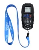
Wireless remote control for Hydra trolling motor


"It's like Google Maps for Boats"
Savvy Navvy is a versatile navigation app that combines several boating-related features into one easy-to-use package. The app provides users with access to nautical charts, weather forecasts, tide information, and route planning tools. It aims to make boating safer and more enjoyable by providing all the necessary information in one app.
Features
- Clear and simple nautical charts that present essential nautical information without unnecessary clutter.
- Route Planning: Allows you to plan a route quickly and easily, taking into account boat settings, weather conditions and tides.
- Estimated Time of Arrival (ETA): Automatically calculates the estimated time of arrival based on winds, weather, tides, and chart data.
- Tide data: Access data from thousands of tide stations around the world, including the direction and strength of tidal currents.
- GPS Tracking: Allows real-time location tracking and viewing of course over ground (COG) and speed over ground (SOG).
- Weather Forecasts: Shows forecasted wind directions and strengths, as well as other weather conditions for the selected area.
- Satellite view: Allows for a closer look at ports, anchorages, and other points of interest.
- Offline maps and weather: Ability to download maps and weather data in advance so you can use them without an internet connection.
Savyy Navyy nautical charts:
Savvy Navvy licenses nautical charts from the United Kingdom Hydrographic Office (UKHO), NOAA and other official hydrographic authorities around the world. Savvy charts are built from the ground up by designers to present essential nautical information in a clear and easy-to-read interface.
Over the Horizon AIS (OHA)
Improve safety by increasing awareness of vessels around you. Using your phone's internet connection, we stream real-time vessel information such as speed, distance, MMSI, position, course of course (COG) and destination.
GPS active tracking
See your real-time location and check your course over ground (COG) and speed over ground (SOG). Center circles around your location quickly illustrate the distance from you to key landmarks around you.
Marine weather forecast
You don't have to be a meteorologist to get the most out of your weather data. Savvy Navvy uses ECMWF technology to combine multiple weather forecasts into a more comprehensive one. Scroll through the coming days to see changing wind directions, strengths and weather conditions.
Cloud and rain radar
This overlay lets you view changing weather patterns in your area. A handy tool to help you avoid annoying showers and gusty weather conditions.
Intelligent route planning
Easily check your traditional navigation for extra confirmation and peace of mind. The program plans your route based on departure time, your boat information, chart data, and wind, weather, and tide information – providing you with a comprehensive and safe itinerary.
Fuel efficiency
No one likes the feeling of running out of fuel. Customizable boat-specific settings help you estimate fuel consumption for your planned route based on engine speed and boat fuel efficiency.
Import waypoints
Import your notes from other navigation tools and see all your saved locations in the Savvy app. This way, your important information continues to enhance your boating experience – while you enjoy the Savvy features you love most.
Port and anchorage information
Boat like a local – the most important information at your fingertips! Select a port or anchorage icon to see essential information about the quality of the bottom, weather protection, services, number of berths, maximum boat length, contact information and much more. Boat globally, think locally.
Anchor alarm
Sleep soundly with the Savvy Anchor Alarm. This easy-to-use tool lets you set your safety limits and alerts you if you drift out of your comfort zone.
Satellite mode
Explore the perfect spot in more detail with satellite mode. This handy overlay gives you a more detailed view of ports and anchorages, so you can make sure you're choosing the best option.
- Clear and simple nautical charts of the entire world
- One-year license
- You will receive a code to activate the nautical charts.
- Savvy Navvy is available for both iOS and Android devices
- Many features that make boating easier;
- Intelligent route planning
- Over the Horizon AIS (via internet connection)
- GPS information
- Marine weather forecast
- Cloud and rain radar
- Fuel efficiency
- Import waypoints from other programs
- Port and anchorage information
- Anchor alarm
- Satellite mode

Diameter: 250mm
Height: 151mm
Mounting diameter: 25mm
Voltage: 12/24V
Frequency: 40/890MHz
Maximum TV devices: 2 or 1 TV and 1 AM/FM radio
Weight: 350g
Supplied with antenna amplifier, 20 meter antenna cable, 1.5 meter cable antenna amplifier and 2 pcs (gold-plated) female connectors.
• Radius of rotation
• Diameter 250mm


Nashira is a round TV and radio antenna with a built-in automatic antenna amplifier. It adjusts itself for the best reception and does not need to be aligned or rotated. The amplifier has two outputs for TV
/TV or TV/FM-AM radio. The size of the antenna improves reception in areas where interference and reflection of TV signals make reception difficult, and in weak signal conditions.
Specifications
- Diameter: 370mm
- Height: 240mm
- Mounting diameter: 25mm
- Impedance: 75 Ohm, 24dB
- Voltage: 12/24V
- Current consumption: 20mA
- TV devices max: 2 or 1 TV and 1 AM/FM radio
- Weight: 975g
The delivery includes an antenna amplifier, 20 meters of antenna cable and 1.5 meters of cable between the antenna amplifier and the TV/radio.
- TV/Radio Antenna
- Round
- Diameter 370mm

Night Vision Camera
Specifications
- Camera type: XQE1350 BSI CMOS
- Resolution: 1280 X 1024
- Frame rate: 30 HZ
- Horizontal field of view: 44°
- Visible spectrum: 400-1200 nm
- Focus range: 10 m - infinity
- Lens: 16mm F/1.4
- Video output: Analog video (NTSC)
- Analog video connection: SMA/BNC/RCA
- Wireless communication: WiFi + Bluetooth
- Power supply: 12Vdc / 5Vdc (USB)
- Power connection: copper wire / USB (with optional cable included)
- IP rating: IP67 (waterproof and dustproof)
- Shock and vibration protection: IEC60945 (V15G | H:9G) | IK08
- Operating temperature: -20°C - +50°C
- Storage temperature: -20°C - +80°C
- Color: Black
- Weight: 870g
- Dimensions: 127 x 127 x 52 mm (5 x 5 x 6 inches)
- Material: UV-resistant polycarbonate
The package includes:
- SIONYX Nightwave Ultra Low-Light Marine Camera (CRV-500C)
- Analog video cable (5 m)
- SMA-BNC adapter
- BNC-RCA adapter
- Fuse and fuse holder
- Digital video cable USB (3 m)
- Installation package
- Installation tools
- User manual
- Installation model
- See a list of compatible multifunction displays with SIONYX Nightwave. Download the SIONYX mobile app from the App Store or Google Play to view live video on your mobile device.
- Navigation camera
- For very low light
- WiFi + Bluetooth

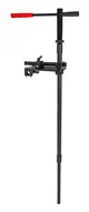
Sturdy transducer mount for live sonar use
- Sturdy and lightweight aluminum construction
- Versatile adjustment and mounting options
- Sturdy 10mm thick aluminum mounting table with adjustment grooves
- In the lower position, the sensor tube locks into the supported slot and always remains in the correct position.
- In the upper position, the sensor tube locks securely horizontally against the mounting table.
- Quick-release locking crank for quick and easy operation
- Possible to install on a railing, platform or rail (rail bracket optional)
- Includes mounting hardware for railing installation (25mm / 1? tube)
- Removable pointer handle
- The sensor tube is removable, leaving only the mounting table on the boat
- Sensor tube can be rotated to the inside of the boat's side, for example when trailering
- Infinitely adjustable height
- Infinitely adjustable rotational resistance
- Total length of sensor tube 150cm
- Sensor tube designed to be shortened to a suitable length for each boat
- Sensor tube diameter 25mm / 1?
- Inner tube construction allows the cable to be attached to the outer tube
- Stainless steel bolts and fasteners
- Suitable for installation on almost all types of boats
- Designed for use with Lowrance Active Target, Garmin Panoptix Livescope and Humminbird Mega Live transducers, among others. The transducers are attached using the transducer's own mount.

Icom AIS transmitter and receiver with display. The MA-510TR from Icom is an AIS transmitter and receiver with a high-resolution 4.3-inch TFT display. The display is bright, so it is easy to see in direct sunlight, and it also has a night mode that does not interfere with your night vision. In addition to menus, the display also shows other vessels and warns of vessels on a collision course - these are marked in red. Familiar vessels can be marked and saved in yellow.
The device is naturally NMEA2000 compatible, which allows you to display AIS data on your plotter or connect a VHF radio. The device can also be integrated with an Icom VHF radio for individual DSC calls (e.g. IC-M605EURO, IC-M506GE, IC-M424GE, IC-M400BBE or IC-M330GE).
This AIS transponder improves your safety at sea. By transmitting and receiving information about your own position and that of other vessels, you can avoid collisions and get help more efficiently if an accident occurs. The device is equipped with dual channels that receive information from both Class A and Class B transmitters simultaneously.
The MA-510TR is compact yet has a large, clear display, making it easy to find a suitable mounting location. The buttons are large and backlit. The device also has an anchor watch function that alerts you if the boat starts to drift. An external GPS antenna is included.
Specifications
Warranty: 5 years
IPX7 rating
Voltage: 12V or 24V
- Transmitter and receiver on screen
- NMEA 2000
- Class B


