Product groups
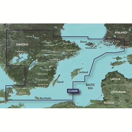
Garmin BlueChart g3 HD HXEU046R Southeast Sweden map card
-8%
-8%
-8%
-8%
-8%
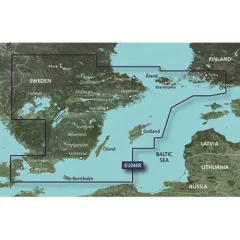
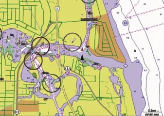
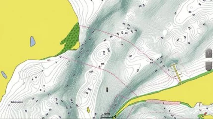
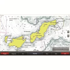
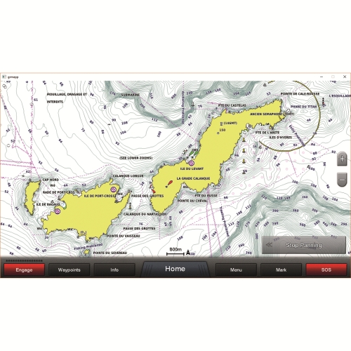
The industry's most comprehensive, clear and detailed new maps, integrating both Garmin and Navionics® content.
The industry's most comprehensive, clear and detailed new maps, integrating both Garmin and Navionics® content.
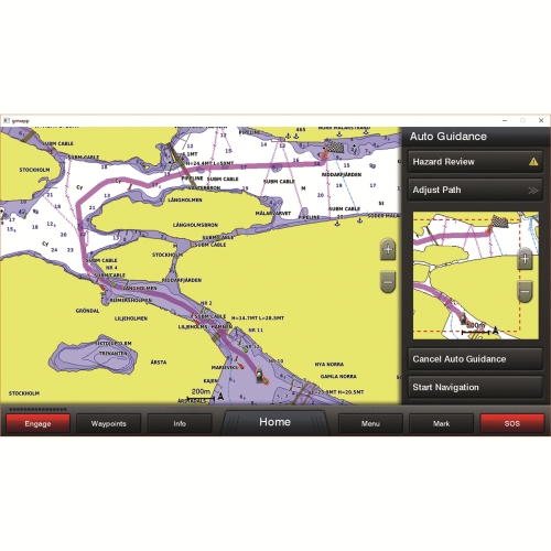
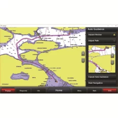
Automatic guidance quickly calculates a route suggestion based on the desired depth and underpass height.
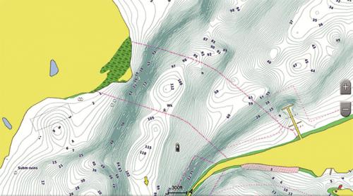
See target depth at a glance with up to 10 depth zones of shading. Fishing charts are detailed, showing bottom contours down to 1 foot (30 cm). Shallow Water Shading lets you set the depth of shading to avoid shallow water. Get comprehensive information and precise detail when you’re on the water. BlueChart® g3 charts are the most comprehensive, clearest, and most detailed in the industry.
Automatic guidance
When you select a destination while boating or fishing, you will see a ready route and nearby obstacles at a safe depth.
Depth of field shading
You can see the target depth up to 10 depth ranges thanks to the accurate shading function.
Shallow water shading
This function allows the user to define the depth of shading and thus avoid shallow water areas.
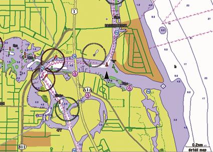
Detailed surface features
BlueChart g3 charts show bottom contours down to 30 cm (1 ft) so you can see fishing charts, marshes, canals and marinas in even greater detail
• Realistic navigation features show everything from shaded depths and coastlines to depth soundings, nautical marks, port information, wrecks, obstacles, tidal zones, prohibited areas, IALA symbols, etc.
• Smooth screen operation and seamless switching between zoom levels, as well as better continuity between map borders.
• Safety shading allows the user to enable terrain shading for all depths that are shallower than a user-defined safe depth.
• Fishing charts help you explore bottom shapes and take depth soundings without cluttering the screen with unnecessary information.
• You can choose between a standard two-dimensional map view, viewed from directly above, or a three-dimensional map view, oriented in the direction of travel, to make it easier to read and navigate the map.
• Compatible with HomePort™ software. The software allows you to access BlueChart data to conveniently plan and organize routes on your computer before your trip
Comes with microSD memory card (SD adapter included)
Features:
• Realistic navigation features show everything from shaded depths and coastlines to depth soundings, nautical marks, port information, wrecks, obstacles, tidal zones, prohibited areas, IALA symbols, etc.
• Smooth screen operation and seamless switching between zoom levels, as well as better continuity between map borders.
• Safety shading allows the user to enable terrain shading for all depths that are shallower than a user-defined safe depth.
• Fishing charts help you explore bottom shapes and take depth soundings without cluttering the screen with unnecessary information.
• You can choose between a standard two-dimensional map view, viewed from directly above, or a three-dimensional map view, oriented in the direction of travel, to make it easier to read and navigate the map.
• Compatible with HomePort™ software. The software allows you to access BlueChart data to conveniently plan and organize routes on your computer before your trip
Automatic guidance quickly calculates a route suggestion based on the desired depth and underpass height.
See target depth at a glance with up to 10 depth zones of shading. Fishing charts are detailed, showing bottom contours down to 1 foot (30 cm). Shallow Water Shading lets you set the depth of shading to avoid shallow water. Get comprehensive information and precise detail when you’re on the water. BlueChart® g3 charts are the most comprehensive, clearest, and most detailed in the industry.
Automatic guidance
When you select a destination while boating or fishing, you will see a ready route and nearby obstacles at a safe depth.
Depth of field shading
You can see the target depth up to 10 depth ranges thanks to the accurate shading function.
Shallow water shading
This function allows the user to define the depth of shading and thus avoid shallow water areas.
Detailed surface features
BlueChart g3 charts show bottom contours down to 30 cm (1 ft) so you can see fishing charts, marshes, canals and marinas in even greater detail
• Realistic navigation features show everything from shaded depths and coastlines to depth soundings, nautical marks, port information, wrecks, obstacles, tidal zones, prohibited areas, IALA symbols, etc.
• Smooth screen operation and seamless switching between zoom levels, as well as better continuity between map borders.
• Safety shading allows the user to enable terrain shading for all depths that are shallower than a user-defined safe depth.
• Fishing charts help you explore bottom shapes and take depth soundings without cluttering the screen with unnecessary information.
• You can choose between a standard two-dimensional map view, viewed from directly above, or a three-dimensional map view, oriented in the direction of travel, to make it easier to read and navigate the map.
• Compatible with HomePort™ software. The software allows you to access BlueChart data to conveniently plan and organize routes on your computer before your trip
Comes with microSD memory card (SD adapter included)
Features:
• Realistic navigation features show everything from shaded depths and coastlines to depth soundings, nautical marks, port information, wrecks, obstacles, tidal zones, prohibited areas, IALA symbols, etc.
• Smooth screen operation and seamless switching between zoom levels, as well as better continuity between map borders.
• Safety shading allows the user to enable terrain shading for all depths that are shallower than a user-defined safe depth.
• Fishing charts help you explore bottom shapes and take depth soundings without cluttering the screen with unnecessary information.
• You can choose between a standard two-dimensional map view, viewed from directly above, or a three-dimensional map view, oriented in the direction of travel, to make it easier to read and navigate the map.
• Compatible with HomePort™ software. The software allows you to access BlueChart data to conveniently plan and organize routes on your computer before your trip
Prodnr: 14486
Manufacturer prodnr: 010-C0782-20
Campaign price
159,00 €172,10 €/ kpl
Total incl. VAT 25.5%
Helsinki LauttasaariAvailablelocation in store: Myymälä / varasto
Vantaa PorttipuistoAvailable
WebshopAvailableDelivery 1 - 3 working days
The industry's most comprehensive, clear and detailed new maps, integrating both Garmin and Navionics® content.
The industry's most comprehensive, clear and detailed new maps, integrating both Garmin and Navionics® content.
Automatic guidance quickly calculates a route suggestion based on the desired depth and underpass height.
See target depth at a glance with up to 10 depth zones of shading. Fishing charts are detailed, showing bottom contours down to 1 foot (30 cm). Shallow Water Shading lets you set the depth of shading to avoid shallow water. Get comprehensive information and precise detail when you’re on the water. BlueChart® g3 charts are the most comprehensive, clearest, and most detailed in the industry.
Automatic guidance
When you select a destination while boating or fishing, you will see a ready route and nearby obstacles at a safe depth.
Depth of field shading
You can see the target depth up to 10 depth ranges thanks to the accurate shading function.
Shallow water shading
This function allows the user to define the depth of shading and thus avoid shallow water areas.
Detailed surface features
BlueChart g3 charts show bottom contours down to 30 cm (1 ft) so you can see fishing charts, marshes, canals and marinas in even greater detail
• Realistic navigation features show everything from shaded depths and coastlines to depth soundings, nautical marks, port information, wrecks, obstacles, tidal zones, prohibited areas, IALA symbols, etc.
• Smooth screen operation and seamless switching between zoom levels, as well as better continuity between map borders.
• Safety shading allows the user to enable terrain shading for all depths that are shallower than a user-defined safe depth.
• Fishing charts help you explore bottom shapes and take depth soundings without cluttering the screen with unnecessary information.
• You can choose between a standard two-dimensional map view, viewed from directly above, or a three-dimensional map view, oriented in the direction of travel, to make it easier to read and navigate the map.
• Compatible with HomePort™ software. The software allows you to access BlueChart data to conveniently plan and organize routes on your computer before your trip
Comes with microSD memory card (SD adapter included)
Features:
• Realistic navigation features show everything from shaded depths and coastlines to depth soundings, nautical marks, port information, wrecks, obstacles, tidal zones, prohibited areas, IALA symbols, etc.
• Smooth screen operation and seamless switching between zoom levels, as well as better continuity between map borders.
• Safety shading allows the user to enable terrain shading for all depths that are shallower than a user-defined safe depth.
• Fishing charts help you explore bottom shapes and take depth soundings without cluttering the screen with unnecessary information.
• You can choose between a standard two-dimensional map view, viewed from directly above, or a three-dimensional map view, oriented in the direction of travel, to make it easier to read and navigate the map.
• Compatible with HomePort™ software. The software allows you to access BlueChart data to conveniently plan and organize routes on your computer before your trip
Automatic guidance quickly calculates a route suggestion based on the desired depth and underpass height.
See target depth at a glance with up to 10 depth zones of shading. Fishing charts are detailed, showing bottom contours down to 1 foot (30 cm). Shallow Water Shading lets you set the depth of shading to avoid shallow water. Get comprehensive information and precise detail when you’re on the water. BlueChart® g3 charts are the most comprehensive, clearest, and most detailed in the industry.
Automatic guidance
When you select a destination while boating or fishing, you will see a ready route and nearby obstacles at a safe depth.
Depth of field shading
You can see the target depth up to 10 depth ranges thanks to the accurate shading function.
Shallow water shading
This function allows the user to define the depth of shading and thus avoid shallow water areas.
Detailed surface features
BlueChart g3 charts show bottom contours down to 30 cm (1 ft) so you can see fishing charts, marshes, canals and marinas in even greater detail
• Realistic navigation features show everything from shaded depths and coastlines to depth soundings, nautical marks, port information, wrecks, obstacles, tidal zones, prohibited areas, IALA symbols, etc.
• Smooth screen operation and seamless switching between zoom levels, as well as better continuity between map borders.
• Safety shading allows the user to enable terrain shading for all depths that are shallower than a user-defined safe depth.
• Fishing charts help you explore bottom shapes and take depth soundings without cluttering the screen with unnecessary information.
• You can choose between a standard two-dimensional map view, viewed from directly above, or a three-dimensional map view, oriented in the direction of travel, to make it easier to read and navigate the map.
• Compatible with HomePort™ software. The software allows you to access BlueChart data to conveniently plan and organize routes on your computer before your trip
Comes with microSD memory card (SD adapter included)
Features:
• Realistic navigation features show everything from shaded depths and coastlines to depth soundings, nautical marks, port information, wrecks, obstacles, tidal zones, prohibited areas, IALA symbols, etc.
• Smooth screen operation and seamless switching between zoom levels, as well as better continuity between map borders.
• Safety shading allows the user to enable terrain shading for all depths that are shallower than a user-defined safe depth.
• Fishing charts help you explore bottom shapes and take depth soundings without cluttering the screen with unnecessary information.
• You can choose between a standard two-dimensional map view, viewed from directly above, or a three-dimensional map view, oriented in the direction of travel, to make it easier to read and navigate the map.
• Compatible with HomePort™ software. The software allows you to access BlueChart data to conveniently plan and organize routes on your computer before your trip
Prodnr: 14486
Manufacturer prodnr: 010-C0782-20
See other products of the brand

Recommended for you
CONTACT INFORMATION
Our customer service is available on weekdays 9-17.
email: asiakaspalvelu@marinekauppa.com
STORES
HELSINKI
Veneentekijäntie 3
00210 Helsinki (Lauttasaari)
FINLAND
mon–fri 9–18
sat 9-15
sun closed
VANTAA
Porttisuontie 13
00120 Vantaa (Porttipuisto)
FINLAND
mon–fri 10-18
sat 10-15
sun closed
Veneentekijäntie 3
00210 Helsinki (Lauttasaari)
FINLAND
mon–fri 9–18
sat 9-15
sun closed
VANTAA
Porttisuontie 13
00120 Vantaa (Porttipuisto)
FINLAND
mon–fri 10-18
sat 10-15
sun closed
COMPANY INFORMATION
Marinekauppa.com / Norcap Oy Ab
Company ID 1827467-5
Founded in 2003
Company ID 1827467-5
Founded in 2003
Payment methods


