Simrad
Simrad -ryhmän tuotteet
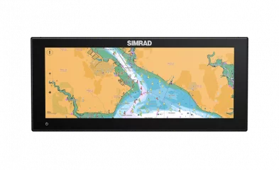
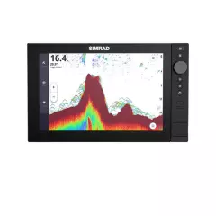
Simrad NSX ULTRAWIDE – A new era of multifunction display
The new ultra-wide display design, combined with ultra-high pixel density, delivers a seamless and immersive user experience. It brings together the same amount of information that would traditionally be split across two screens, but does so in a more efficient and visually pleasing way. Whether it’s viewing a map, using multiple apps at once, or viewing information, NSX ULTRAWIDE delivers a unique user experience without the usual interference between screens.
Simrad NSX ULTRAWIDE - Features
All the benefits of multiple displays without the hassle of installation: NSX ULTRAWIDE combines the functionality of two displays into one stylish ultrawide display, eliminating the need for multiple installations.
Fewer cables, one hole, less installation hassle: Forget about complicated cabling and time-consuming installation. One hole and fewer cables make installation faster and simpler.
Seamless user experience: Thanks to the new ultrawide display aspect ratio and high pixel density, all information from two screens fits together, providing a complete and seamless user experience.
A panoramic display that enhances your boat's aesthetics: The elegant design of the NSX ULTRAWIDE perfectly matches the appearance of your boat, allowing you to create a clean, low-profile dashboard that evokes the style of luxury cars.
Easily Consumable Information: A larger display space provides more information presented in a more digestible format. The ultra-wide layout allows for a clear and detailed view of maps, apps and navigation tools.
More screen, less space: A larger display area and fewer devices mean a more streamlined and spacious dashboard without sacrificing functionality.
Simplified installation: One display instead of two makes the installation process faster and easier. Fewer parts and less effort.
Unique display format – new to the marine industry: This high-tech display format is the first of its kind in the marine industry, offering a completely new and efficient way to view and use boat data.
Better visibility: A larger display improves visibility from different angles, ensuring that all important information is easily readable even in challenging lighting conditions.
Enables automotive-style dashboards: The sleek and modern design of the NSX ULTRAWIDE enables high-end, luxury automotive-style dashboard design for your boat – combining functionality and style.
Connections and Features:
Sonar:
- One 9-pin Xsonic 1 kW sonar connector
- Single channel CHIRP (50/200 kHz), SideScan & DownScan up to 800 kHz
- Network probe compatible with other NSX devices
- Ethernet: 1 port (5-pin connector)
Radar compatibility:
- Halo Dome Radars
- Halo open radars
- 3G/4G, HD radars
- USB: 1 port (USB A)
- Output: 5V DC, 1.5A
- External storage: 1 MicroSD card slot, 1 port (USB A)
- NMEA 2000: 1 x NMEA 2000 Micro-C port, 1 LEN
In the package
- NSX 3012 sun visor
- Recessed mounting kit
- 4-pin power cable
- Fuse set
- Screen size: 12"
- Touchscreen
- Sonar must be purchased separately
- Resolution: 1920 x 720 px
- Screen type: SolarMax IPS Ultrawide
- A touchscreen that offers wide viewing angles, excellent brightness, and excellent sunlight visibility even with polarized sunglasses.
- Viewing angles: 85° (top, bottom, left and right)
- Screen brightness: 1000 nits
- Backlight: White
- Voltage: 12 V DC (min. 10 V - max. 17 V DC)
- Maximum consumption: 19.8 W (1434 mA @ 13.8 V)
- Protections: Reverse polarity and overvoltage protection (max. 18 V)
- Recommended fuse: 3A
- Dimensions (W x H x D):
- Without stands and sunshade: W: 337.0 mm x H: 147.9 mm x D: 88.5 mm
- With Gimbal Mount: H: 157.9 mm x D: 96.5 mm
- Weight: 1.5 kg
- Installation type:
- Flush mount (bracket included)
- Rack mount (rack sold separately)
- Compass safe distance: 50 cm
- Operating temperature range: -15°C - 55°C
- Storage temperature range: -20°C - 60°C
- Waterproof rating: IPx6 and IPx7
Compatible charts: CMAP Discover X, CMAP Reveal X, Navionics

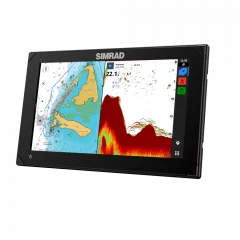
Simrad NSX 3009 9" offers powerboaters the latest in chartplotter and sonar technology
This is based on an all-new operating system designed to redefine the boating experience. Simple setup wizards guide the user through every step of the device setup process, and Simrad® app integration makes smartphone connection easy.
Features
- Compatible charts: C-MAP® Discover X or Reveal X.
- Compatible transducers: 1 x port 9 pin for Xsonic 1 kW transducer. Single channel CHIRP, 50/200 khz, HDI, Active Imaging
- Compatible radars: HALO
- AIS data available via NMEA2000 network
- Autopilots: full control for NAC-1, NAC-2, NAC-3 and NAC-D autopilots
- Audio devices: SonicHub®2, FusionLink, JL Audio, NMEA 2000® compatible audio players
- Ethernet: 1 port (5-pin connector)
- NMEA2000: 1 x NMEA 2000® Micro-C port, 1 LEN
- NMEA0183: No
- Camera input: IP Camera, RSTP, ONVIF, IP CAM-1
- Built-in WiFi
- Built-in Bluetooth 4, support for Bluetooth classic (full support coming with update)
- Built-in 10Hz GPS antenna
Smart chartplotter and sonar take your experience to the next level
With an innovative modern interface, powerful navigation features and C-MAP® support, you can see everything better. NSX features integrated sonar and full support for radar and autopilot systems. Our setup wizard makes getting started a breeze. All you have to do is choose the direction of your next adventure.
New, intuitive touchscreen experience
NSX offers a clear and easy-to-use interface, along with high-resolution imaging capabilities that together elevate the user experience to a whole new level. All NSX functions are easily accessible, and the display can be easily customized with drag and drop. The gauge bar is also fully customizable, and day and night modes have been improved. The bright SolarMAXTM IPS touchscreen provides crystal-clear images of maps, structures and bottom shapes. The display can be viewed from any angle, even in direct sunlight and with polarized glasses.
Powerful C-MAP® navigation features
See map data in a new way. Optimized for marine use, C-MAP® DISCOVERTM X and REVEALTM X charts offer an intuitive layout and the latest updates. C-MAP® charts feature full-featured vector maps, custom depth shading, and high-resolution depth contours with one-foot accuracy.
Our fastest ever automatic routing and tide and current projections improve your preparation and route planning, while the map also features an information feature that gives you information on locations, points of interest, tides, and more with just one tap.
Full radar, sonar and autopilot capabilities
Identify hazards with HALO® pulse compression sonar, stay on course with Autopilot systems, and experience a range of integrated sonar. Get high-resolution images of below and to the sides of your boat with Active ImagingTM and CHIRP sonar, SideScan/DownScan ImagingTM, and FishRevealTM. Even search deeper with a wide range of compatible 1kW transducers.
- Award-winning HALO® pulse compression radars: Identify hazards instantly and see near and far at the same time.
- Fast updates every second: Use custom modes like harbor, offshore, and weather modes to highlight targets in specific environments.
- Stay on course: Navigate to waypoints and follow routes effortlessly
- CHRIP sonar, SideScan/DownScan Imaging and FIshReveal
Setup wizard
The integrated Simrad® app and other handy features help you get going in no time. A step-by-step setup wizard helps you get set up quickly, while the Simrad® app offers a wealth of other features, including easy software updates, on- and off-shore trip planning, a common chart view across all platforms, and easy data transfer, including routes and waypoints.
Convenient features of NSX
- Switch between apps quickly and easily with the touch of a button. Accessed via the always-on activity bar – no need to return to the home screen.
- Change map settings in the blink of an eye, map settings (including advanced settings) can be accessed with a single button directly from the map screen.
- Full screen mode, switch to full screen mode from any split screen with a single tap.
- Map information feature: Select a location on the map, such as a marina or marker buoy, to get additional information about it, such as a detailed description, opening hours, services, etc.
- The Map Orientation button allows you to instantly change the orientation mode: North Up, Heading Up, or Course Up.
- The Waypoints & Routes app lets you manage your waypoints and routes. Sort by location, filter in different ways (e.g. most recent, alphabetical, etc.), and export single or multiple waypoints.
- Screen size: 9"
- Touchscreen
- Sonar readiness
- Waterproof: IPX6 and IPX7
- SolarMax IPS touchscreen
- Size (flush mount): 239 x 148.5 x 80.6 mm (WxHxD)
- Size (with mounting foot): 263 x 172.6 x 80.6mm (WxHxD)
- Weight: 1.2kg
- Resolution: 1280 x 720 px
- Screen brightness: 1200 nits
- Screen viewing angle: 80 degrees from both directions
- Power consumption (max): 18.8 W
- USB: 1 port (USB A) Output: 5 V DC, 1.5 A
- Operating temperature: -15 to +55 degrees
- Built-in 10Hz GPS antenna
- GPS receiver: 48-channel
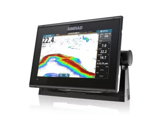
Simrad GO 9 XSE is a compact 9" touchscreen chartplotter
Compatible maps
Specifications
- Display type WVGA Color TFT LCD
- Screen size 9" widescreen
- Backlight LED / 1200 nits
- Resolution 800 x 480
- 10 Hz internal GPS
- NMEA 2000 - 1 port
- Ethernet - 1 port (For radar antenna only)
- Operating temperature -15 °C to +55 °C
- Waterproof IPx7
- Operating voltage 10-17 V DC
- Power consumption approx. 950mA5
- Weight 1.32 kg
- Device dimensions W 243 x H 171 x D 83 mm
- A feature-rich chartplotter that supports a wide range of charts
- Simple waypoint management
- 9-inch display that can be mounted directly or via a stand
- Bright LED backlight for daytime use
Product package contents
- Go9 XSE
- Power cord 2 m
- Monitor mounting bracket + thumb screws
- Recessed mounting kit
- Sunscreen
- Screen size: 9"
- Touchscreen
- Sonar must be purchased separately
- Broadband and HALO radar compatible
- StructureScan and ForwardScan compatible
- Easy-to-use, multi-functional touchscreen interface
- Fast 10 Hz GPS receiver
- Speedboating/cruising navigation page
- Broadband sonar and CHIRP
- DownScan Imaging™
- Built-in Wi-Fi
- GoFree™ cloud service enabled
- NMEA 2000® compatible
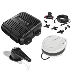
Simrad NAC-3 series autopilot for boats over 10 meters
The NAC-3 autopilot computer is the brain of the Simrad autopilot system. It contains the electronics required to operate a hydraulic steering pump or mechanical steering, as well as an interface to other components such as steering sensors and rudder angle sensors. The NAC-3 is designed for vessels of 10 meters (35 feet) or longer and can operate high-current pumps, mechanical steering and solenoid valves (30 amps continuous and 50 amps peak).
Main features
- Reliable autopilot based on Simrad Continuum steering technology
- Recommended for boats over 10 meters (35 feet) in length
- Continuous power 30 amps and peak power 50 amps
- Switch output (up to 3 amps)
- Compatible with high-flow work pumps, mechanical actuators, hydraulic linear actuators and solenoid valves
- Virtual rudder angle sensor makes installation easier on boats with outboard motors (outboard or sterndrive)
- Supports Simrad RF25 and RF300 rudder angle sensors
- NMEA 2000® connectivity for heading sensors, rudder angle sensors, separate autopilot control panels and multifunction displays
- NMEA 0183® input
Simrad Continuum steering technology
Every Simrad steering innovation is based on over sixty years of experience in autopilot development. This development continues at Simrad Yachting’s autopilot research center in Norway. The result of this development is, for example, the Continuum algorithm, which is the software that drives Simrad steering technology. Continuum brings years of research and experience on the water to the helm. It is an intelligent pilot you can trust to steer.Good power
The NAC-3 autopilot computer is recommended for boats over 10 meters (35 feet) in length. It has a continuous output of up to 30 amps and a peak output of 50 amps. It also has a switch output. It is suitable for controlling high-current duty pumps such as the Simrad RPU160 and RPU300, mechanical drives such as the Simrad DD15, hydraulic linear duty units such as the HLD2000 series, and solenoid valves.Virtual Rudder Feedback
Simrad Virtual Rudder Feedback technology eliminates the need for a separate rudder feedback sensor on boats equipped with outboard engines (outboard or sterndrive). This reduces the overall cost and simplifies the autopilot system. It is ideal for applications where a rudder feedback sensor cannot be used due to mechanical limitations.Rudder angle sensors
Rudder angle sensors are mechanically attached to the rudder and continuously report the rudder position to the autopilot computer. This allows the Simrad Continuum steering algorithm to make the best possible steering decisions. These sensors are typically used on sterndrive boats, larger vessels and in special applications where a virtual rudder angle sensor cannot be used. The NAC-3 supports SimNet or NMEA 2000® connected Simrad RF25 angle sensors and rudder angle sensors with variable frequency power, such as the Simrad RF300.Easy to install
Industry-standard NMEA 2000® connectivity and NMEA 0183® input allow for easy connection of steering sensors, rudder angle sensors, autopilot control panels and multifunction displays anywhere on your boat.Precision 9 compass
The Precision-9 compass provides accurate heading and rate of turn information to Simrad autopilot, radar and navigation systems via NMEA 2000® connectivity. Internal solid-state sensors continuously measure motion and heading in nine axes. This allows the Precision-9 to provide roll, pitch and roll information to a compatible device. The easily adjustable mount and single-cable connection make installation simple on any boat, including mast mounting on suitable steel-hulled boats.Main features
- Heading, rate of turn (ROT), roll, pitch and roll displacement via NMEA 2000® network
- Accurate and reliable semiconductor sensor technology
- Steering direction accuracy ±2° after calibration
- Easily adjustable bracket can be mounted on bulkhead or mast
- IPX7 waterproof for external mast mounting on steel-hulled vessels
- Easy installation – single NMEA 2000® connection
- One compact sensor measures steering direction, yaw rate, roll, pitch and yaw, and horizontal displacement
- Reliable solid-state sensor technology – no moving parts
- Easy and affordable installation
- Suitable for most hull types, including mast mounting on steel-hulled vessels
NMEA 2000® – heading and rate of turn information
The Simrad Precision-9 compass uses a NMEA 2000® network to provide heading, rate of turn (ROT), roll, pitch and roll, and horizontal displacement to connected devices including autopilots, radar, sonar, multifunction displays, and other navigation systems.Semiconductor sensor technology
The Precision-9 compass uses an advanced solid-state sensor system based on MEMS technology. This highly accurate system measures motion in nine axes: heading, masthead, trim, roll, pitch, roll, heave, roll, and horizontal displacement. The information from these nine axes is used to calculate the most accurate heading and rate of turn possible, while avoiding the limitations of conventional magnetic gyro compasses and instead providing a heading accurate to ±2 degrees after calibration.Attaches to almost anything
The easily adjustable mount allows the Precision-9 compass to be mounted on any boat, in almost any location. The compass can also be mounted directly on any flat surface. In addition, the compass is IPX7 waterproof, allowing it to be mounted externally on the mast of steel-hulled boats, avoiding magnetic interference. Installation is also made easier with NMEA 2000® connectivity – a single cable for both power and data.- Includes rudder angle sensor
- Recommended for boats over 10m (35')
- Package contents:
- NAC-3 Autopilot Computer
- Precision-9 compass
- Micro-C Backbone Kit
- RF25N, rudder position sensor, 5 m, Micro-C
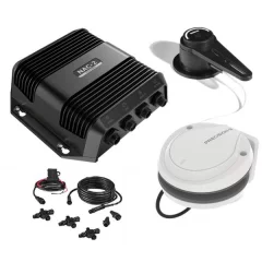
Main features
- Reliable autopilot based on Simrad Continuum steering technology
- Recommended for boats up to 10 meters (35 feet) in length
- Continuous power 8 amps, peak power 16 amps
- Switch output (up to 3 amps)
- Compatible with low-flow duty pumps, mechanical actuators, hydraulic linear actuators and solenoid valves
- Virtual rudder angle sensor makes installation easier on boats with outboard motors (outboard or sterndrive)
- Supports Simrad RF25 rudder angle sensors
- Plug and play connectors make installation easy
- NMEA 2000® connectivity for heading sensors, rudder angle sensors, separate autopilot control panels and multifunction displays
Simrad Continuum steering technology
Every Simrad steering innovation is based on over sixty years of experience in autopilot development. This development continues at Simrad Yachting’s autopilot research center in Norway. The result of this development is, for example, the Continuum algorithm, which is the software that drives Simrad steering technology. Continuum brings years of research and experience on the water to the helm. It is an intelligent pilot you can trust to steer.
Standard power
The NAC-2 autopilot computer is recommended for boats up to 10 meters (35 feet) in length. It has a continuous output of up to 8 amps and a peak output of 16 amps. It also has a switch output. It is suitable for controlling low-current duty pumps such as the Simrad RPU80, mechanical drives such as the Simrad SD10, hydraulic linear duty units such as the HLD350 series, and solenoid valves.
Virtual Rudder Feedback
Simrad Virtual Rudder Feedback technology eliminates the need for a separate rudder feedback sensor on boats equipped with outboard engines (outboard or sterndrive). This reduces the overall cost and simplifies the autopilot system. It is ideal for applications where a rudder feedback sensor cannot be used due to mechanical limitations.
Rudder angle sensors
Rudder angle sensors are mechanically attached to the rudder and continuously report the rudder position to the autopilot computer. This allows the Simrad Continuum steering algorithm to make the best possible steering decisions. These sensors are typically used on sterndrive boats, larger vessels, and in special applications where a virtual rudder angle sensor cannot be used. The NAC-2 supports SimNet or NMEA 2000® connected Simrad RF25 angle sensors and resistive rudder angle sensors.
Easy to install
Plug and play connectors simplify installation and minimize the wiring required for an autopilot system installation. Industry-standard NMEA 2000® connectivity allows easy connection of steering sensors, rudder angle sensors, autopilot control panels and multifunction displays to any location on the boat.
Main features
- Heading, rate of turn (ROT), roll, pitch and roll displacement via NMEA 2000® network
- Accurate and reliable semiconductor sensor technology
- Steering direction accuracy ±2° after calibration
- Easily adjustable bracket can be mounted on bulkhead or mast
- IPX7 waterproof for external mast mounting on steel-hulled vessels
- Easy installation – single NMEA 2000® connection
- One compact sensor measures steering direction, yaw rate, roll, pitch and yaw, and horizontal displacement
- Reliable solid-state sensor technology – no moving parts
- Easy and affordable installation
- Suitable for most hull types, including mast mounting on steel-hulled vessels
The Simrad Precision-9 compass uses a NMEA 2000® network to provide heading, rate of turn (ROT), roll, pitch and roll, and horizontal displacement to connected devices including autopilots, radar, sonar, multifunction displays, and other navigation systems.
Semiconductor sensor technology
The Precision-9 compass uses an advanced solid-state sensor system based on MEMS technology. This highly accurate system measures motion in nine axes: heading, masthead, trim, roll, pitch, roll, heave, roll, and horizontal displacement. The information from these nine axes is used to calculate the most accurate heading and rate of turn possible, while avoiding the limitations of conventional magnetic gyro compasses and instead providing a heading accurate to ±2 degrees after calibration.
Attaches to almost anything
The easily adjustable mount allows the Precision-9 compass to be mounted on any boat, in almost any location. The compass can also be mounted directly on any flat surface. In addition, the compass is IPX7 waterproof, allowing it to be mounted externally on the mast of steel-hulled boats, avoiding magnetic interference. Installation is also made easier with NMEA 2000® connectivity – a single cable for both power and data.
- Includes rudder angle sensor
- Recommended for boats up to 10m (35')
- Package contents:
- NAC-2 Autopilot Computer
- Precision-9 compass
- Micro-C Backbone Kit
- RF25N, rudder position sensor, 5 m, Micro-C
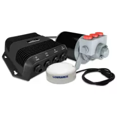
- Control your outboard by heading, waypoint, route, or cursor from the multifunction display.
- The Lowrance SmartSteer™ interface allows you to hydraulically steer your outboard motor and electrically steer your MotorGuide Xi5 Pinpoint trolling motor.
- One-touch route creation from saved tracks.
- Repeat the route with automatic turn patterns.
- Recommended for single outboard boats up to 30 feet long.
- VRF (Virtual Rudder Feedback) makes installation easier – no separate rudder feedback is required.
- Easy installation – straightforward instructions guide you through the first installation.
- Simple plug and socket connection, no complicated wiring
- Backed by Lowrance Advantage Service Program
- Can be used with Lowrance Elite FS, HDS Gen2 /Gen3/Carbon/Live series devices
- Can be used with Simrad NSS evo2/evo3/evo3s, Go series devices

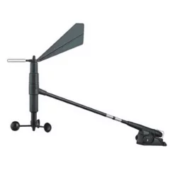
NMEA2000 compatible wind sensor. Does not include mast cable.
Compatible devices:
- For B&G Triton 2, Triton T41, IS42 and IS20 systems.
- Manufacturer's product code: 000-13714-001
- Does not include mast cable
- 20m Mast cable is 000-10757-001
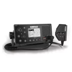
Travel safer on the water with a VHF marine radio
Class B AIS transceiver with built-in GPS. The integrated Class B AIS transceiver lets you see nearby AIS vessels and they can see yours. You can add up to two optional handsets to the system, allowing you to communicate from anywhere on the vessel.
See and be seen with integrated AIS
The RS40-B includes a Class B AIS transceiver that both receives AIS targets and communicates your vessel’s position to nearby AIS vessels. This allows other mariners to spot your vessel regardless of the conditions, day or night. The built-in AIS receiver monitors the position of nearby AIS vessels, helping to avoid collisions in busy ports and heavily trafficked waterways. AIS data can be viewed on the radio display, on the chart or on the radar screen via the multifunction display.
Detachable handheld microphone
The RS40-B radio's detachable handheld microphone can be connected to the front or rear of the radio. With the optional extension cable, the microphone and radio can be mounted separately. This creates an easy and cost-effective solution for installation in any location without the hassle of cables. For example, the RS40-B can be mounted on the ceiling without hanging cables, while the microphone can be connected to an additional socket in the dashboard below.
Expandable with wireless handset sets
By connecting the optional HS40 handset to the system, you can use the radio anywhere on your boat. Each handset displays the radio’s display and controls, allowing you to access all key functions remotely. Up to two handsets can be connected to a single RS40-B radio. The radio also functions as an intercom for your vessel when multiple handsets are connected.
- Integrated Class B AIS transceiver
- Class D DSC-approved VHF radio
- Integrated GPS receiver
- Detachable handheld microphone supports front and rear connection
- Connect up to two wireless handsets
- Connect an optional hailer or external speaker
- NMEA 0183® and NMEA 2000® connectivity
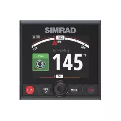
- Display 4.1"
- On-screen buttons and a rotating scroll wheel
- Low glass screen
- Low power consumption
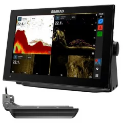
The Simrad NSX is a 12-inch touchscreen
NSX combines a clear and easy-to-use interface with high-resolution graphics to provide a completely new experience when boating. With a modern and easy-to-use interface, as well as powerful navigation functionality that supports next-generation C-MAP Discover X and Reveal X marine charts, you can see everything better and clearer than ever before. NSX has an integrated 1 kW sonar and full compatibility with Simrad radar and autopilots.
Simrad NSX delivers crystal-clear images of marine chart detail, structure and bottom features on a versatile SolarMAX IPS touchscreen display that is viewable from all angles, in direct sunlight and even through polarized sunglasses.
- Simrad's easy-to-use and practical installation guide will get you up and running quickly.
- New and intuitive touchscreen experience
- Powerful C-MAP navigation function
- Simrad's fastest Autorouting ever
- Fully equipped display for sonar, radar and autopilot
- Seamless integration with Simrad app
- Easy-to-use installation guide
- Android-based operating system
Simrad NSX is fully compatible with C-MAP DISCOVER X and C-MAP REVEAL X marine charts, offering a fresh, intuitive map display and the latest updates. C-MAP charts include full vector maps with custom depth tones and detailed depth information showing precise contours with up to a foot of accuracy. Improved planning and route planning with tide and current predictions and Simrad's fastest Autorouting ever. Autorouting calculates the best route to reach your destination. Warning areas on the route are color-coded. It can also be used for planning - the entire route or individual stages.
The NSX also features a new map exploration feature that gives you access to information about locations, points of interest, tides, channels and more at the touch of a button. Innovative display sizes provide more display for the overall size of the product and more flexibility in instrument panel arrangement. Multiple display configurations in a smaller space or larger displays in an existing one.
With the easy-to-install and seamlessly integrated Simrad app, you’ll be up and running in no time. NSX’s built-in setup guide takes you step-by-step to get you up and running quickly and easily, while the Simrad app offers a host of additional features. These include hassle-free software updates, route planning for both at sea and on land, a clean and fluid chart view that looks the same across all platforms, and easy transfer of all your marine data, including routes and waypoints.
The Simrad NSX has a 1kW built-in sonar for even better target resolution. Complete your NSX with radar and autopilot. Simrads HALO radar experiences with pulse compression for the best situational awareness. Navigate safely in poor visibility, track upcoming weather events and locate flocks of birds. The NSX acts as an autopilot controller when connected to a Simrad autopilot system.
Comes with Simrad Active Imaging transducer. See structures and protection in a new level of detail thanks to Simrad Active Imaging, featuring CHIRP sonar, SideScan and DownScan Imaging™, and Active Imaging 2-in-1 sonar with SideScan and DownScan.
- Screen size: 12'
- Touchscreen
- Includes Active Imaging transducer
- AI transducer included in the package
- Autorouting function
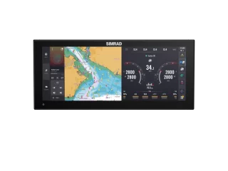
Simrad NSX ULTRAWIDE – A new era of multifunction display
The new ultra-wide display design, combined with ultra-high pixel density, delivers a seamless and immersive user experience. It brings together the same amount of information that would traditionally be split across two screens, but does so in a more efficient and visually pleasing way. Whether it’s viewing a map, using multiple apps at once, or viewing information, NSX ULTRAWIDE delivers a unique user experience without the usual interference between screens.
Simrad NSX ULTRAWIDE - Features
All the benefits of multiple displays without the hassle of installation: NSX ULTRAWIDE combines the functionality of two displays into one stylish ultrawide display, eliminating the need for multiple installations.
Fewer cables, one hole, less installation hassle: Forget about complicated cabling and time-consuming installation. One hole and fewer cables make installation faster and simpler.
Seamless user experience: Thanks to the new ultrawide display aspect ratio and high pixel density, all information from two screens fits together, providing a complete and seamless user experience.
A panoramic display that enhances your boat's aesthetics: The elegant design of the NSX ULTRAWIDE perfectly matches the appearance of your boat, allowing you to create a clean, low-profile dashboard that evokes the style of luxury cars.
Easily Consumable Information: A larger display space provides more information presented in a more digestible format. The ultra-wide layout allows for a clear and detailed view of maps, apps and navigation tools.
More screen, less space: A larger display area and fewer devices mean a more streamlined and spacious dashboard without sacrificing functionality.
Simplified installation: One display instead of two makes the installation process faster and easier. Fewer parts and less effort.
Unique display format – new to the marine industry: This high-tech display format is the first of its kind in the marine industry, offering a completely new and efficient way to view and use boat data.
Better visibility: A larger display improves visibility from different angles, ensuring that all important information is easily readable even in challenging lighting conditions.
Enables automotive-style dashboards: The sleek and modern design of the NSX ULTRAWIDE enables high-end, luxury automotive-style dashboard design for your boat – combining functionality and style.
Connections and Features
Sonar:
- One 9-pin Xsonic 1 kW sonar connector
- Single channel CHIRP (50/200 kHz), SideScan & DownScan up to 800 kHz
- Network probe compatible with other NSX devices
- Ethernet: 1 port (5-pin connector)
Radar compatibility:
- Halo Dome Radars
- Halo open radars
- 3G/4G, HD radars
- USB: 1 port (USB A)
- Output: 5V DC, 1.5A
- External storage: 1 MicroSD card slot, 1 port (USB A)
- NMEA 2000: 1 x NMEA 2000 Micro-C port, 1 LEN
In the package
- NSX 3015 sunshade
- Recessed mounting kit
- 4-pin power cable
- Fuse set
- Screen size: 15"
- Touchscreen
- Sonar must be purchased separately
- Resolution: 1920 x 720 px
- Screen type: SolarMax IPS Ultrawide
- A touchscreen that offers wide viewing angles, excellent brightness, and excellent sunlight visibility even with polarized sunglasses.
- Viewing angles: 85° (top, bottom, left and right)
- Display brightness: 1000 nits
- Backlight: White
- Voltage: 12 V DC (min. 10 V - max. 17 V DC)
- Maximum consumption: 25 W (1811 mA @ 13.8 V)
- Protections: Reverse polarity and overvoltage protection (max. 18 V)
- Recommended fuse: 3A
- Dimensions (W x H x D):
- Without stands and sunshade: W: 390.0 mm x H: 170.4 mm x D: 88.5 mm
- With Gimbal Mount: H: 180mm x D: 96.5mm
- Weight: 1.9 kg
- Installation type:
- Flush mount (bracket included)
- Rack mount (rack sold separately)
- Compass safe distance: 50 cm
- Operating temperature range: -15°C - 55°C
- Storage temperature range: -20°C - 60°C
- Waterproof rating: IPx6 and IPx7
Compatible charts: CMAP Discover X, CMAP Reveal X, Navionics
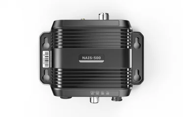
The latest generation fully integrated Class B AIS transponder. AIS is an essential navigation aid in today's busy shipping lanes and congested ports. Compact and lightweight, fully waterproof. Low power consumption and multiple connection ports. The NAIS-500 is compatible with all Navico Group (Simrad, Lowrance and B&G) AIS-enabled multifunction displays, as well as all other brands of AIS-enabled devices with NMEA 2000, NMEA 0183 or USB (computer) connectivity.
See ships moving around you
Helps you see and be seen at sea, a great help in today's congested ports and shipping lanes. AIS centrally monitors all vessels in sight and helps reduce the risk of collision by exchanging safety information between vessels.
As well as a variety of information about ships moving around
The NAIS-500 utilizes an advanced automatic digital time division transmission method, which enables the device to transmit and receive static information such as MMSI (Maritime Mobile Service Identifier), vessel name, call sign and vessel type. It can also transmit and receive dynamic information such as position, course and distance. The data is exchanged between vessels or between vessels and shore stations. When connected to a compatible chartplotter, the device displays the position and movements of all vessels within range and transmitting AIS data.
Versatile connections
The NAIS-500 is a Class-B AIS system that offers multiple connectivity options (NMEA 0183, NMEA 2000, USB and NMEA 0183 multiplexing). In addition to the versatile connectivity options, the NSPL-500 antenna splitter is available, which, when combined with the NAIS-500, allows the use of just one VHF antenna for VHF, AIS and FM radio receivers. This solution reduces the number of antennas and thus installation problems, as well as saving money.
Main features
- The enclosure protection class is IPX7.
- Class B AIS transceiver system with built-in 50-channel GPS receiver + external GPS-500 antenna
- NMEA-2000/SimNet/NMEA-0183 (high speed) compatible
- USB connection for computers
- AIS transceiver (AIS Class-B)
Specifications
- 38400 baud
- Power consumption 180 mAh 12 V
- Operating voltage 9.6 - 31.2 V DC
- Weight 250g
- IPX7 waterproof (30 min immersion at 1 m depth)
Product package contents
- NAIS-500 AIS module
- GPS-500 GPS antenna
- 1.8m NMEA 2000 cable
- NMEA 2000 T-connector
- Class B AIS transceiver
- NMEA-2000/SimNet/NMEA-0183 compatible
- USB connection for computers
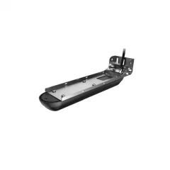
Active Imaging 3in1 transducer
Active Imaging 3-in-1 sonar delivers crystal-clear, high-resolution images of fish and structure at a longer range than any other structure imaging technology. It’s perfect for identifying fish hiding places like rocks, logs, algae growth and deep water. For even more detailed views of structure and hiding places and excellent range, Active Imaging 3-in-1 sonar features CHIRP sonar, SideScan imaging and DownScan imaging with FishReveal technology.
Active Imaging sonar’s superior clarity, target separation and detail help you find more fish, making it easier than ever to identify fish hiding places, seeing rocks, logs, algae growth and deep water from further away. Get the best CHIRP sonar views and DownScan images with the unique FishReveal smart target view, which helps you easily identify fish in structure and hiding places with high-resolution DownScan images.
Main features
- More detail and better range than any other imaging technology
- Active Imaging 3-in-1 transducer with Lowrance CHIRP, SideScan and DownScan
- Easier target identification with FishReveal™ intelligent target view
- Active Imaging 3D sensor (side/bottom) available
- Supports mid and high CHIRP frequencies (83/200 kHz) + 455/800 kHz
- Compatible with Lowrance HDS LIVE, HDS Carbon, Elite Ti2, Elite FS
Product package contents
- Active Imaging 3-in-1 sensor
- Transom mount for StructureScan 3D, StructureScan HD and TotalScan Skimmer transducers, with 7.6m cable
Compatible with the following devices
- Lowrance HDS Carbon, HSD Live, Elite Ti2, Elite FS
- Simrad NSS Evo3, Go series
Specifications
- Sonar cable length 7.6 m
- Displays water temperature
- Very sturdy metal transom mount
- CHIRP, SideScan and DownScan features
- Even more precise details and better range than the previous Totalscan sensor
- Easier target identification with the smart FishReveal view
- Frequencies CHIRP 83/200 kHz + 455/800 kHz
- Cable length: 7.6m
- CHIRP, SideScan and DownScan features
- More detailed information
- Fits Lowrance HDS Carbon, HSD Live, Elite Ti2, Elite FS
- Suitable for Simrad NSS Evo3, Go series
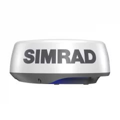
Main features:
- 10 W pulse compression
- 24 nautical mile range with a compact 20-inch dome
- Unparalleled at short range
- No radiation hazard
- Easy-to-use harbor, offshore and weather modes
- MARPA target tracking function
- InstantOn
- Low power consumption
- Caution areas
Specifications:
- Pulse Compression radar technology
- Operating voltage 10.5 - 31.2 VDC (for 12/24V systems)
- Beam width 4.9 horizontal x 25 vertical
- Typical power consumption 18 W
- Maximum power consumption 20 W
- Maximum range 24 NM
- Rotation speed up to 24 RPM
- Minimum range, scale 50 m / 200 ft / 50 yds
- Radar modes Harbour, Offshore, Weather, North Up, Course Up, Relative motion, True Motion
- Waterproof rating IPX6
- Operating temperature range -25 - + 55C
- Weight 5.9 kg
- Diameter 510 mm, height 223 mm
- Recommended fuse size 5 A
Product package contents:
- Simrad Halo20 radar antenna
- Radar cable 10 m
- Ethernet adapter 1.5 m
The compact HALO20 dome radar is a cost-effective way to improve situational awareness and avoid collisions. The radar’s pulse compression technology detects collision risks and other nearby targets up to 24 nautical miles away. The compact and low-profile HALO20 is the perfect radar choice for budget-conscious boaters on small sportfishing and day boats.
Unparalleled performance at short and medium ranges
Pulse compression radar technology allows you to see up to 24 nautical miles from the bow of your boat. The technology enables an effective combination of long and short detection range, precise target identification and flicker suppression.
Improved situational awareness and collision avoidance
The HALO20 radar’s comprehensive feature set enhances situational awareness and safety on the water. With MARPA target tracking, you can monitor up to 10 collision hazards of your choice. In dual-area mode, you can monitor up to 20 collision hazards. HALO20 excels in both busy waterways and low-visibility conditions, filtering out distractions to create a clear, real-time view of your surroundings.
Ease of use
With Harbour, Offshore and Weather modes, as well as custom modes, HALO20 radar's advanced signal processing capabilities ensure targets are visible even in challenging conditions.
Always ready
The HALO20 radar wakes up from a low-power standby mode in an instant, so it is ready to use exactly when you need it. Even if the HALO20 radar is completely powered down, it will start up in just seconds, unlike traditional radars that require a start-up period of minutes.
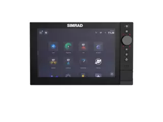
Completely redesigned, the NSS® 4 is now sleeker, faster and smarter
The touchscreen, rotary control, and keypad all work in harmony for efficient control. Inside, a powerful 8-core Qualcomm® processor delivers smoother transitions and faster updates. Plus, advanced fish-finding features like dual-channel 1kW CHIRP sonar, Active Imaging™ HD transducer support, and enhanced customization options make this a premium all-in-one chartplotter and fishfinder.
Hybrid controllers for all conditions
NSS 4 features three control options designed to make it easy to control your functions in all environments and conditions. The touchscreen is ideal for exploring maps, and it’s smoother than ever with NSS 4. Drag to find new areas, pinch to zoom in and out, and tap to see more information about areas of interest. The rotary control lets you navigate menus and adjust information displays in an instant. The keypad also provides a range of one-touch functions for easy navigation.
Superior speed
Experience the power of a lightning-fast 8-core Qualcomm® processor, designed to keep up with your every move on the water.
Respond immediately
Seamlessly switch between apps without lag and enjoy smooth transitions, so you can focus on boating and fishing instead of staring at the screen.
Ultra-fast mapping
NSS 4 offers the fastest automatic routing ever and a fast map display, so you can get to your next location quickly.
Advanced fishing technology for a premium sport fishing system
Active Imaging™ HD offers ultra-bright, high-resolution sonar that reveals fish and underwater structure in stunning detail – making it easy to find the best fishing spots.
Integration
Seamless integration with Simrad® electronics puts you in complete control. Easily use the device with the most powerful HALO® radars, RECON™ trolling motor or the incredible Simrad® app.
Designed to be fully customizable
Make NSS 4 your own with a variety of customization options. Build gauge displays that work for you by modifying predefined dashboards to match your boating style. You can also create custom split screens based on your preferences and display settings.
- Screen size: 10'
- Touchscreen and buttons
- Sonar must be purchased separately
- Three hybrid controls: touch, rotary control and keyboard
- Premium glass-edge design
- Lightning-fast 8-core Qualcomm® processors
- Revamped operating system
- Built-in dual-channel 1 kW CHIRP sonar
- Active Imaging™ and Active Imaging™ HD support
- Compatible with Simrad® RECON™, Rhodan® and Motorguide® trolling motors
- Compatible with Simrad series: S3100 and S5100 sonar modules, radar and more
- Support for Mercury®, CZone®, SiriusXM® and more
- Two-year limited warranty
Support for C-MAP® X-gen charts and other charts
- Easy to use
- Precise control function
- Optimized for minimal power consumption
- For quiet sailing
- Waterproof construction
- SimNet compatible
- Reliable and durable for propeller-driven boats up to 37 feet long
- Low power consumption and precise control capabilities
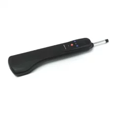
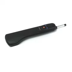
Easy to use
Straightforward control functions make operation easy.
Precise control function
Superior performance in a variety of conditions, even in the most demanding weather conditions. Excellent suitability for coastal navigation.
Optimized for minimal power consumption
Low power consumption extends battery life between charges, enabling longer sailings without using the engine.
For quiet sailing
The TP series autopilots are designed to operate as quietly as possible. You can enjoy boating without unnecessary noise.
Waterproof construction
Withstands marine conditions well.
SimNet compatibility
Plug-and-play connection. Easy to install even by yourself without an expert.
- Easy to use
- Precise control function
- Optimized for minimal power consumption
- For quiet sailing
- Waterproof construction
- SimNet compatible
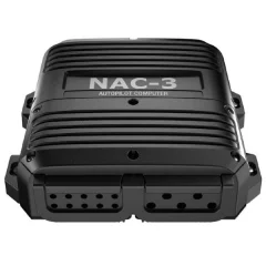
This kit contains the basic components needed to install a Continuum autopilot system on your boat. The contents of the kit are designed for outboard boats over 10 meters (35 feet) in length. Simply add the appropriate control unit for your steering system and choose a Simrad autopilot control panel or multifunction display.
NAC-3 autopilot basic package
This kit includes a Simrad NAC-3 autopilot computer, a Precision-9 solid-state compass, and all the cables and connectors needed to create a NMEA 2000® backbone or connect the autopilot to an existing NMEA 2000® network. This kit is recommended for outboard boats over 10 meters (35 feet) in length and is suitable for use with high-flow duty pumps (e.g. Simrad RPU160 and RPU300), mechanical drives (e.g. Simrad DD15), hydraulic linear duty units (e.g. HLD2000 series), and solenoid valves.Multiple control functions
A wide range of autopilot control panels are available. You can also control the autopilot from your existing Simrad multifunction display. You can install an additional autopilot station, which is a good solution for dual-helm vessels, or control the vessel and autopilot from anywhere on the boat with Simrad's WR10 wireless remote control.Easy to install and configure
Simrad's Virtual Rudder Feedback (VRF) technology eliminates the need for a mechanical rudder feedback sensor on boats equipped with outboard engines (outboard or sterndrive). VRF technology greatly simplifies autopilot installation and provides uncompromised performance for Continuum steering. Industry-standard NMEA 2000® connectivity and NMEA 0183® input allow for simple connection of steering sensors, autopilot control panels and multifunction displays to any location on the boat. Auto-tuning simplifies setup and ensures optimal steering performance, while automatic compass calibration continuously improves heading accuracy during the voyage.The package includes
- Precision-9 compass
- NAC-3 autopilot computer
- Micro-C backbone kit
- Basic autopilot system components – just add the controller and control panel
- Ideal for outboard or sterndrive boats over 10 meters (35 feet) in length
- Compatible with high-flow work pumps, mechanical actuators, hydraulic linear actuators and solenoid valves
- Control via Simrad AP44 autopilot control panel, IS42 display and OP12 keypad or multifunction display connected to the same network
- Virtual rudder angle sensor eliminates the need to install a mechanical rudder angle sensor
- Easy setup with automatic adjustment and compass calibration
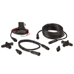
The NMEA 2000 Starter Kit includes everything you need to build a NMEA 2000 network, including a power cord, a 15-foot NMEA 2000 cable, T-connectors (2), and network termination resistors (2).
- NMEA2000 starter kit
- AC power cord, 0.6 m (2 ft) N2K cable
- 4.5 m (15 ft) N2K cable
- 2 x T-connector
- 2 x network termination resistor