Hamnguiden
Hamnguiden group products
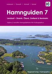
A very comprehensive and well-illustrated port guide to the east coast of Sweden
Each port is presented with a detailed port map, helicopter photo and port information.
The first section of the book presents all of the more than 250 natural harbors and about 40 guest harbors between Landsort and Påskallavik. This first-class map material is produced by Hydrographica, which means that the map material has been produced from 3D aerial photographs and verified with on-site measurements. Helicopter photos provide an overview of the harbors, their surroundings, facilities, inlets, dangerous places and mooring opportunities. Important shoals and rocks are marked in the images.
The second part of the book presents 140 guest harbours and about 20 natural harbours from Påskallavik to Skanör , as well as the islands of Gotland, Öland and Bornholm. This material is not produced by Hydrographica, but contains new images and updated harbour information for the harbours in the region compared to the 1st edition.
In addition to sea and waterway charts, the materials produced by Hydrographica include advanced topographic maps of the areas, based on laser scanning to measure contours and a 3D image of the area created with shading. These help assess where it is best to anchor, whether islands are open and sensitive to wind.
- 2nd edition
- Swedish-speaking
- Two-piece
- Part one: Landsort - Påskallavik. Includes over 250 natural harbors and about 40 guest harbors
- Part two: Påskallavik - Skanör. Also the islands of Gotland, Öland and Bornholm. Includes 140 guest harbours and about 20 natural harbours

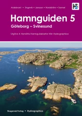
A very comprehensive and well-illustrated port guide to the west coast of Sweden
Includes 371 natural and guest harbors between Tistlarna in the south and Svinesund in the north. Each harbor is presented with a detailed harbor map, helicopter photo and harbor information.
The 4th edition is a completely revised edition of the previous ones, the first of which was published in 2007. The map material is unique. Each map is produced by Hydrographica, which means that the map material has been produced from 3D aerial photographs and verified with on-site measurements. Helicopter photos provide an overview of the ports, their surroundings, facilities, inlets, dangerous places and mooring possibilities. Notable shoals and rocks are marked on the images.
Hamnguiden 5 is divided into a general and a maritime section. The general section describes the history and nature of the area and gives tips for activities in the area. The maritime section focuses on safe navigation, where it is best to anchor and what to pay special attention to. Side moorings in natural harbors have become more common and this book tells about 1000 different places where it is possible.
In addition to sea and waterway charts, Hamnguid's books include advanced topographic maps of the areas, based on laser scanning to measure contours and create a 3D image of the area using shading. These help assess where it is best to anchor, whether the islands are open and sensitive to wind.
- 4 edition
- Swedish-speaking
- 371 ports and natural harbors in the area Tistlarna - Svinesund
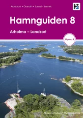
A very comprehensive and well-illustrated harbor guide to the Stockholm archipelago
Includes over 400 natural and guest harbors from Arholma to Landsort. Each harbor is presented with a detailed harbor map, helicopter photo and harbor information.
The map data is unique. Each map is produced by Hydrographica, which means that the map data is produced from 3D aerial photographs and verified with on-site measurements. Helicopter images provide an overview of the ports, their surroundings, facilities, inlets, hazards and mooring opportunities. Notable shoals and rocks are marked on the images.
In addition to sea and waterway charts, Hamnguid's books include advanced topographic maps of the areas, based on laser scanning to measure contours and create a 3D image of the area using shading. These help assess where it is best to anchor, whether the islands are open and sensitive to wind.
- 4 edition
- Swedish-speaking
- The most comprehensive and best port guide to the Stockholm archipelago
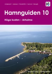
A comprehensive and well-illustrated harbour guide from the High Coast in the north to Arholma in the south. Contains 206 well-known and lesser-known natural and guest harbours. Each harbour is presented with a detailed harbour map, helicopter photo and harbour information. The book also contains tips for getting around the area.
The map data is unique. Each map is produced by Hydrographica, which means that the map data is produced from 3D aerial photographs and verified with on-site measurements. Helicopter images provide an overview of the ports, their surroundings, facilities, inlets, hazards and mooring opportunities. Notable shoals and rocks are marked on the images.
In addition to sea and waterway charts, Hamnguid's books include advanced topographic maps of the areas, based on laser scanning to measure contours and create a 3D image of the area using shading. These help assess where it is best to anchor, whether the islands are open and sensitive to wind.
- New book, 1st edition.
- Swedish-speaking
- 206 harbours and natural harbors between the High Coast and Arholma
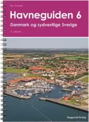
Port book covering the whole of Denmark and the west coast of Sweden from Skänör to Gothenburg.
- Norwegian and English-speaking
- Also included is the Falsterbo Canal

A comprehensive and well-illustrated harbour guide for the areas of Göta älv, Vänern, Dalslands kanal, Vikingaleden, Göta kanal and Vättern. Contains 255 well-known and lesser-known natural and guest harbours. natural and guest harbours from the above-mentioned areas. Each harbour is presented with a detailed harbour map, helicopter photo and harbour information. In addition, the book contains tips for moving around the area.
The map data is unique. Each map is produced by Hydrographica, which means that the map data is produced from 3D aerial photographs and verified with on-site measurements. Helicopter images provide an overview of the ports, their surroundings, facilities, inlets, hazards and mooring opportunities. Notable shoals and rocks are marked on the images.
In addition to sea and waterway charts, Hamnguid's books include advanced topographic maps of the areas, based on laser scanning to measure contours and create a 3D image of the area using shading. These help assess where it is best to anchor, whether the islands are open and sensitive to wind.
- Published 2020
- Swedish-speaking
- 255 harbours and natural harbours from the areas of Göta älv, Vänern, Dalslands kanal, Vikingaleden, Göta kanal and Vättern.


