Outlet accessories for electronics
Accessories and spare parts for boat electronics at OUTLET prices.Outlet accessories for electronics group products
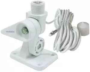
- 16 foot cable

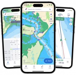
"It's like Google Maps for Boats"
Savvy Navvy is a versatile navigation app that combines several boating-related features into one easy-to-use package. The app provides users with access to nautical charts, weather forecasts, tide information, and route planning tools. It aims to make boating safer and more enjoyable by providing all the necessary information in one app.
Features
- Clear and simple nautical charts that present essential nautical information without unnecessary clutter.
- Route Planning: Allows you to plan a route quickly and easily, taking into account boat settings, weather conditions and tides.
- Estimated Time of Arrival (ETA): Automatically calculates the estimated time of arrival based on winds, weather, tides, and chart data.
- Tide data: Access data from thousands of tide stations around the world, including the direction and strength of tidal currents.
- GPS Tracking: Allows real-time location tracking and viewing of course over ground (COG) and speed over ground (SOG).
- Weather Forecasts: Shows forecasted wind directions and strengths, as well as other weather conditions for the selected area.
- Satellite view: Allows for a closer look at ports, anchorages, and other points of interest.
- Offline maps and weather: Ability to download maps and weather data in advance so you can use them without an internet connection.
Savyy Navyy nautical charts:
Savvy Navvy licenses nautical charts from the United Kingdom Hydrographic Office (UKHO), NOAA and other official hydrographic authorities around the world. Savvy charts are built from the ground up by designers to present essential nautical information in a clear and easy-to-read interface.
Over the Horizon AIS (OHA)
Improve safety by increasing awareness of vessels around you. Using your phone's internet connection, we stream real-time vessel information such as speed, distance, MMSI, position, course of course (COG) and destination.
GPS active tracking
See your real-time location and check your course over ground (COG) and speed over ground (SOG). Center circles around your location quickly illustrate the distance from you to key landmarks around you.
Marine weather forecast
You don't have to be a meteorologist to get the most out of your weather data. Savvy Navvy uses ECMWF technology to combine multiple weather forecasts into a more comprehensive one. Scroll through the coming days to see changing wind directions, strengths and weather conditions.
Cloud and rain radar
This overlay lets you view changing weather patterns in your area. A handy tool to help you avoid annoying showers and gusty weather conditions.
Intelligent route planning
Easily check your traditional navigation for extra confirmation and peace of mind. The program plans your route based on departure time, your boat information, chart data, and wind, weather, and tide information – providing you with a comprehensive and safe itinerary.
Fuel efficiency
No one likes the feeling of running out of fuel. Customizable boat-specific settings help you estimate fuel consumption for your planned route based on engine speed and boat fuel efficiency.
Import waypoints
Import your notes from other navigation tools and see all your saved locations in the Savvy app. This way, your important information continues to enhance your boating experience – while you enjoy the Savvy features you love most.
Port and anchorage information
Boat like a local – the most important information at your fingertips! Select a port or anchorage icon to see essential information about the quality of the bottom, weather protection, services, number of berths, maximum boat length, contact information and much more. Boat globally, think locally.
Anchor alarm
Sleep soundly with the Savvy Anchor Alarm. This easy-to-use tool lets you set your safety limits and alerts you if you drift out of your comfort zone.
Satellite mode
Explore the perfect spot in more detail with satellite mode. This handy overlay gives you a more detailed view of ports and anchorages, so you can make sure you're choosing the best option.
- Clear and simple nautical charts of the entire world
- One-year license
- You will receive a code to activate the nautical charts.
- Savvy Navvy is available for both iOS and Android devices
- Many features that make boating easier;
- Intelligent route planning
- Over the Horizon AIS (via internet connection)
- GPS information
- Marine weather forecast
- Cloud and rain radar
- Fuel efficiency
- Import waypoints from other programs
- Port and anchorage information
- Anchor alarm
- Satellite mode

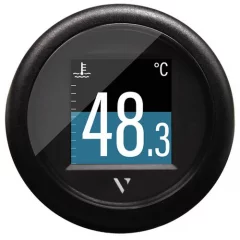
The VL FLEX 52 is a versatile marine instrument that supports analog sensors, NMEA 2000 and LIN interfaces. Its bright 1.44" display fits perfectly into a standard 52mm housing and displays data in single or dual values. It also has a digital input for easy switching between day and night mode.
The VL Flex 52 displays the boat's most important engine values, such as RPM, temperature, pressure and fuel level. The values ??displayed can be easily configured using the app on an NFC-enabled phone. Alarms can be set for incoming signals and are clearly displayed in red so that potential problems can be quickly identified.
The VL Flex 52 has two analog inputs, one for RPM and one for resistance measurements such as temperature, tank level or pressure. One of the inputs is reserved for battery monitoring with the Veratron IBS system. In addition, the device has a NMEA 2000 input, which allows data to be received and displayed from a NMEA 2000 network. A comprehensive list of data that can be received and displayed can be found in the user manual.
Analog inputs allow direct reading of engine sensor data. NMEA 2000® and LIN 2.0 interfaces extend functionality by enabling the processing of digital network data.
Specifications
Nominal voltage: 12/24V
Operating voltage: 8-32V
Power consumption: 50mA (maximum backlight)
Protection class: IP67
Dimensions: outer diameter 60mm, mounting hole diameter 52mm
Frame: Black polycarbonate
Lens: PMMA, anti-reflective and anti-fog treatment
Display: 1.44-inch sunlight-readable color TFT
Resolution: 125x125 pixels
Analog inputs: 1x resistance measurement / 1x frequency
Connection: Tyco/Hirschmann MQS connector, 8 pins
Digital ports: NMEA 2000, LIN bus
Wireless connection: NFC
Operating temperature: -20°C – +70°C
Display modes:
Fuel level
Freshwater level
Wastewater level
Trim angle
Rudder angle
Coolant temperature
Boost pressure
Engine oil temperature
Drivetrain oil pressure
Depth
Tachometer
Speedometer
Ammeter
Voltmeter
Battery state of charge (SOC)
Battery temperature
Remaining battery life
Engine hours
Speed ??on Ground (SOG)
Course of travel (COG)
Clock
- Multifunctional instrument
- NMEA 2000 compatible
- The diameter of the mounting hole is 52mm

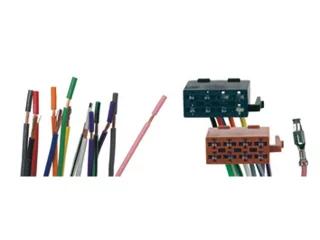
- Universal ISO audio connector
- RAC5250

The world's easiest to use transducer mounting platform that glues to the boat's hull. No more drilling holes in the boat's hull to install the transducer! The product's sales package includes everything you need; Stern Saver Original mounting plate, adhesive, alignment pin, protective gloves and installation instructions. Stern Saver Original is suitable for large oblique/3D transducers such as Lowrance Active Imaging 3in1, TotalScan, LSS-HD, LSS-3D and TripleShot.
- The package includes everything you need: Sensor bracket, epoxy glue, protective gloves and a cleaning cloth.
- Size: 11.4cm x 8.9cm x 1.9cm.
- Color: Black
- No more drilling below the boat's waterline
- No tools required for installation, the package includes everything you need
- Installation takes less than 10 minutes
- Extremely durable and permanent sensor mount
- Size W: 11.40 x H: 8.9cm x D: 1.9cm
- Color: Black

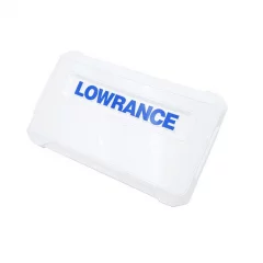
Compatible with 7-inch Lowrance Elite FS devices. Protects the screen of your valuable device during transport and storage, for example.
- Lowrance product code: CVR-FS-7
- Compatible: Elite FS 7"
This mounting foot pedal kit is compatible with the 12-inch HDS LIVE/PRO display.
Product package contents:
- Mounting foot
- Rack knobs
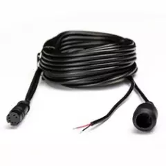
3 meter (10 foot) sonar extension cable for Hook2 4x Bullet sonar.
- Jatkojohto 3m
- Hook2 4x Bullet -kaikuanturille
- Lowrance tuotekoodi: XT-10HOOK2-4X
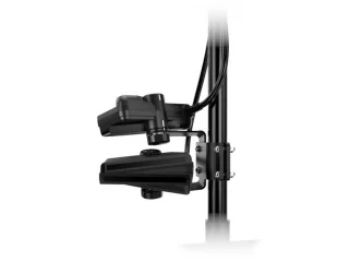
- For two AT2 sensors
- Easy installation for Scout Wide space
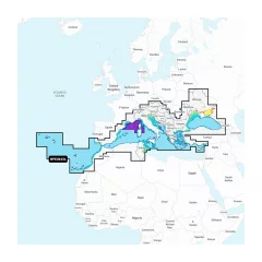
Integrated maps for a wide range of chartplotters
Navionics+ marine charts are a comprehensive solution that combines clear, reliable coastal/inland content with advanced guidance features, supporting a wide range of chartplotter brands.
Navionics chart data can be accessed in advance for free in the Navionics WebApp service.
Always ensure that the map card is compatible with your device before ordering.
Comprehensive mapping solution
Get detailed maps that include coastal features, lakes, and rivers, for a wide range of compatible chartplotters. Integrated coastal and inland lake content helps boaters worldwide.
Daily map updates
The charts are constantly updated with new and changed content. Thousands of updates are made every day. You also get a one-year subscription to get daily chart updates via the Navionics Chart Installer software.
Route guidance between ports
Advanced route guidance technology2 calculates route suggestions between ports based on boat settings, chart data and most frequently traveled routes.
Curves up to 0.5m apart
Making both fishing and navigation easier, the curves drawn at intervals of up to 0.5 meters clearly show the bottom shapes on fishing maps and in detail, for example in marshes, canals, harbors and marinas.
Advanced map settings
Community edits
Downloadable community edits provide useful local information in the Navionics Boating app and allow you to view the data on your compatible chartplotter.
Plotter synchronization
Real-time SonarChart™ maps
More Premium Features with Navionics Platinum+ Chart Solutions:
- Accurate shading
Downloadable shading5 shows the shapes of the base with colors and shadows, making it easier to interpret and clearer than just curved lines.
- Accurate satellite images
Downloadable high-resolution satellite imagery5 gives you a realistic view of your surroundings, which is especially handy when arriving in unfamiliar ports.
- Aerial photos
Ports, marinas, bridges, docks, boat ramps, dams and navigational landmarks are particularly clearly visible in aerial and surface imagery, improving situational awareness above the water surface.
- 3D view
Unique 3D views give you an additional perspective above and below the water surface to enhance situational awareness as key features are highlighted.
- Navionics Mediterranean and Black Sea NPEU643L
- Detailed information about the Mediterranean and Black Seas
- MicroSD card (32GB, SD adapter included)
- Includes the Mediterranean and Black Sea regions
- 1 year of free updates
- Route guidance

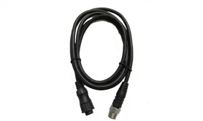
1.5 meter cable to connect E80 and E120 Classic Multifunction Displays to Devicenet.
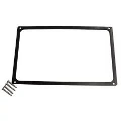
Simrad Cruise 5 chartplotter mounting kit.
- Recessed frame
- Screws

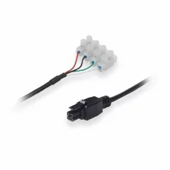
Power cable for Teltonika router. Terminal block power, ground, IO in/out
- Terminal block power, ground, IO in/out
- Teltonika product code: PR2FK20M
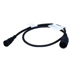
Adapter cable that allows you to connect Raymarine DSM sonar modules to normal non- DSM transducers. Includes adapter cable only.
The adapter cable allows you to connect the following non- DSM transducers to the DSM sonar module:
- P48
- P58
- P74
- P79
- P319
- B60
- B744V
- B258
- B164


