Nautical Chart Series
Domestic nautical chart series from the Finnish coast.Nautical Chart Series -ryhmän tuotteet
The chart sheets of the nautical chart series have been supplemented with detailed special charts to ensure safe boating near ports and narrows. The scale of the chart series is 1:50,000 (1 cm on the map = 500 m). The coordinate system of the charts is EUREF - FIN ( WGS 84).
Depths on Finnish nautical charts are indicated in meters. In marine areas, depths are indicated from mean water level, and in inland waters from a level marked separately on each chart, which usually corresponds to the low water level of the water area in question.
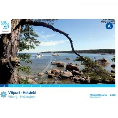
- Area: Vyborg - Helsinki
- Release year: 2016
- Corrected: 20.03.2016
- Scale: 1:50,000
- Size: 46 × 34 cm
- Type: series
- Publisher: Traficom
- Languages: FI, SE, EN
NEW 2025 EDITION! Extensive new oceanographic surveys have been carried out in the sea area. The new chart series also feature a new nautical chart symbol, 'area of ??difficult navigation'. The black dotted line warns of very rocky areas where navigation requires special caution.
The new chart series excludes chart sheets 714, 730–733, which cover the Kihti area. The N2000 update has not yet progressed to the area and the missing sheets will be published in conjunction with the D series, which is expected to be completed for the 2026 sailing season.
The nautical chart series published by the Finnish Transport Agency (traficom) are suitable for archipelago and coastal navigation due to their scale and accuracy. The nautical chart series shows, among other things, the locations of fairways and signs, underwater reefs and cables, and depth information. The nautical chart series is a spiral-bound chart sheet packed in a plastic pocket.
The chart sheets of the nautical chart series have been supplemented with detailed special charts to ensure safe boating near ports and narrows. The scale of the chart series is 1:50,000 (1 cm on the map = 500 m). The coordinate system of the charts is EUREF-FIN (WGS 84)
Depths on Finnish nautical charts are indicated in meters. In marine areas, depths are indicated from mean water level, and in inland waters from a level marked separately on each chart, which usually corresponds to the low water level of the water area in question.
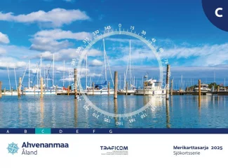
- Region: Åland Islands
- Release year: 2025
- Corrected: 30.4.2024
- Scale: 1:50,000
- Size: 46 × 34 cm
- Type: series
- Publisher: Traficom
- Languages: FI, SE, EN
The nautical chart series published by the Finnish Transport Agency (traficom) are suitable for archipelago and coastal navigation due to their scale and accuracy. The nautical chart series shows, among other things, the locations of fairways and signs, underwater reefs and cables, and depth information. The nautical chart series is a spiral-bound chart sheet packed in a plastic pocket.
The chart sheets of the nautical chart series have been supplemented with detailed special charts to ensure safe boating near ports and narrows. The scale of the chart series is 1:50,000 (1 cm on the map = 500 m). The coordinate system of the charts is EUREF-FIN (WGS 84).
Depths on Finnish nautical charts are indicated in meters. In marine areas, depths are indicated according to the N2000 standard, and in inland waters, according to a level marked separately on each chart, which usually corresponds to the low water level of the water area in question.
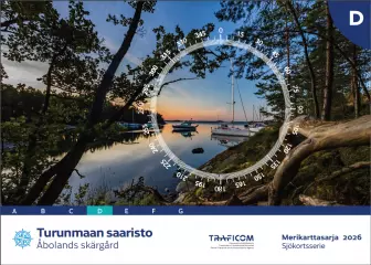
- Area: Turunmaa archipelago
- Release year: 2026
- Scale: 1:50,000
- Size: 46 × 34 cm
- Type: series
- Publisher: Traficom
- Languages: FI, SE, EN
The chart sheets of the nautical chart series have been supplemented with detailed special charts to ensure safe boating near ports and narrows. The scale of the chart series is 1:50,000 (1 cm on the map = 500 m). The coordinate system of the charts is EUREF - FIN ( WGS 84).
Depths on Finnish nautical charts are indicated in meters. In marine areas, depths are indicated from mean water level, and in inland waters from a level marked separately on each chart, which usually corresponds to the low water level of the water area in question.
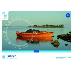
- Area: Bothnian Sea
- Release year: 2024
- Weight: 20.5.2024
- Scale: 1:50,000
- Size: 59 × 42 cm
- Type: series
- Publisher: Traficom
- Languages: FI, SE, EN
The chart sheets of the nautical chart series have been supplemented with detailed special charts to ensure safe boating near ports and narrows. The scale of the chart series is 1:50,000 (1 cm on the map = 500 m). The coordinate system of the charts is EUREF - FIN ( WGS 84).
Depths on Finnish nautical charts are indicated in meters. In marine areas, depths are indicated from mean water level, and in inland waters from a level marked separately on each chart, which usually corresponds to the low water level of the water area in question.
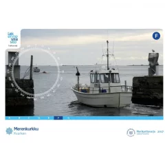
- Region: Merenkurkku
- Release year: 2023
- Scale: 1:50,000
- Size: 59 × 42 cm
- Type: series
- Publisher: Traficom
- Languages: FI, SE, EN
The chart sheets of the nautical chart series have been supplemented with detailed special charts to ensure safe boating near ports and narrows. The scale of the chart series is 1:50,000 (1 cm on the map = 500 m). The coordinate system of the charts is EUREF - FIN ( WGS 84).
Depths on Finnish nautical charts are indicated in meters. In marine areas, depths are indicated from mean water level, and in inland waters from a level marked separately on each chart, which usually corresponds to the low water level of the water area in question.
- Area: Bothnian Bay
- Release year: 2022
- Scale: 1:50,000
- Size: 59 × 42 cm
- Type: series
- Publisher: Traficom
- Languages: FI, SE, EN
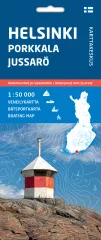
The double-sided map sheet Helsinki Porkkala Jussarö 1:50 000 covers the coast and archipelago of the Gulf of Finland in the east to the Isosaari and Santahamina areas off Helsinki and in the west to Jussarö. Porkkalanniemi is located in the middle of the area. In the north, Barösund, Inkoo, Kantvik, Espoo Bay and the waters near Helsinki are visible. In the south, the map extends to the outermost islands, such as Jussarö, Bågaskär, Porkkala–Kallbådan and Gråskärsbådan.
The new waterproof boating maps from the Finnish Map Centre depict the terrain and objects of land areas, ports of call, and various protected and restricted areas in greater detail than before. The navigation information includes, among other things, waterways with their depths, depth information, sea marks, and reefs and rocks. The maps are perfect travel companions for boaters and kayakers.
The map set is made of waterproof and tear-resistant material. When folded, the compact map is easy to handle and store on the boat. The maps are printed on both sides, so they cover almost twice the area compared to previous boating maps. When unfolded, the map shows a wide area and is especially suitable for route planning and use in combination with digital maps.
The boating information on the maps is based on the Finnish Transport and Communications Agency Traficom data from 2022, and has been supplemented with data from the National Land Survey of Finland's terrain database and other data. The scale of the maps in the maritime area is more accurate than before, at 1:50,000.
- Area: Helsinki-Porkkala-Jussarö
- Scale: 1:50,000
- Waterproof and tear-resistant material
- Double-sided, very comprehensive information about the area
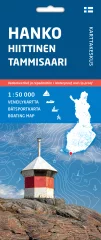
The double-sided map sheet Hanko Hiittinen Tammisaari 1:50 000 covers the coast and archipelago in the east to Jussarö and in the west to Örön–Högsåra. Hankoniemi is located in the middle of the area. In the north you can see Taalintehdas, Padva peninsula, the Bromarvi archipelago and the city of Tammisaari. In the south the map extends to the outermost islands, such as Bengtskär, Russarö, Längden and Segelskär.
The new waterproof boating maps from the Finnish Map Centre depict the terrain and objects of land areas, ports of call, and various protected and restricted areas in greater detail than before. The navigation information includes, among other things, waterways with their depths, depth information, sea marks, and reefs and rocks. The maps are perfect travel companions for boaters and kayakers.
The map set is made of waterproof and tear-resistant material. When folded, the compact map is easy to handle and store on the boat. The maps are printed on both sides, so they cover almost twice the area compared to previous boating maps. When unfolded, the map shows a wide area and is especially suitable for route planning and use in combination with digital maps.
The boating information on the maps is based on the Finnish Transport and Communications Agency Traficom data from 2022, and has been supplemented with data from the National Land Survey of Finland's terrain database and other data. The scale of the maps in the maritime area is more accurate than before, at 1:50,000.
- Area: Hanko-Hiittinen-Emmisaari
- Scale: 1:50,000
- Waterproof and tear-resistant material
- Double-sided, very comprehensive information about the area
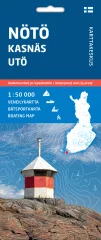
The double-sided map sheet Nötö Kasnäs Utö 1:50 000 covers the Archipelago Sea in the east to the Rosala – Högsåra – Paraisten portti area and in the west to the Utön–Österskär area. The Nötö archipelago is located in the middle of the area. In the north, Korpoström, Pärnäinen, Nauvo and Attu are visible. In the south, the map extends to the outermost islands, such as Utö, Jurmo, Borstö, Vänö and Örö.
The new waterproof boating maps from the Finnish Map Centre depict the terrain and objects of land areas, ports of call, and various protected and restricted areas in greater detail than before. The navigation information includes, among other things, waterways with their depths, depth information, sea marks, and reefs and rocks. The maps are perfect travel companions for boaters and kayakers.
The map set is made of waterproof and tear-resistant material. When folded, the compact map is easy to handle and store on the boat. The maps are printed on both sides, so they cover almost twice the area compared to previous boating maps. When unfolded, the map shows a wide area and is especially suitable for route planning and use in combination with digital maps.
The boating information on the maps is based on the Finnish Transport and Communications Agency Traficom data from 2022, and has been supplemented with data from the National Land Survey of Finland's terrain database and other data. The scale of the maps in the maritime area is more accurate than before, at 1:50,000.
- Area: Nötö-Kasnäs-Utö
- Scale: 1:50,000
- Waterproof and tear-resistant material
- Double-sided, very comprehensive information about the area
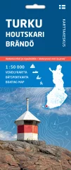
The double-sided map sheet Turku Houtskari Brändö 1:50 000 covers the Archipelago Sea and the easternmost archipelago of Åland, in the east to the Port of Turku – Kakskerta – Stormalö and in the west to the line Brändön Fiskö – Lappo – Jungfruskär. The Houtskari archipelago is located in the middle of the area. In the north you can see Åva, Iniö, Laupunen, Velkua and Naantali. In the south the map extends to the Gustaf Dalen archipelago, Gyltö, Korpoose and Nauvoo.
The new waterproof boating maps from the Finnish Map Centre depict the terrain and objects of land areas, ports of call, and various protected and restricted areas in greater detail than before. The navigation information includes, among other things, waterways with their depths, depth information, sea marks, and reefs and rocks. The maps are perfect travel companions for boaters and kayakers.
The map set is made of waterproof and tear-resistant material. When folded, the compact map is easy to handle and store on the boat. The maps are printed on both sides, so they cover almost twice the area compared to previous boating maps. When unfolded, the map shows a wide area and is especially suitable for route planning and use in combination with digital maps.
The boating information on the maps is based on the Finnish Transport and Communications Agency Traficom data from 2022, and has been supplemented with data from the National Land Survey of Finland's terrain database and other data. The scale of the maps in the maritime area is more accurate than before, at 1:50,000.
- Area: Turku-Houtskari-Brändö
- Scale: 1:50,000
- Waterproof and tear-resistant material
- Double-sided, very comprehensive information about the area
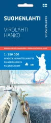
When planning longer sailing trips or even a boating holiday, it is good to see large coastal areas at a glance. It is essential to get an overall picture of the waterways, suitable stages, stopping places and ports from the map. The new boating planning maps are perfect for this purpose.
The Archipelago Sea map covers the entire coast of southwestern Finland, the Archipelago Sea and the waters surrounding Åland. The map extends to Hanko and Teijo in the east, Uusikaupunki in the north and Signilskär west of Eckerö in the west. A planning map of the Gulf of Finland is also available.
The scale of the planning maps is 1:150,000 (1 cm on the map = 1.5 km / 0.81 mpk on the water), so one double-sided map sheet covers a large area. The maps present essential maritime information for planning: fairways with their navigation depths, general depth information, territorial water boundaries, lighthouses and ports of call with the number of guest berths. Fairway lines are also classified according to their navigation depth and bridges according to their clearance height. The content is supplemented by information on land areas from the GT road map.
More detailed information about ports of call can be found, for example, on the Vierassatamat.fi website.
The maps are made of waterproof and tear-resistant material. The folded map is easy to handle and store on a boat. The maps are based on data from the Finnish Transport and Communications Agency Traficom, which has been supplemented with other map data.
- Area: Archipelago Sea
- Boating planning map
- Scale: 1:150,000
- Waterproof and tear-resistant material
When planning longer sailing trips or even a boating holiday, it is good to see large coastal areas at a glance. It is essential to get an overall picture of the waterways, suitable stages, stopping places and ports from the map. The new boating planning maps are perfect for this purpose.
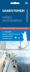
The map of the Gulf of Finland covers the entire coast of Uusimaa and Kymenlaakso from Hanko to Virolahti. The map also shows the Estonian coast and islands in the Tallinn region, as well as the coastlines and lighthouses of the outer islands of the Gulf of Finland belonging to Russia. A planning map of the Gulf of Finland is also available.
The scale of the planning maps is 1:150,000 (1 cm on the map = 1.5 km / 0.81 mpk on the water), so one double-sided map sheet covers a large area. The maps present essential maritime information for planning: fairways with their navigation depths, general depth information, territorial water boundaries, lighthouses and ports of call with the number of guest berths. Fairway lines are also classified according to their navigation depth and bridges according to their clearance height. The content is supplemented by information on land areas from the GT road map.
More detailed information about ports of call can be found, for example, on the Vierassatamat.fi website.
The maps are made of waterproof and tear-resistant material. The folded map is easy to handle and store on a boat. The maps are based on data from the Finnish Transport and Communications Agency Traficom, which has been supplemented with other map data.
- Area: Gulf of Finland
- Boating planning map
- Scale: 1:150,000
- Waterproof and tear-resistant material

The double-sided map sheet Kotka Loviisa Virolahti 1:50 000 covers the coast and archipelago in the east to Virolahti and in the west to the Loviisa plain. The city of Kotka is located in the middle of the area. In the north, Ahvenkoski, Pyhtää, Hamina and Virojoki are visible. In the south, the map extends to the outermost islands, such as Orrengrund, Mustaviiri, Ristisaari, Haapasaaret and Ulko-Tammio. The Eastern Gulf of Finland National Park is located in the map area.
The new waterproof boating maps from the Finnish Map Centre depict the terrain and objects of land areas, ports of call, and various protected and restricted areas in greater detail than before. The navigation information includes, among other things, waterways with their depths, depth information, sea marks, and reefs and rocks. The maps are perfect travel companions for boaters and kayakers.
The map set is made of waterproof and tear-resistant material. When folded, the compact map is easy to handle and store on the boat. The maps are printed on both sides, so they cover almost twice the area compared to previous boating maps. When unfolded, the map shows a wide area and is especially suitable for route planning and use in combination with digital maps.
The boating information on the maps is based on the Finnish Transport and Communications Agency Traficom data from 2022, and has been supplemented with data from the National Land Survey of Finland's terrain database and other data. The scale of the maps in the maritime area is more accurate than before, at 1:50,000.
- Area: Kotka-Loviisa-Virolahti
- Scale: 1:50,000
- Waterproof and tear-resistant material
- Double-sided, very comprehensive information about the area
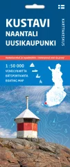
The double-sided map sheet Kustavi Naantali Uusikaupunki 1:50 000 covers the coast and archipelago from the east of Naantali to the north of Pyhäranta. The waters of Kustavi and Taivassalo are located in the middle of the area. In the south, Merimasku, Velkua and Iniö Aukko are visible. In the west, the map extends to Kihti Selka and the islands of the Bothnian Sea coast, such as Isokari, Vekara and Pyhämaa. The southern part of the Bothnian Sea National Park is located in the map area.
The new waterproof boating maps from the Finnish Map Centre depict the terrain and objects of land areas, ports of call, and various protected and restricted areas in greater detail than before. The navigation information includes, among other things, waterways with their depths, depth information, sea marks, and reefs and rocks. The maps are perfect travel companions for boaters and kayakers.
The map set is made of waterproof and tear-resistant material. When folded, the compact map is easy to handle and store on the boat. The maps are printed on both sides, so they cover almost twice the area compared to previous boating maps. When unfolded, the map shows a wide area and is especially suitable for route planning and use in combination with digital maps.
The boating information on the maps is based on the Finnish Transport and Communications Agency Traficom data from 2022, and has been supplemented with data from the National Land Survey of Finland's terrain database and other data. The scale of the maps in the maritime area is more accurate than before, at 1:50,000.
- Area: Kustavi-Naantali-Uusikaupunki
- Scale: 1:50,000
- Waterproof and tear-resistant material
- Double-sided, very comprehensive information about the area
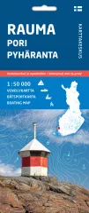
The double-sided map sheet Rauma Pori Pyhäranta 1:50 000 covers the coast and archipelago of the Bothnian Sea in the south to Pyhäranta and in the north to the north of Tahkoluoto. The Luvia archipelago is located in the middle of the area. In the west, the map extends to the outermost islands, such as Kylmä-Pihlaja, Säppi, Reposaari and Iso-Enskeri. In the east, Pyhämaa, Rauma, Eurajoensalmi, Preiviikinlahti and the Kokemäenjoki estuary as far as Pori are visible. The central part of the Bothnian Sea National Park is located in the map area.
The new waterproof boating maps from the Finnish Map Centre depict the terrain and objects of land areas, ports of call, and various protected and restricted areas in greater detail than before. The navigation information includes, among other things, waterways with their depths, depth information, sea marks, and reefs and rocks. The maps are perfect travel companions for boaters and kayakers.
The map set is made of waterproof and tear-resistant material. When folded, the compact map is easy to handle and store on the boat. The maps are printed on both sides, so they cover almost twice the area compared to previous boating maps. When unfolded, the map shows a wide area and is especially suitable for route planning and use in combination with digital maps.
The boating information on the maps is based on the Finnish Transport and Communications Agency Traficom data from 2022, and has been supplemented with data from the National Land Survey of Finland's terrain database and other data. The scale of the maps in the maritime area is more accurate than before, at 1:50,000.
- Area: Kustavi-Naantali-Uusikaupunki
- Scale: 1:50,000
- Waterproof and tear-resistant material
- Double-sided, very comprehensive information about the area
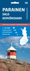
The double-sided map sheet Parainen Salo Kemiönsaari 1:50 000 covers the inner archipelago in Parainen and the western, northern and eastern waters of Kemiönsaari. Kemiönsaari is located in the middle of the area. Turku, Kaarina, Paimio, Sauvo and Salo are visible in the north. In the west, the map extends to Airisto and Gullkrona Selka, and in the south it includes Bromarv, Särkisalo, Västanfjärd, Taalintehdas and Purunpää Cape. The northeastern part of the Archipelago National Park and Teijo National Park are located within the map area.
The new waterproof boating maps from the Finnish Map Centre depict the terrain and objects of land areas, ports of call, and various protected and restricted areas in greater detail than before. The navigation information includes, among other things, waterways with their depths, depth information, sea marks, and reefs and rocks. The maps are perfect travel companions for boaters and kayakers.
The map set is made of waterproof and tear-resistant material. When folded, the compact map is easy to handle and store on the boat. The maps are printed on both sides, so they cover almost twice the area compared to previous boating maps. When unfolded, the map shows a wide area and is especially suitable for route planning and use in combination with digital maps.
The boating information on the maps is based on the Finnish Transport and Communications Agency Traficom data from 2022, and has been supplemented with data from the National Land Survey of Finland's terrain database and other data. The scale of the maps in the maritime area is more accurate than before, at 1:50,000.
- Area: Parga Salo Kemiönsaari
- Scale: 1:50,000
- Waterproof and tear-resistant material
- Double-sided, very comprehensive information about the area
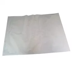
Waterproof, transparent map pocket. Suitable for all nautical chart sets. Can also be used for general charts, coastal charts and harbor charts if the chart sheet is folded slightly.
- Size: 76 x 58cm
- Watertight closure
- Suitable for all nautical charts


