Lake Map Series
A comprehensive selection of lake maps and inland water maps of Finland's lake regions.Lake Map Series -ryhmän tuotteet
The coordinate system of Finnish nautical charts, EUREF-FIN, is based on the WGS 84 coordinate system, which is an international maritime standard and is also used in the GPS satellite system. EUREF-FIN coincides with the WGS 84 coordinate system with an accuracy of approximately one meter, so in practical navigation the difference in coordinate systems does not need to be taken into account. All coordinates in the list of landmarks are presented only in this system.
There are still a few map products produced before 2003 in Finnish inland waters, which are based on the national cartographic coordinate system (KKJ). The reference ellipsoid is the international reference ellipsoid INT 1924 (Hayford 1910). The WGS 84 coordinate system used by the Global Positioning System (GPS) satellite positioning equipment differs from the KKJ system. These maps are identified by their green color. New maps are blue. On old green maps, the symbols of the lights are shown with Finnish and Swedish abbreviations.
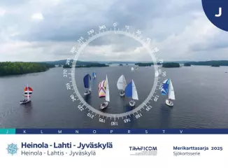
- Map series: J
- Area: Heinola-Lahti-Jyväskylä
- Scale: 1:40,000
- Edition: 2025 (20.2.2025)
- Size: 46 x 34cm
- Publisher: Finnish Transport Agency (traficom)
- Languages: Finnish, Swedish, English
The coordinate system of Finnish nautical charts, EUREF-FIN, is based on the WGS 84 coordinate system, which is an international maritime standard and is also used in the GPS satellite system. EUREF-FIN coincides with the WGS 84 coordinate system with an accuracy of approximately one meter, so in practical navigation the difference in coordinate systems does not need to be taken into account. All coordinates in the list of landmarks are presented only in this system.
There are still a few map products produced before 2003 in Finnish inland waters, which are based on the national cartographic coordinate system (KKJ). The reference ellipsoid is the international reference ellipsoid INT 1924 (Hayford 1910). The WGS 84 coordinate system used by the Global Positioning System (GPS) satellite positioning equipment differs from the KKJ system. These maps are identified by their green color. New maps are blue. On old green maps, the symbols of the lights are shown with Finnish and Swedish abbreviations.
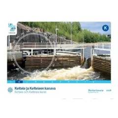
- Map series: K
- Area: Keitele and Keitele Canal
- Scale: 1:40,000
- Edition: 2018
- Corrected: 30.4.2018
- Size: 46 x 34cm
- Publisher: Finnish Transport Agency (traficom)
- Languages: Finnish, Swedish, English
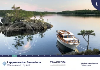
- Map series: L
- Area: Savonlinna - Lappeenranta / Villmanstrand-Nyslott
- Altitude system: N2000
- Scale: 1:40000, 1:20000
- Edition: 2025 (20.8.2025)
- Size: 59 x 42cm
- Publisher: Finnish Transport Agency (traficom)
- ISBN 978-952-311-573-6
- Languages: Finnish, Swedish, English
J Vesijärvi–Päijänne 1:40,000
K Keitele and Keitele's canal 1:40,000
L Lappeenranta–Savonlinna 1:40,000
M Savonlinna–Kuopio 1:40,000
N Tampere–Currents 1:30,000
O Tampere–Hämeenlinna 1:30,000
P Valkeakoski–Längelmäki–Hauho 1:30,000
R Pielisjoki 1:20,000
S Saimaa Canal 1:10,000
T Oulujärvi 1:40 000
V Savonlinna–Joensuu 1:40,000
- Scale: 1:40,000
- Size: 59 × 42 cm
- Appearance/binding: wire-boundSeries: Inland Water Chart Series
- Library class: 69.6302
- ISBN : 951-49-0543-1
- EAN : 9789514905438
- ID: F125722
- Publisher: Traficom
- Language: Finnish, English, German
- Year of publication: 2016
The Finnish Transport Agency's lake area nautical chart series are intended for all types of boating. In addition to the normal map pages, the chart series contain a large number of special charts that facilitate navigation in certain difficult-to-navigate areas. The chart series are spiral-bound atlases, and they are packed in a plastic pocket. The coordinate system of the atlas is EUREF - FIN (WGS84).
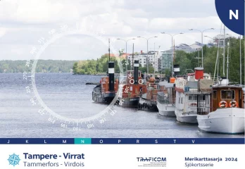
- Map series N
- Tampere-Virrat area
- Scale: 1:30,000
- Size: 49 × 36 cm
- Appearance/binding: wire-bound
- Series: Inland Water Chart Series
- Library class: 69.6302
- Publisher: Traficom
- Language: Finnish, English, German
- Year of publication: 2024
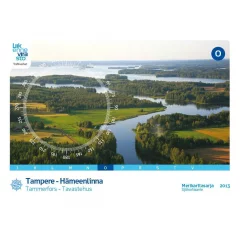
The lake area nautical chart series O Tampere-Hämeenlinna is published for the first time in blue. The series has been completely revised, and is now published for the first time with international map symbols and the WGS 84 ( EUREF - FIN ) coordinate system.
The series, which was last published in 2004, covers the route from Tampere via Pirkkala, Lempäälä, Viiala and Valkeakoski to Hämeenlinna – one of the most beautiful waterways in Finland. The depth data on the map has been updated so that 6-meter deeper depth curves have been added to sheets 521-529 and rock information has been updated. The terrain data has been renewed throughout the series.
The chart sheets of the nautical chart series have been supplemented with detailed special charts to ensure safe boating near harbors and narrows. The scale of the O series is 1:30,000 (1 cm on the map = 300 m).
- Size 46 × 34 cm. 34 sts, thread bound
- Library class 69.6302
Size: 46 × 34 cm
Number of pages: 32
Appearance/binding: wire-bound
Series: Inland Water Chart Series
Library class: 69.6302
ISBN : 978-952-266-101-2
EAN : 9789522661012
ID: F203000
Publisher: Karttakeskus
Language: Finnish, English, German
Year of publication: 2013
The Finnish Transport Agency's lake area nautical chart series are intended for all types of water navigation. In addition to the normal map pages, the chart series contain a large number of special charts that facilitate navigation in certain difficult-to-navigate areas. The chart series are spiral-bound atlases, and they are packed in a plastic pocket. The coordinate system of the atlas is EUREF - FIN , and the map is colored blue. The inland water nautical chart series are divided regionally as follows:
- J Vesijärvi–Päijänne 1:40,000
- K Keitele and Keitele's canal 1:40,000
- L Lappeenranta–Savonlinna 1:40,000
- M Savonlinna–Kuopio 1:40,000
- N Tampere–Currents 1:30,000
- O Tampere–Hämeenlinna 1:30,000
- P Valkeakoski–Längelmäki–Hauho 1:30,000
- R Pielisjoki 1:20,000
- S Saimaa Canal 1:10,000
- T Oulujärvi 1:40 000
- V Savonlinna–Joensuu 1:40,000
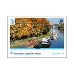
- Map series P
- Valkeakoski-Längelmäki-Hauho area
- Scale: 1:30,000
- Size: 46 × 34 cm
- Appearance/binding: wire-bound
- Series: Inland Water Chart Series
- Library class: 69.6302
- ISBN: 978-952-266-220-0
- EAN: 9789522662200
- ID: F203500
- Publisher: Karttakeskus
- Language: Finnish, English, German
- Year of publication: 2014
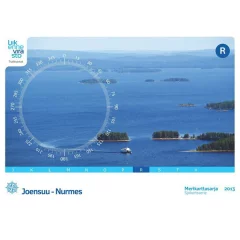
The 2013 edition of the Lakeland nautical chart series R is the first blue nautical chart for the Pielinen region. The area covered by the series has expanded from the previous Pielisjoki to the Pielinen. The new series replaces the inland water charts 424, 425 and 426 that were previously on sale in Pielinen.
The scale of the R-series, produced in a small series size (46 × 34 cm), is 1:40,000 in Pielinen and 1:20,000 in Pielisjoki. The scales of special maps are even more precise.
Many changes have been made to the R-series compared to the previous edition. For example, all depth information for Pielinen has been updated and most of the Pielisjoki has been updated. Similarly, the terrain information has been renewed for the entire series area, and the pier information has been updated.
The Finnish Transport Agency's lake area nautical chart series are intended for all types of boating. In addition to the normal map pages, the chart series contain a large number of special charts that facilitate navigation in certain difficult-to-navigate areas. The chart series are spiral-bound atlases, and are packed in a plastic pocket. The coordinate system of the atlas is EUREF - FIN (WGS84). The inland water nautical chart series are divided regionally as follows:
- J Vesijärvi–Päijänne 1:40,000
- K Keitele and Keitele's canal 1:40,000
- L Lappeenranta–Savonlinna 1:40,000
- M Savonlinna–Kuopio 1:40,000
- N Tampere–Currents 1:30,000
- O Tampere–Hämeenlinna 1:30,000
- P Valkeakoski–Längelmäki–Hauho 1:30,000
- R Joensuu–Nurmes 1:20,000 / 1:40,000
- S Saimaa Canal 1:10,000
- T Oulujärvi 1:40 000
- V Savonlinna–Joensuu 1:40,000
- Map series R
- Joensuu-Nurmes area
- Scale: 1:40,000/1:20,000
- Size: 46 × 34 cm
- Number of pages: 52
- Appearance/binding: wire-bound
- Series: Inland Water Chart Series
- Library class: 69.6302
- ISBN : 978-952-266-102-9
- EAN : 9789522661029
- ID: F203001
- Publisher: Karttakeskus
- Language: Finnish, English, German
- Year of publication: 2013
The Finnish Transport Agency's lake area nautical chart series are intended for all types of boating. In addition to the normal map pages, the chart series contain a large number of special charts that facilitate navigation in certain difficult-to-navigate areas. The chart series are spiral-bound atlases, and they are packed in a plastic pocket. The coordinate system of the atlas is KKJ , and the map is colored green. The inland water nautical chart series are divided regionally as follows:
- J Vesijärvi–Päijänne 1:40,000
- K Keitele and Keitele's canal 1:40,000
- L Lappeenranta–Savonlinna 1:40,000
- M Savonlinna–Kuopio 1:40,000
- N Tampere–Currents 1:30,000
- O Tampere–Hämeenlinna 1:30,000
- P Valkeakoski–Längelmäki–Hauho 1:30,000
- R Pielisjoki 1:20,000
- S Saimaa Canal 1:10,000
- T Oulujärvi 1:40 000
- V Savonlinna–Joensuu 1:40,000
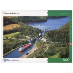
- Map series S
- Area Saimaa Canal
- Scale: 1:10,000
- Size: 59 × 42 cm
- Number of pages: 22
- Appearance/binding: wire-bound
- Series: Inland Water Chart Series
- Library class: 69.6302
- ISBN : 978-952-266-224-8
- EAN : 9789522662248
- ID: F203661
- Publisher: Karttakeskus
- Language: Finnish, English, German
- Year of publication: 2000
The Finnish Transport Agency's lake area nautical chart series are intended for all types of boating. In addition to the normal map pages, the chart series contain a large number of special charts that facilitate navigation in certain difficult-to-navigate areas. The chart series are spiral-bound atlases, and are packed in a plastic pocket. The coordinate system of the atlas is EUREF - FIN (WGS84). The inland water nautical chart series are divided regionally as follows:
- J Vesijärvi–Päijänne 1:40,000
- K Keitele and Keitele's canal 1:40,000
- L Lappeenranta–Savonlinna 1:40,000
- M Savonlinna–Kuopio 1:40,000
- N Tampere–Currents 1:30,000
- O Tampere–Hämeenlinna 1:30,000
- P Valkeakoski–Längelmäki–Hauho 1:30,000
- R Pielisjoki 1:20,000
- S Saimaa Canal 1:10,000
- T Oulujärvi 1:40 000
- V Savonlinna–Joensuu 1:40,000
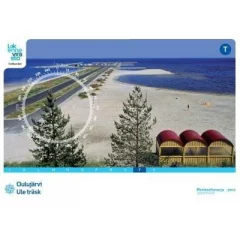
- Map series T
- Area Oulujärvi
- Scale: 1:40,000
- Size: 59 × 42 cm
- Appearance/binding: wire-bound
- Series: Inland Water Chart Series
- Library class: 69.6302
- ISBN : 978-952-255-783-4
- EAN : 9789522557834
- ID: F202380
- Publisher: John Nurminen Marine
- Language: Finnish, English, German
- Year of publication: 2011
The coordinate system of Finnish nautical charts, EUREF-FIN, is based on the WGS 84 coordinate system, which is an international maritime standard and is also used in the GPS satellite system. EUREF-FIN coincides with the WGS 84 coordinate system with an accuracy of approximately one meter, so in practical navigation the difference in coordinate systems does not need to be taken into account. All coordinates in the list of landmarks are presented only in this system.
There are still a few map products produced before 2003 in Finnish inland waters, which are based on the national cartographic coordinate system (KKJ). The reference ellipsoid is the international reference ellipsoid INT 1924 (Hayford 1910). The WGS 84 coordinate system used by the Global Positioning System (GPS) satellite positioning equipment differs from the KKJ system. These maps are identified by their green color. New maps are blue. On old green maps, the symbols of the lights are shown with Finnish and Swedish abbreviations.
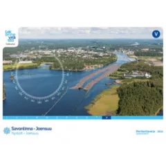
- Map series: V
- Area: Savonlinna - Joensuu
- Scale: 1:40,000
- Edition: 2011
- Corrected: 10.3.2011
- Size: 46 x 34cm
- Publisher: Finnish Transport Agency (traficom)
- Languages: Finnish, Swedish, English
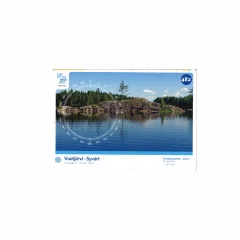
Size: 117 × 82.5 cm
Appearance/binding: folded
Series: Boating map
Library class: 69.6302
ISBN : 978-952-255-786-5
EAN : 9789522557865
ID: F202507
Publisher: John Nurminen Marine
Language: Finnish, English, German
Year of publication: 2011
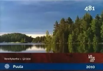
Size: 82 × 116 cm
Series: Boating map
Library class: 69.6302
ISBN : 978-952-266-134-0
EAN : 9789522661340
ID: F20324
Publisher: Karttakeskus
Language: Finnish, English, German
Edition: 2.
Year of publication: 2010
Waterproof, transparent map pocket. Suitable for all nautical chart sets. Can also be used for general charts, coastal charts and harbor charts if the chart sheet is folded slightly.
- Size: 76 x 58cm
- Watertight closure
- Suitable for all nautical charts


